Hiking Swiss Cheese Mountain

Thursday, July 20th, 2023

Starting mileage: 9590, Distance travelled: 50

Miles hiked: 5

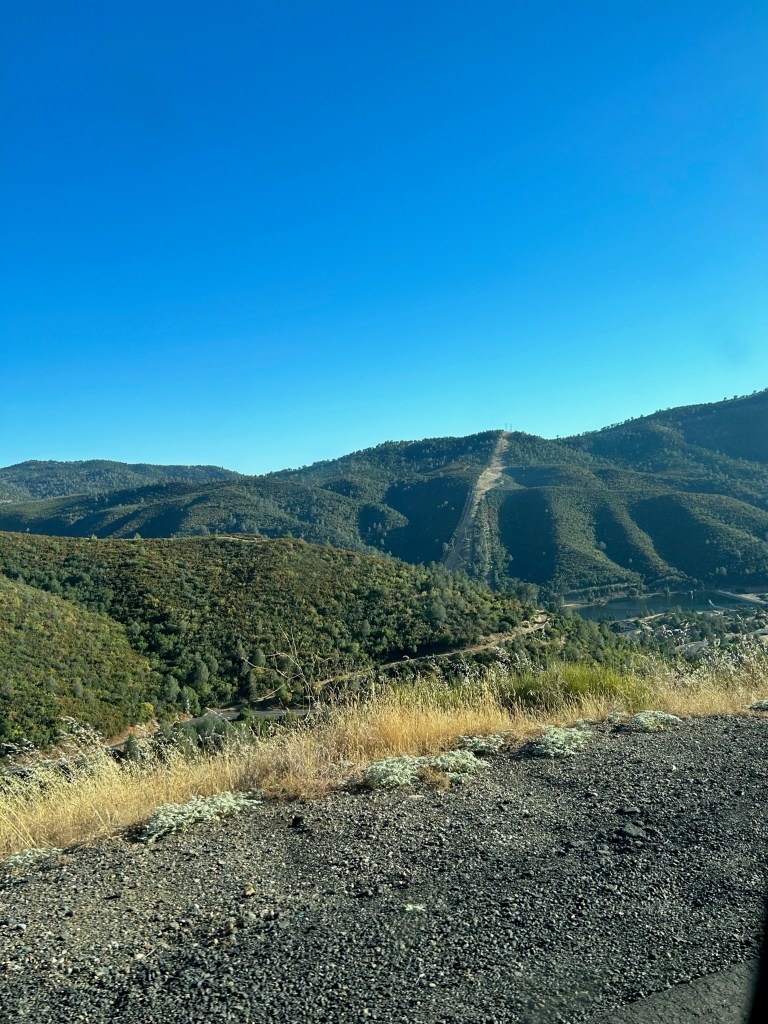
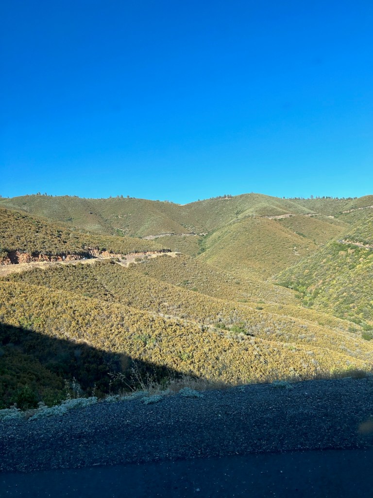
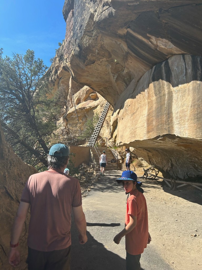
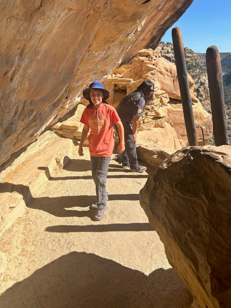
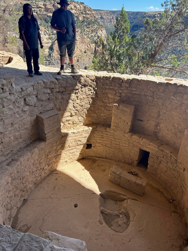
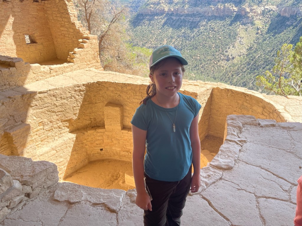
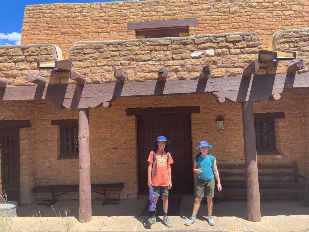
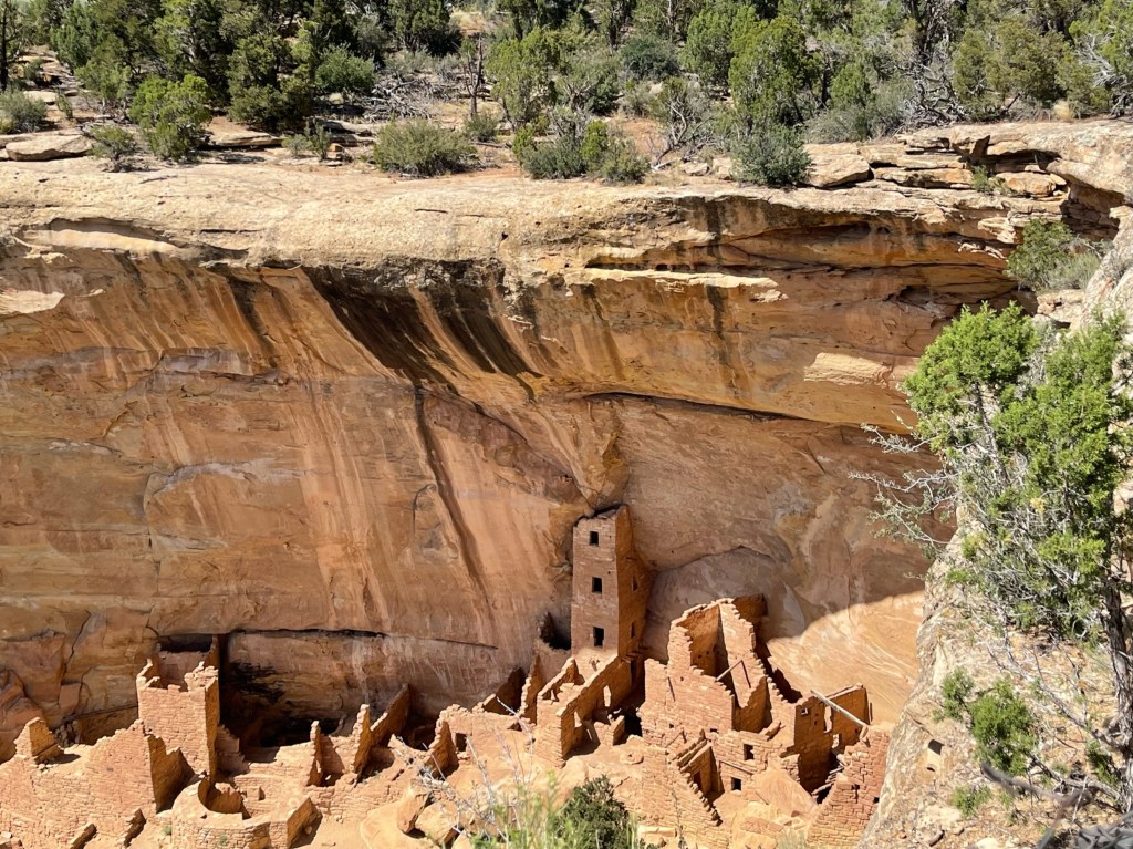
We started the day with another spectacular mountain drive up onto the Mesa, complete with views down into Montezuma Valley. We did an amazing guided tour of Balcony House, an ancient cliff dwelling, with a Navajo native tour guide named Davin who was working as an intern in the park for the summer. The Navajo are one of the 26 tribes descended from the indigenous cliff dwellers of Mesa Verde and our guide made connections with his tribe’s rituals and culture and the cliff dwellers of the 13th century. We had to climb a 32-foot ladder and climb through a 18-inch-wide tunnel as part of the tour so it wasn’t for the feint of heart.

After the tour we drove to the Archeological Museum, ate lunch, explored the exhibits and watched a film about the cultural history of Mesa Verde. The architectural design of the buildings was intended to blend in with the surroundings and call back to the techniques of the cliff dwellers who came before. Several buildings in the complex were on the National Historic Register.

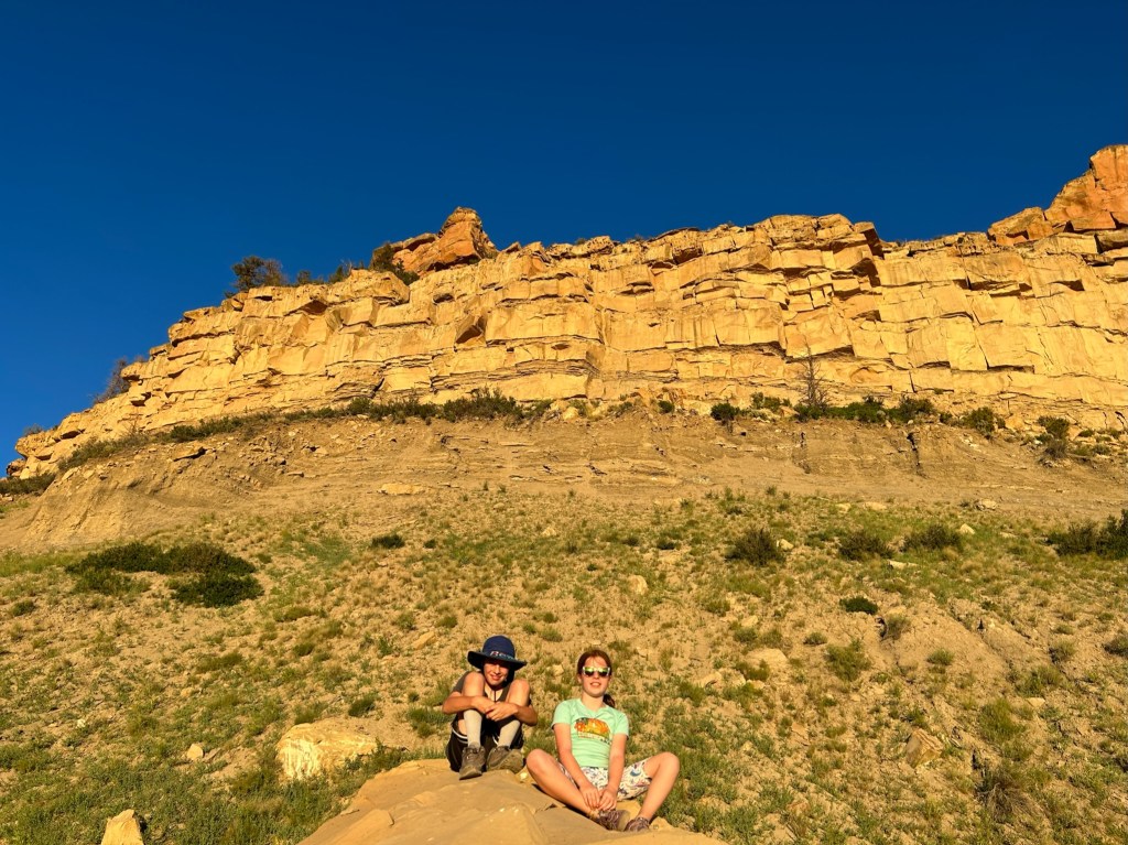
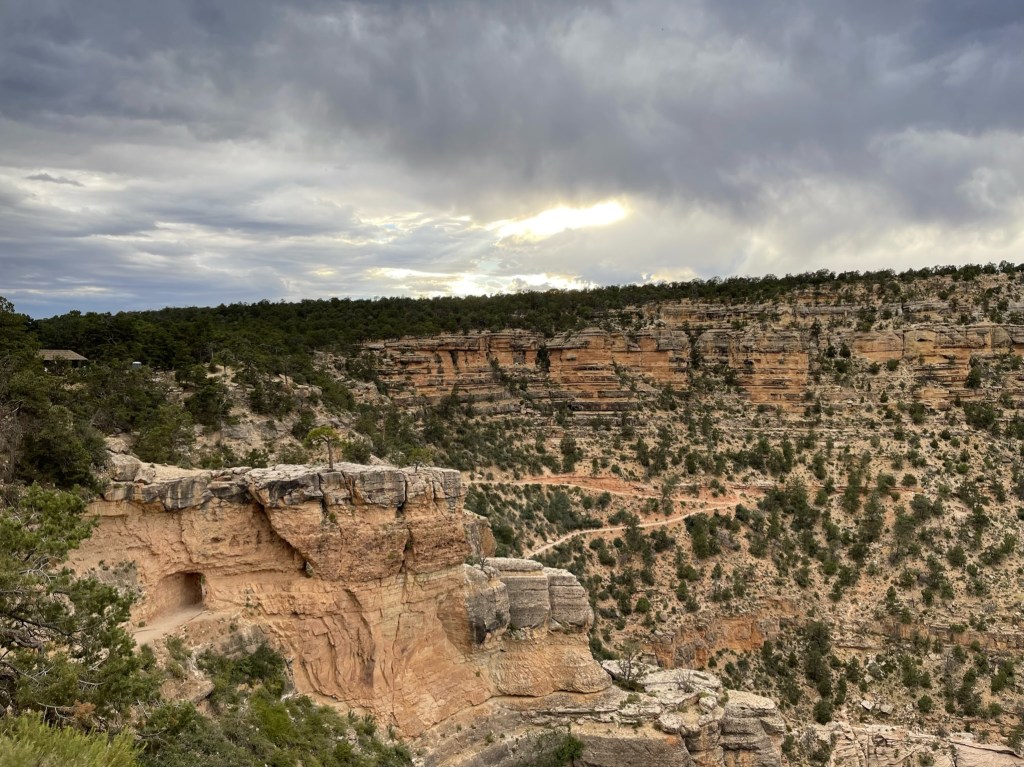
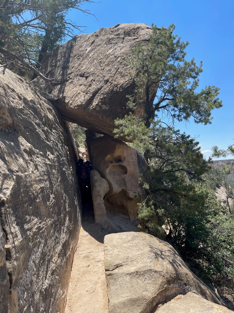
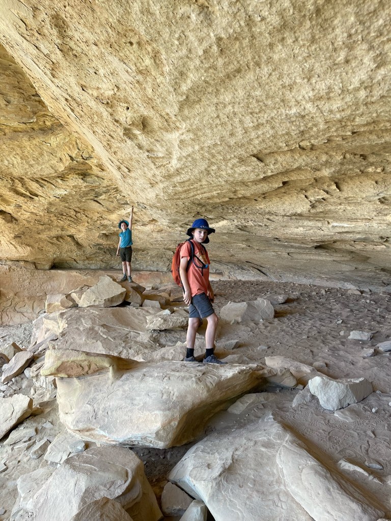
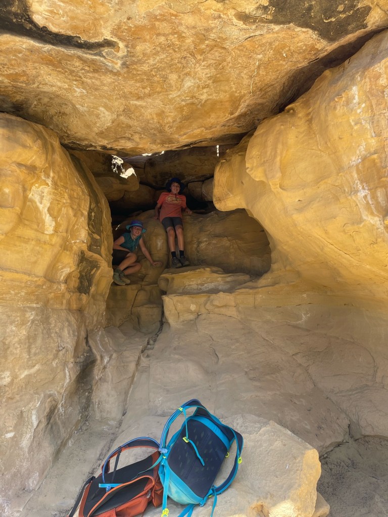
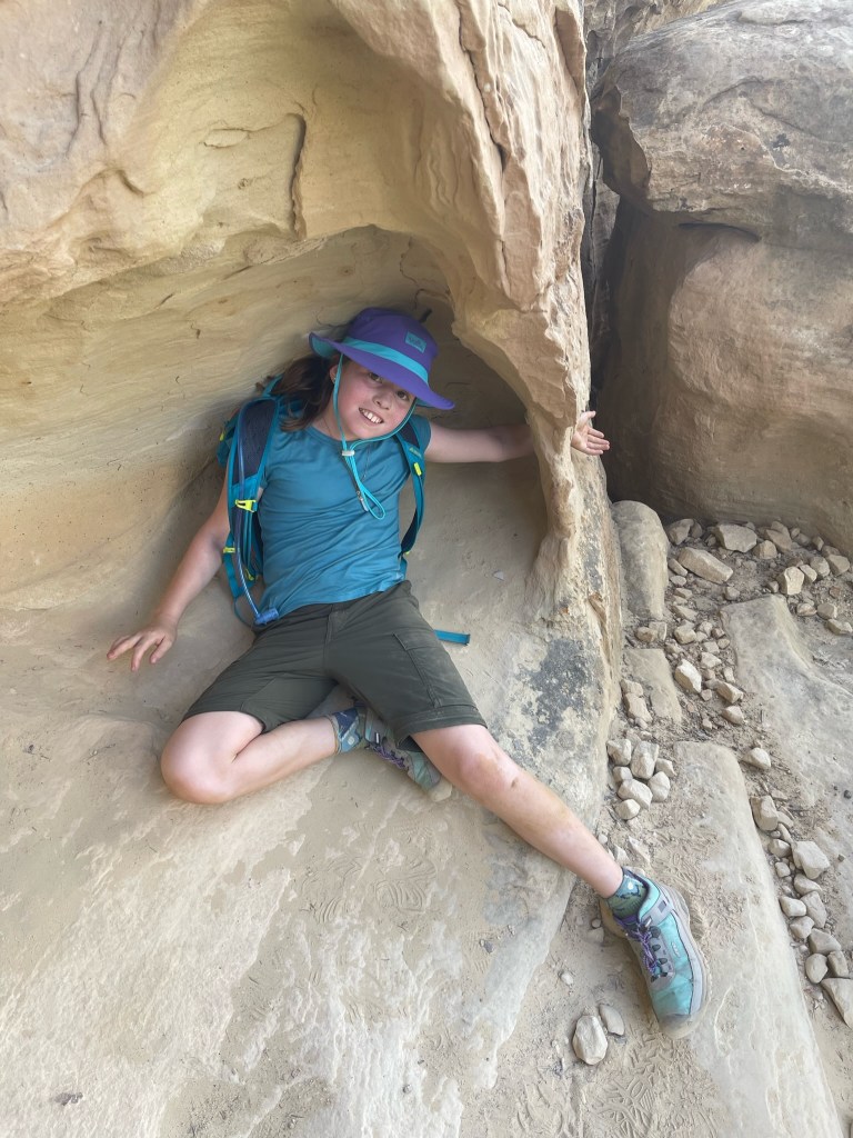
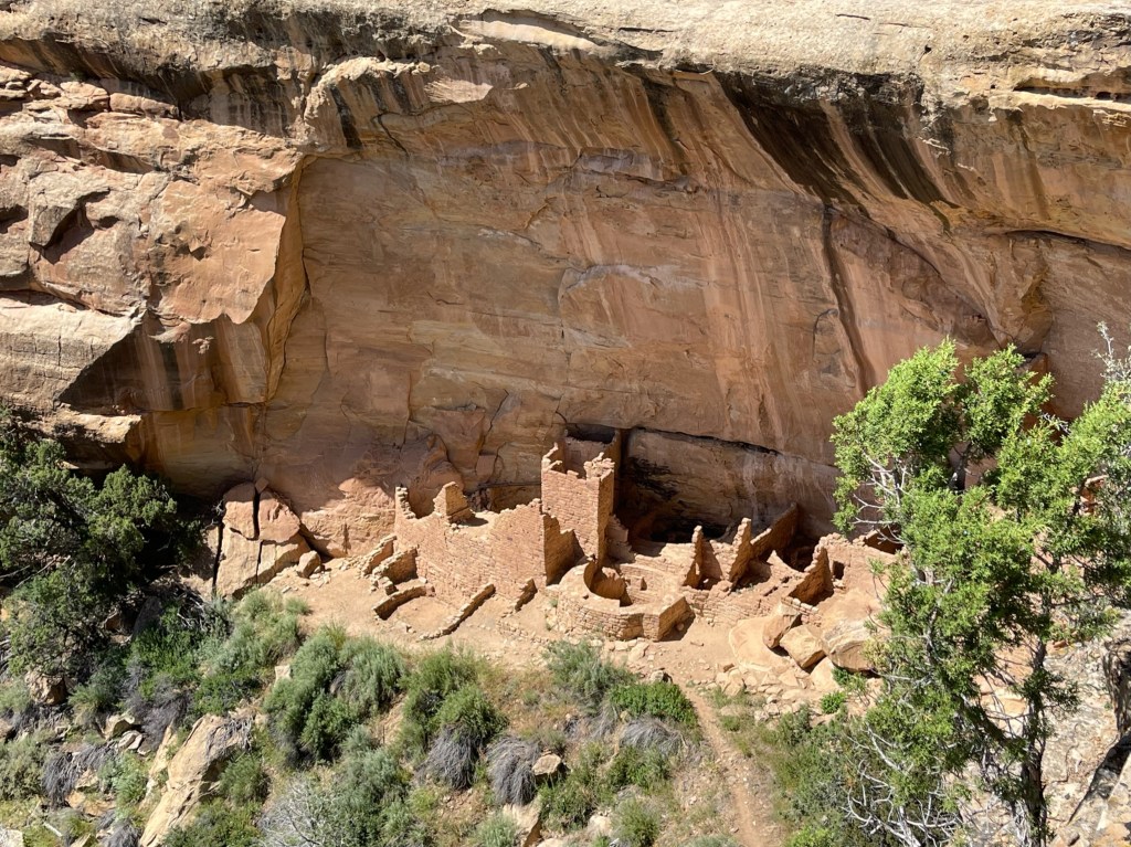
After eating lunch in the camper van, we hiked the Petroglyph Point trail, which we dubbed Swiss cheese mountain for all the holes and huge overhangs along the entire canyon wall. The hike started at Spruce Tree House Overlook, the third largest dwelling in the park. Our hike was narrated by the children and David imagining which little nooks and crannies would serve as bedrooms, living rooms, etc. when we moved into the cliff side. Right at the halfway point of the hike, we came across the petroglyphs for which the trail is actually named, the only authentic markings accessible to the public in the park. We had a great time clambering through all the alcoves, some optional, others part of a pretty advanced trail. There was an additional bonus archeological site along the route with foundations still visible.

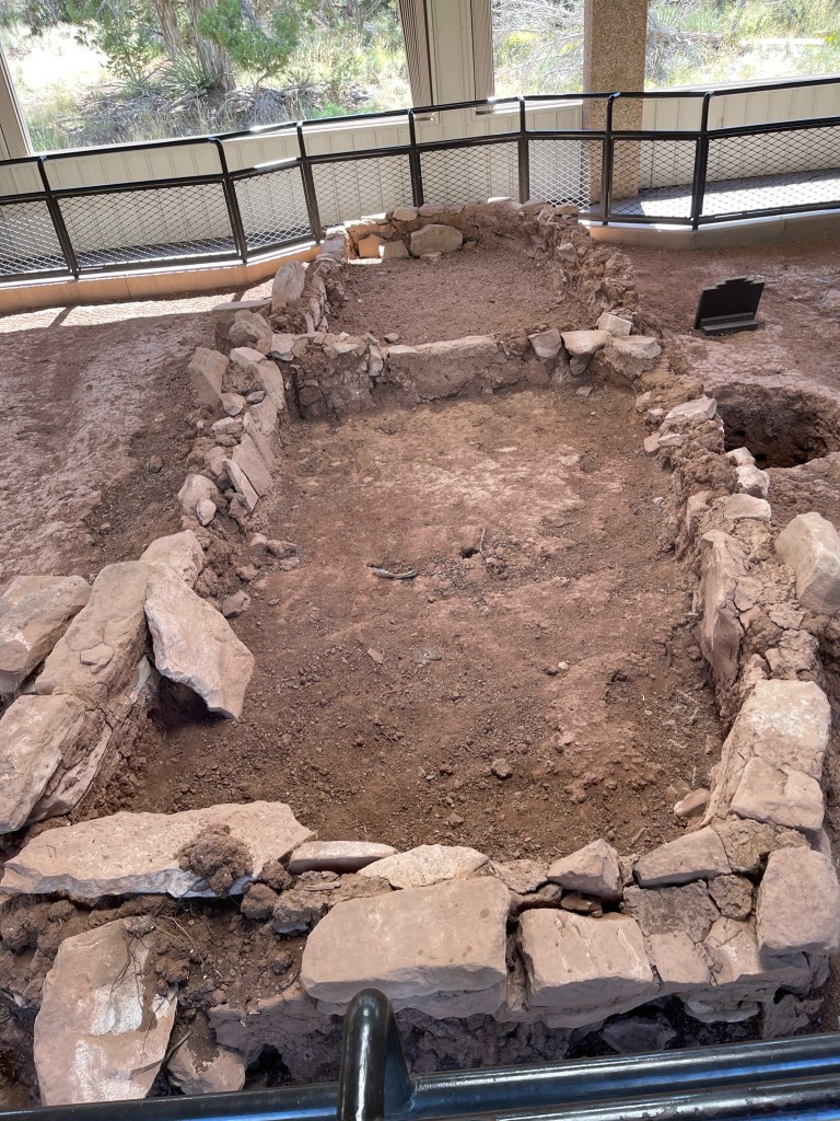
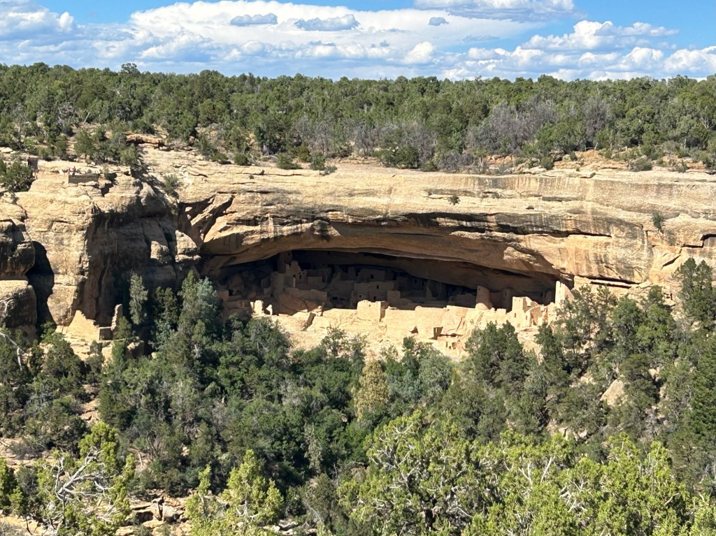
After we’d recovered from the 2-hour hike in the blazing sun, helped by cold refreshments, we returned to the van to take a self-guided audio car tour around the Mesa Top Loop. The stops on the tour traced the evidence of the increasingly complex dwellings designed by the indigenous inhabitants of the region. Each archeological site revealed the types of houses from 550 AD (pit houses) right up through 1300 AD (Sun Temple and Cliff Palace) when the last of the ancestral Puebloans migrated away from the area.

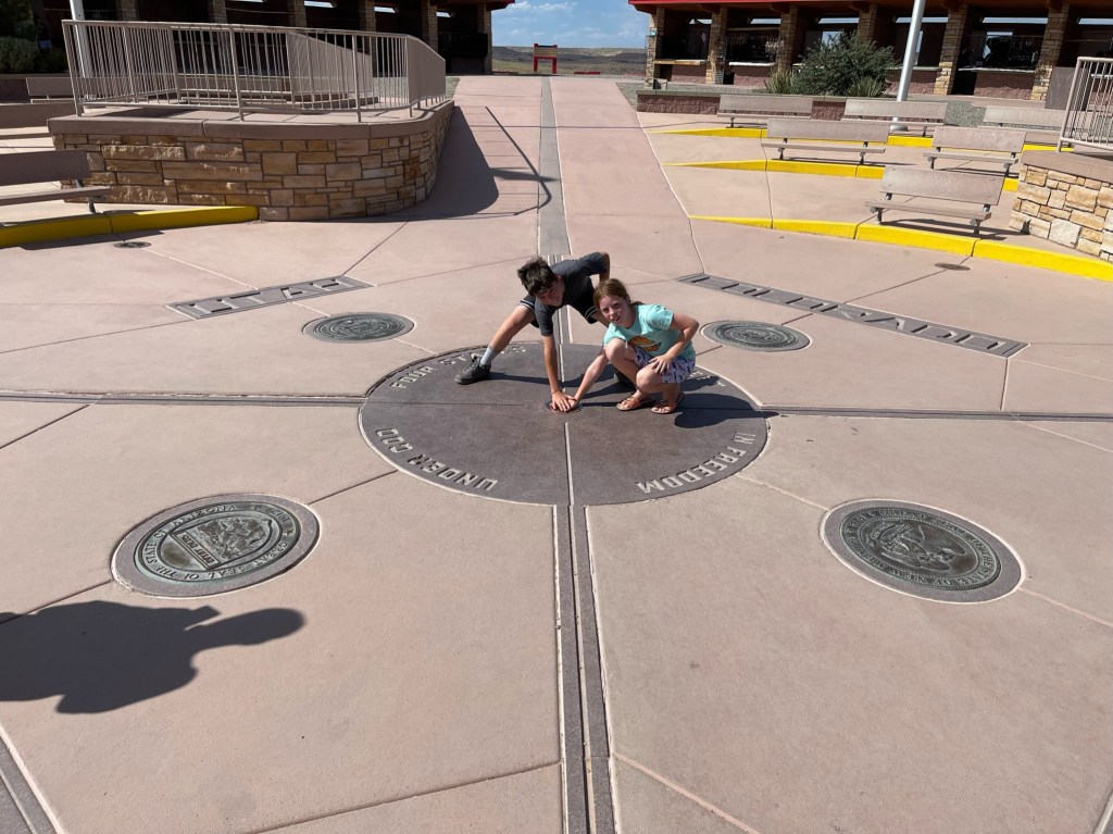
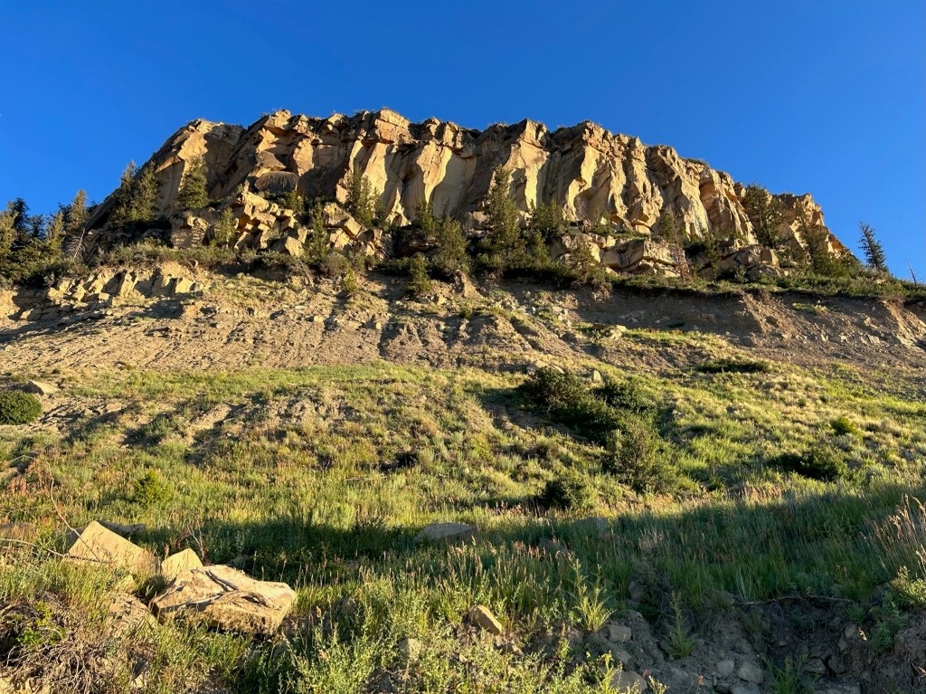
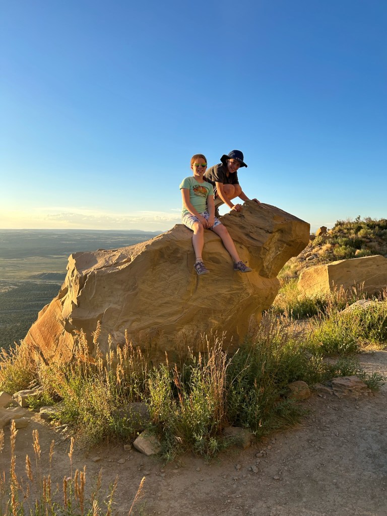
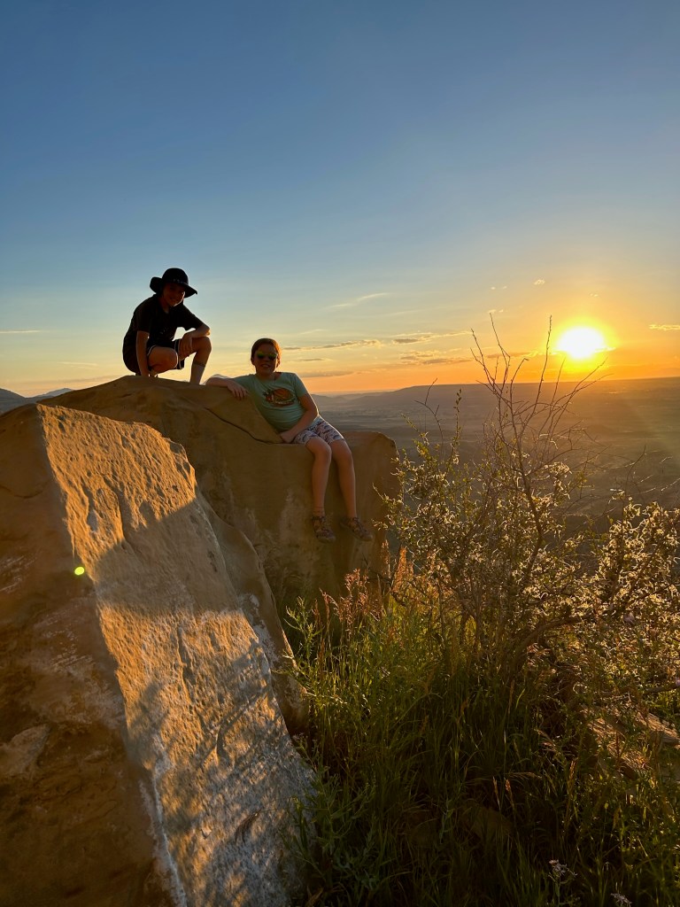
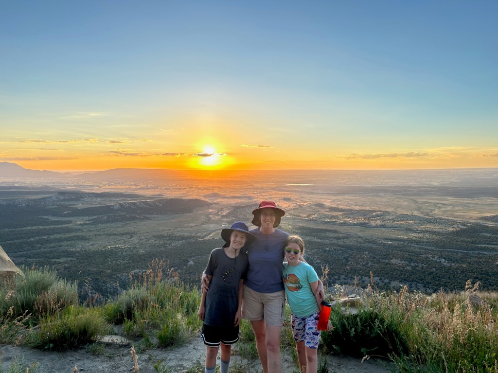
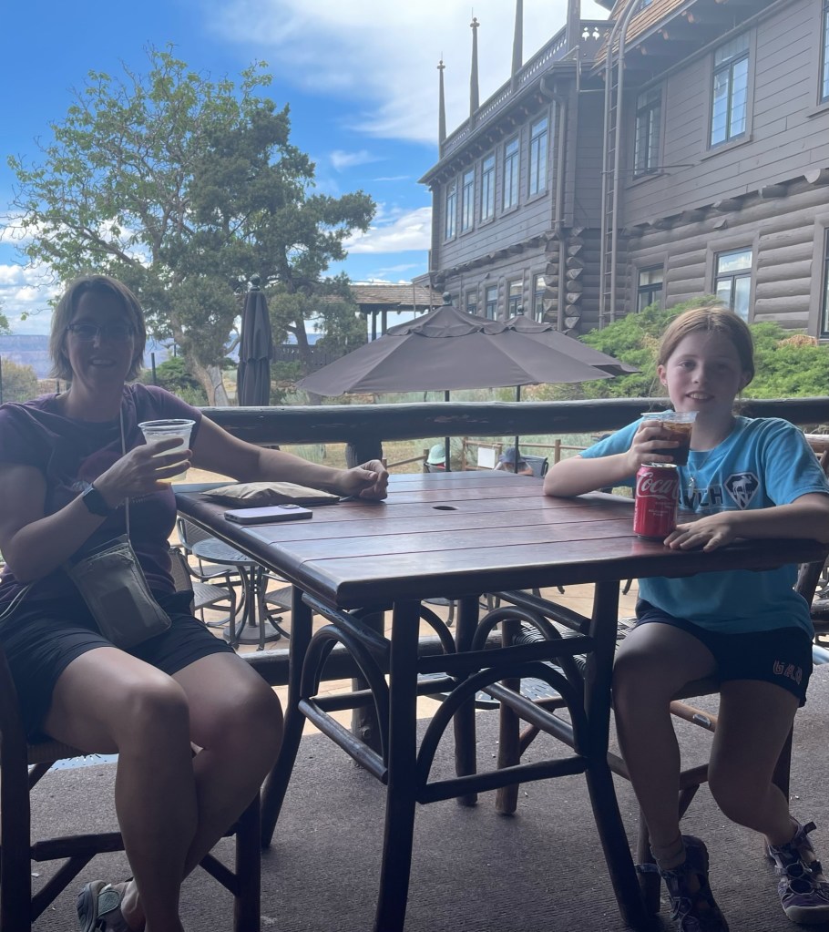
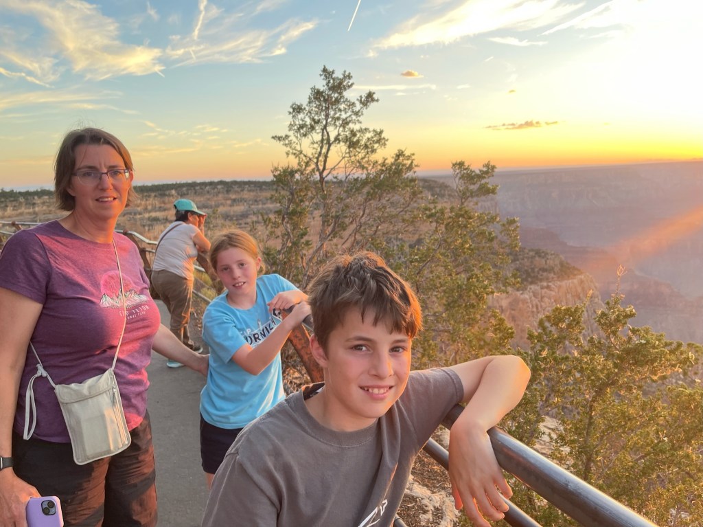
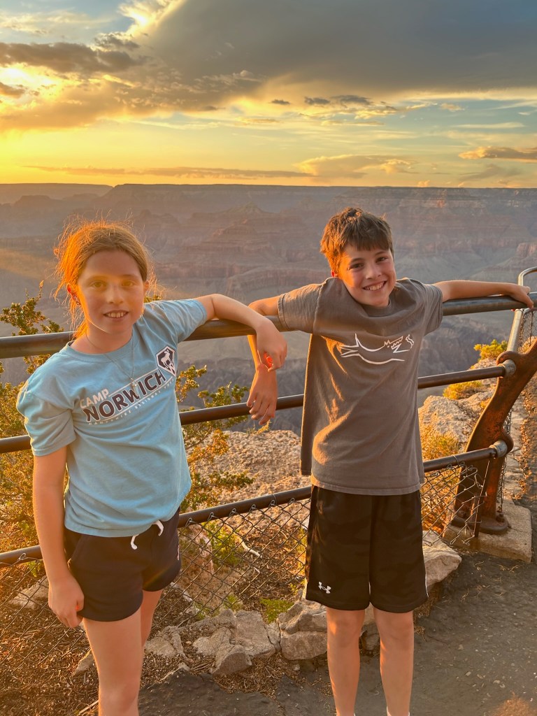
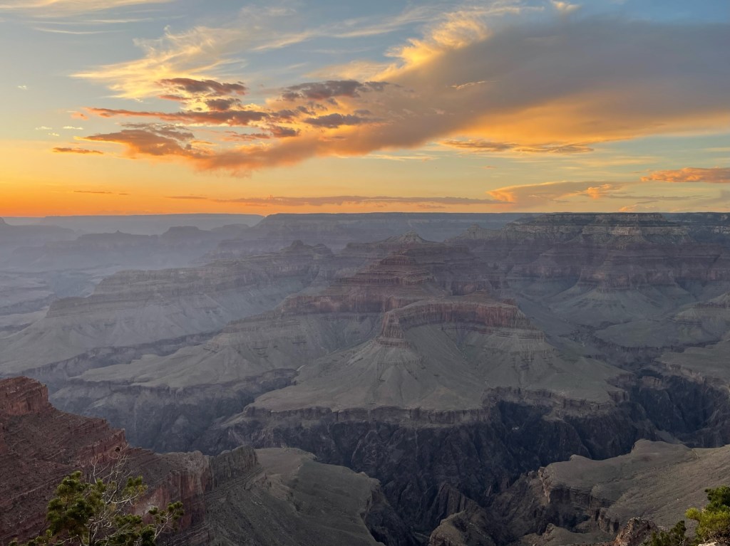
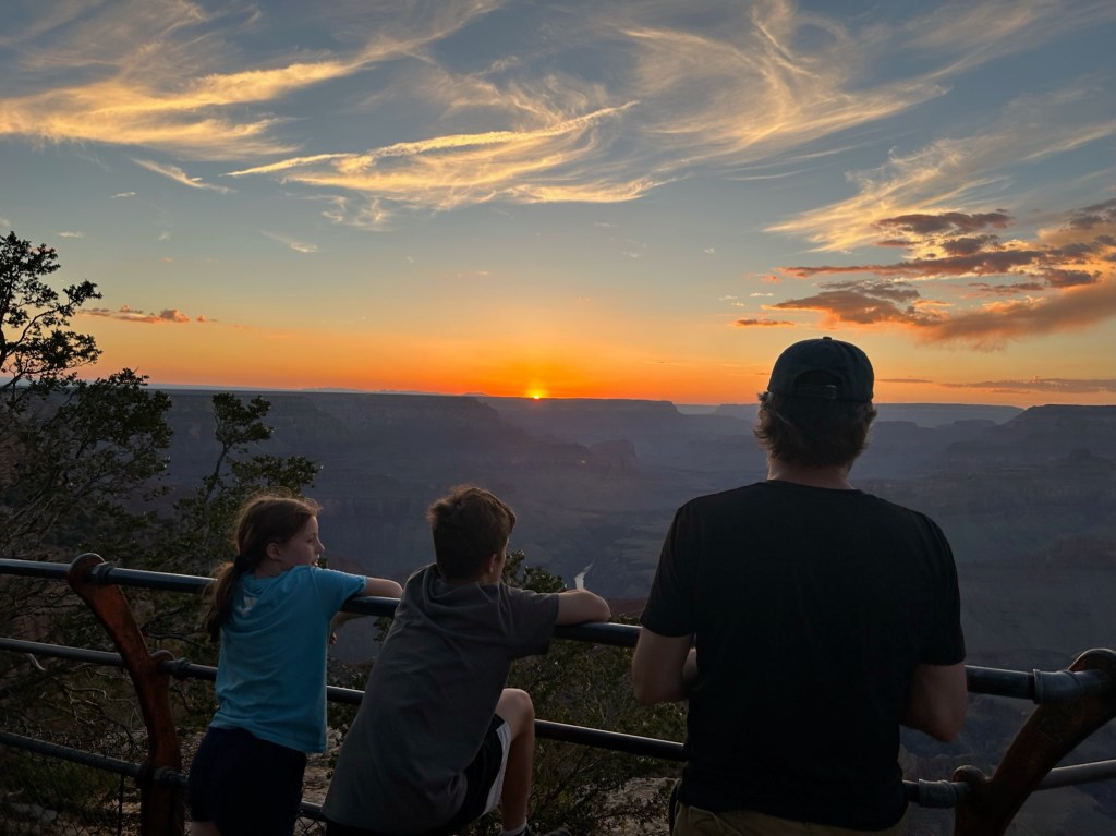
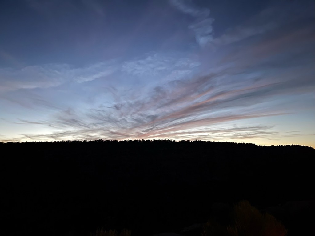
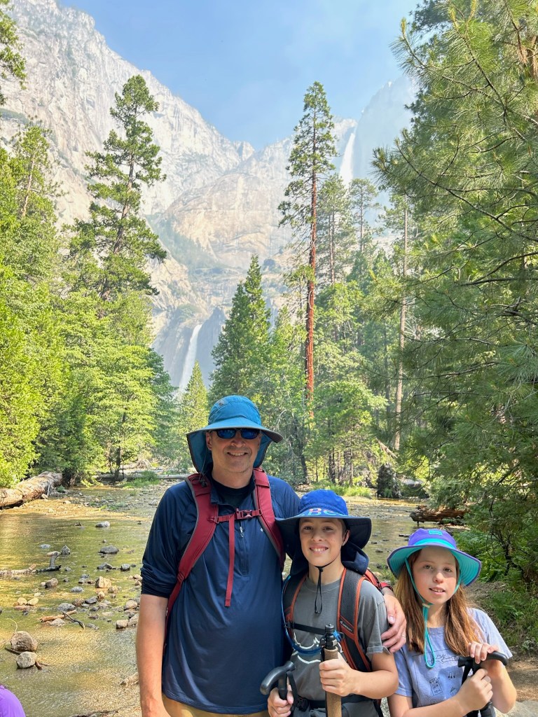
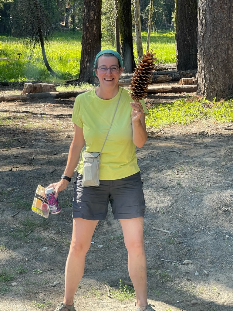
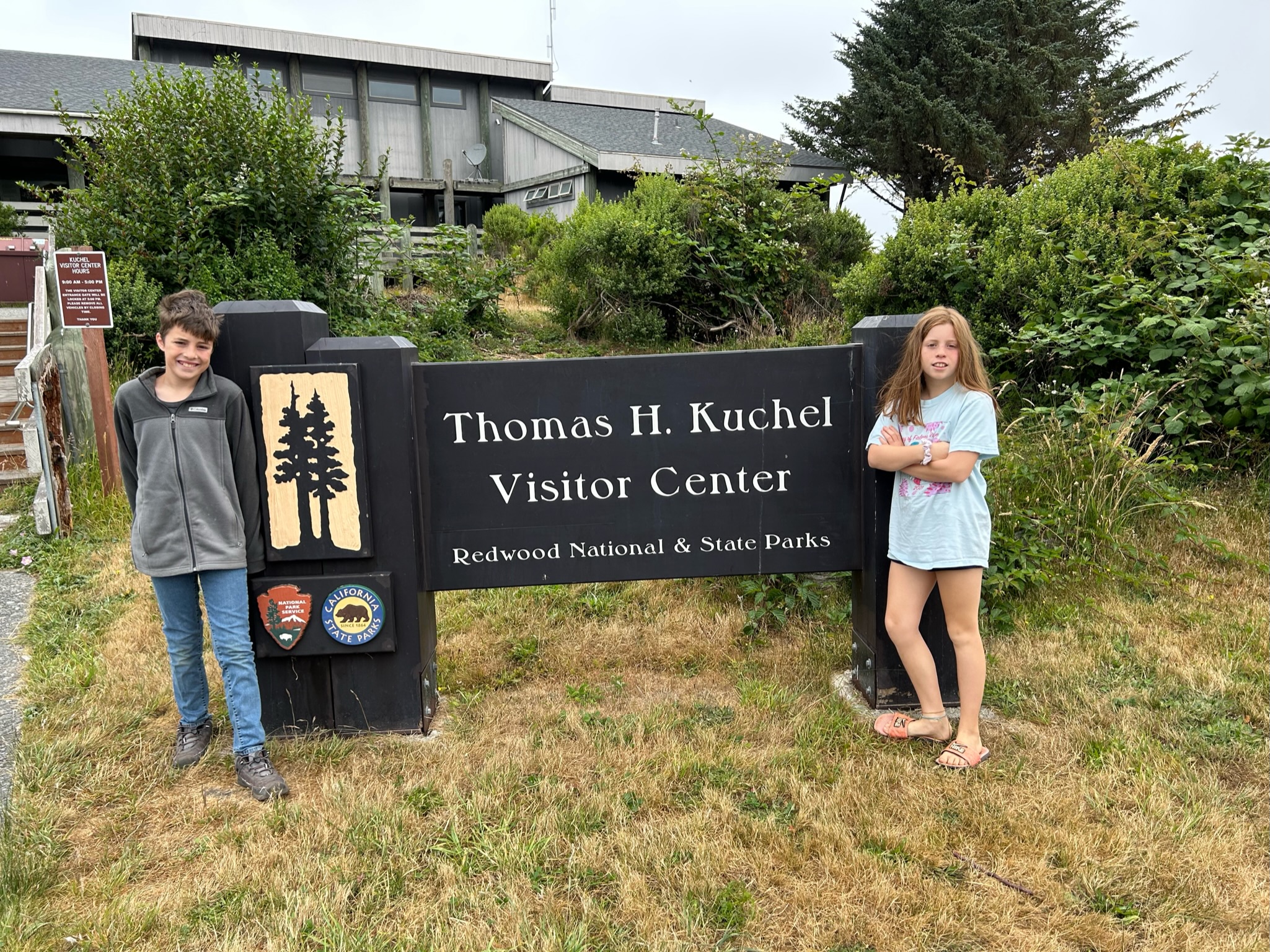
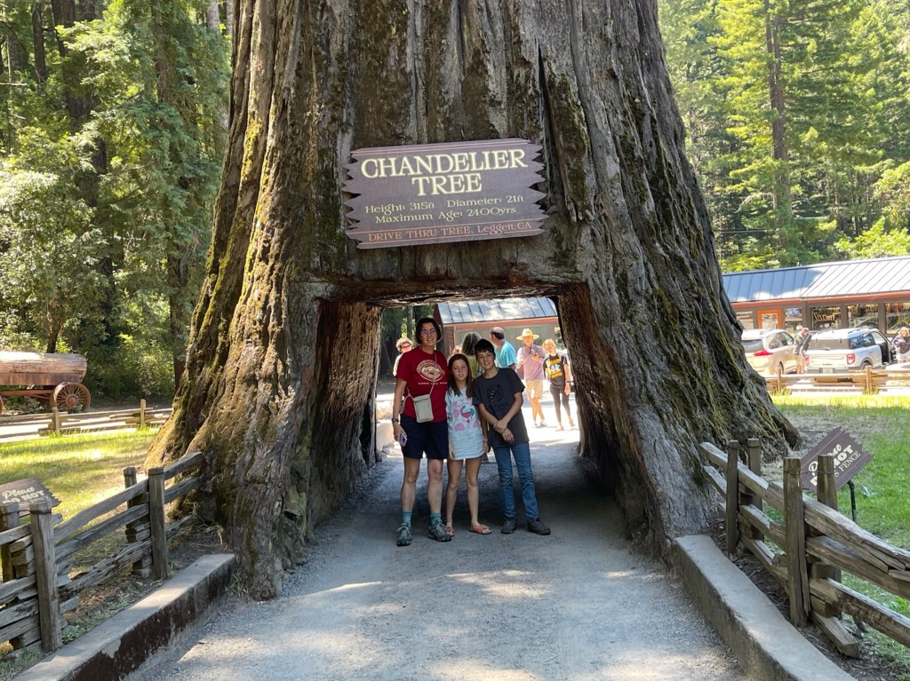
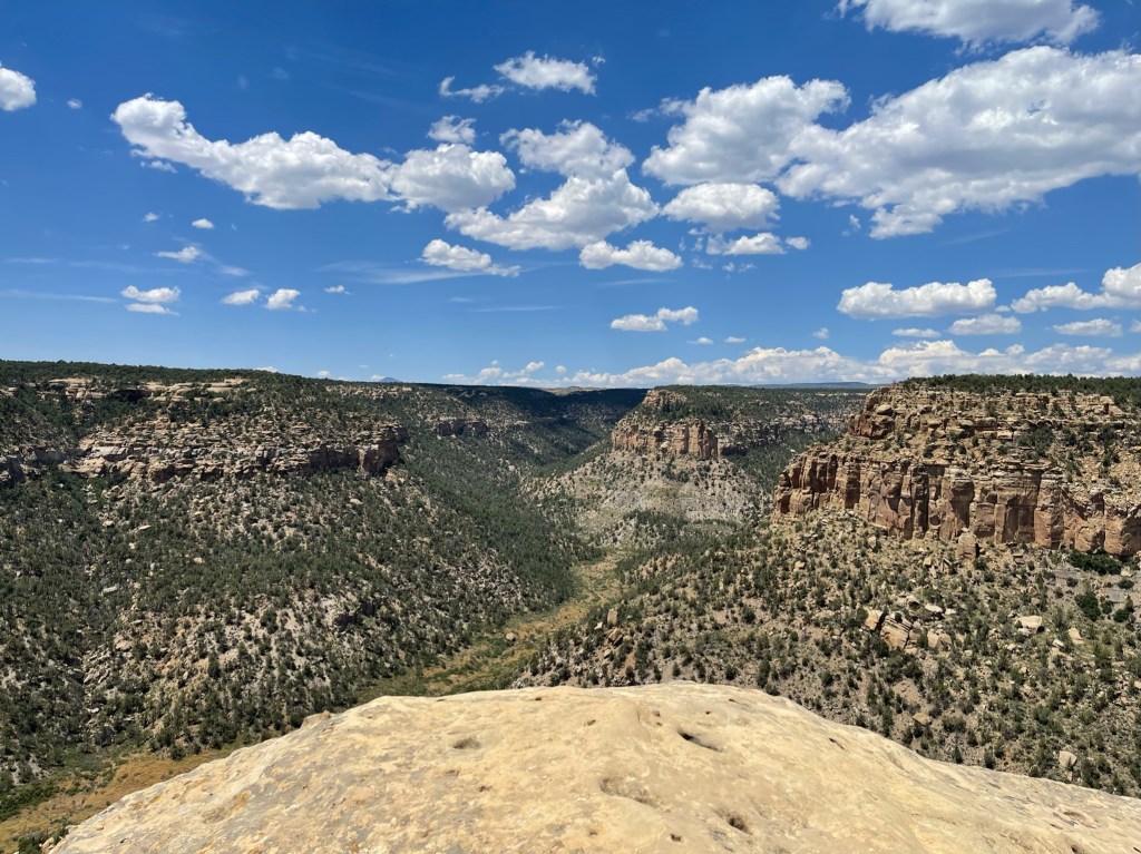
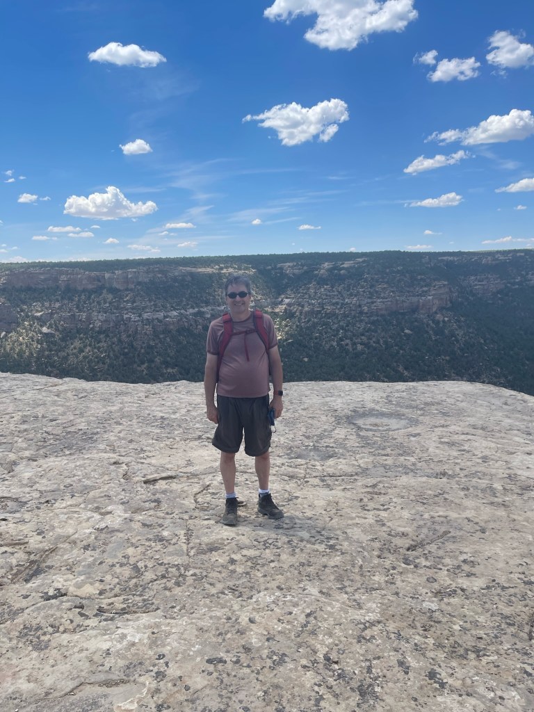
Our last stop of the day on our way back to the campsite was Park Point, the highest elevation in the park at 8,572 feet and home to the historic fire lookout. Conveniently, it was also home to the only cell signal in the entire park, so we were able to send our happy 80th birthday video to Grandpa before the end of the day! We also sent the following picture as proof 🙂

Saying Goodbye to the Grand Canyon and Hello to Mesa Verde

Wednesday, July 19th, 2023

Starting mileage: 9305, Distance travelled: 285

Miles hiked: 4

We started the day driving to the Grand Canyon visitors center to catch the shuttle to the other inner canyon trailhead. We hiked down the South Kaibab trail .9 miles to Ooh Aah Point. We traversed intense switchbacks, dropping down 1000 feet in elevation in just under a mile of trail. The views were much more expansive than Bright Angel, culminating in a nearly 360 degree view at Ooh Aah Point, earning its name.

Next we drove out to Desert View Watchtower, also designed by Mary Colter. We scored the last set of timed tickets to go up into the upper floors of the tower, which had been closed the day before. The architecture was intended to blend in with the environment and told the story about some of the native tribes in pictograms on the inner walls of the tower. The Desert View vistas were fabulous, offering 270 degree canyon views. We also learned it was the site of a 1956 passenger jet collision that lead to the formation of the FAA.

We said goodbye to Grand Canyon National Park, impressed by their infrastructure, transportation, and facilities. It was one of the best in that regard compared to all the others we had visited. The drive from Grand Canyon to Mesa Verde was striking. The desert landscape treated us to a rainbow of striking colors; dusty rose to mustard yellow to rusty red to tan and white. Dramatic rock structures uplifted, seemingly out of nowhere randomly in the desert. We watched what looked like a dust storm far off into the distance for 45 minutes until we finally got close enough to realize it was a rainstorm…in the desert! We didn’t plan on stopping at Four corners but it was right on the road we were driving through the Navajo Nation Reservation. There’s not much to recommend it. It was what you’d expect from a tourist trap but the kids got a kick out of it. The blazing heat kept our visit very brief.

We pulled into the campground at Mesa Verde around 6pm, surrounded by rock formations and plenty of wildlife (deer mostly). After dinner Susan and the kids hiked the nearby Knife’s Edge trail to see the sunset. There were at least 8 distinct flowers to capture photos of. The views from the end were awesome and the kids loved getting photos on top of all kinds of rocks. On the way back we saw two deer, a male and a female, hanging out in the pasture.

When we returned from our sunset walk, Brady captured a couple of night sky photos in the absence of artificial light.

Grand Canyon Buffet

Tuesday, July 19th, 2023

Starting mileage: 9291, Distance travelled:

Miles hiked/walked: 5.5

Our day started with a 2-hour bus tour out to Hermit’s Rest, a stopping point for the old Santa Fe Railroad-supported tourism infrastructure back in the early part of the 20th century. The only way out to this western end of the south rim tourism area is by shuttle, bus tour, bike or on foot. Our hilarious tour guide/bus driver, Gail, cracked us up and filled our heads with history, geology, and nonsense for the entire trip. We also popped out of the bus for views and lessons along the way, at Mohave Point and Pima Point before making it to one of Mary Jane Colter’s buildings, Hermit’s Rest.

Along the route, we got several wildlife sightings.

We got back to our room and ate lunch before heading back out to the Village to visit the remaining sites. We walked along the Rim Trail to Kolb Studio, Hopi House and the Verkamp visitors center, scoring two more stamps in our passport and picking up some more souvenirs. While having cocktails on the patio of the El Tovar Hotel, we observed two park rangers comically trying to wrangle a big horn sheep off of the busy south rim trail but he would have none of it.

We drove to Tusayan, just minutes outside the park to the IMAX theater to see Grand Canyon: Rivers of Time. It was a combination historical re-enactment/white water adventure film which everyone enjoyed. Upon returning to our hotel, we walked over to Bright Angel Lodge to get dinner at the Arizona Steakhouse. Although overpriced, the food was decent.

We finished dinner with only 45 minutes until sunset. After a false start walking in the wrong direction, we got to the shuttle queue out to a good view spot back west toward Hermit’s Rest. While waiting, David spotted a rainbow across the way and Brady snapped a photo of the illuminated canyon in case we missed the sunset on the bus. We caught the last shuttle to get to Hopi Point in time. The sunset was gorgeous and we shared it with lots of people.

Hiking the Hot Rim and the Deep Canyon

Monday, July 17th, 2023

Starting mileage: 9291, Distance travelled: 0

Miles hiked: 8

It was a slow starting morning but we got on the shuttle by 9:45am to head to the Grand Canyon visitor center on the eastern end of the South Rim tourist area. We arrived and got our passport stamp and stickers before heading to the Rim Trail. David captured a photo of an enormous 3D relief map along one wall of the visitors center. Sadly, both films were unavailable due to technical difficulties.

The temperature was pushing 100 and shade was sparse so we slathered on the sunscreen, donned our hats and hit the “trail” (paved walkway along the entire south rim of the canyon). We started our hike at the Mather Point Overlook, which was overrun with tourists but offered spectacular views.

After soaking in all the views and taking all the photos, we fled the mass of humanity to walk further along the Rim Trail, where crowds thinned out pretty quickly. We found a couple of spots to get a full family rim photo.

Every turn seemed to reveal another stunning viewpoint. We could also glimpse the Colorado River way down at the bottom of the inner canyon in a few spots.

We reached the Yavapai Geology Museum, got a reprieve from the unrelenting sun, then continued along the trail. Shortly after, we found an amazing outcropping where we could get panoramic photos.

We stopped for lunch on the only shaded benches we had seen, right at the point we would turn off the trail to go toward the Yavapai Lodge area for coffee, ice cream and groceries.

After taking the shuttle back to our hotel, stocked with supplies (and caffeine and sugar), we rested for a bit in the air conditioning during the hottest part of the day. The extreme heat warning issued for the inner canyon meant we had to be careful about our choices for hiking any of the interior trails. We decided to start a hike into the canyon on the Bright Angel Trail at 4pm when the temperature had started to decline. We hiked down to the 1.5 Mile Resthouse, which meant hiking back UP, of course. It took us just over 2 hours. We reached the top of the canyon soaked in sweat, dragging Laura who struggled for much of the uphill part. We were glad to have made a sensible choice about the distance.

Driving Through Mars

Sunday, July 16th, 2023

Starting mileage: 8895, Distance travelled: 396

Miles walked: 2

Susan woke up early and took advantage of the credit card-only laundry facilities (totally done with quarters for a load that cost $4.50!) Shout out to Hampton Inn for the excellent room, laundry facilities, and fantastic breakfast (complete with more Belgian waffles). When David got up, he brought the van to get an oil change while Laura and Susan took another swim in the pool. It was 95 degrees even at 8:30am.

We left at 11am with clean bodies, clean clothes and fresh oil in our van. The temperature was already 104 degrees. We had another long day of driving ahead of us but kept ourselves entertained with more of our audiobook. We just started the second of Philip Pullman’s His Dark Materials trilogy, the Subtle Knife. In the first half of the day we saw a double decker train, witnessed what appeared to be a desert sandstorm and crossed the Colorado River into Arizona. We stopped for lunch at a Jack in the Box (yes, we are trying to experience all the regional fast food chains possible) in Needles, CA shortly before crossing the border. David also pumped $6.69/gallon gas in 114 degree heat right after lunch and doesn’t recommend the experience.

The next stretch of route 40 across Arizona was the most poorly maintained section of interstate we’ve driven this entire trip. The 75 mph speed limit far exceeded what felt safe for the deeply rutted lanes. The view, however, was exceptional, transitioning from high desert (that looked like a martian landscape) to rocky, mountainous terrain with some greenery, to grasslands sprinkled with real trees. We also passed the Golf Ball House in Yucca, AZ (another great RoadsideAmerica.com find) that was originally built as a restaurant. During most of the day, we travelled adjacent, across, or on (for a bit) the old, iconic Route 66, passing numerous examples of vestiges of the roadside American kitsch of the old cross-country route.

When we got close to the Grand Canyon, we noticed a large plume of smoke on the horizon and learned that the Aspen Fire was burning on the North Rim.

Given the extreme heat forecast, we had upgraded our Grand Canyon accommodations from an RV park to an air conditioned hotel room with a kitchenette. It was astounding that accommodations were even available with 24-hours notice when normally places book solid 6 months in advance. We weren’t complaining though and our room at Maswik Lodge was an awesome place to land for the next three nights. Once we got settled, we walked over to the next lodge over, Bright Angel Lodge, where there was a tavern to get dinner. We caught our first glimpse of the canyon and the setting sun on our walk over. We also saw our first park wildlife, a baby bunny. On our way out of dinner, to our surprise, it was already dark at only 8:30.

Back to Urgent Care

Saturday, July 15th, 2023

Starting mileage: 8525, Distance travelled: 370

We woke up not sure where we would end up at the end of the day, needing to travel nearly 1,000 miles to the Grand Canyon over the next two days. Death Valley was suddenly off the table as we found ourselves in a massive heat dome causing a record-breaking heat wave. We toyed with ideas of trying to speed through Sequoia National Park or hitting Las Vegas, but the extra driving distance was prohibitive. We also had to find an urgent care to get Brady antibiotics for what we assumed was also strep throat. On the road by 9am, the first 50 miles continued to plague David with white-knuckle driving along cliffs and turns until we got down out of the Sierras, including one stretch of road that had partially collapsed into a ravine along the edge, making it too narrow for the van. They laid a gravel burm on the road – touch it with your tires and you were headed into that ravine. It was hard to capture but here are a few attempts by Laura from the front seat.

We drove for about 3 hours to get to Fresno where we got lunch and got Brady hooked up with antibiotics (after a predictably positive test for strep). Laura was definitely on the mend now and Brady was perking up after a long nap on the road. When we started the van, the change oil warning illuminated for the first time, which added to our anxiety about the desert drive ahead of us.

The second half of the drive included beautifully landscaped route 58, a train that entered 4 mountain tunnels in a row, and the most expansive wind farm we’d ever seen.

The heat was creeping up the entire time and we were worried about blowing a tire or breaking down and perishing in the desert. We eventually made it safely to Barstow, CA, a crossroads of sorts between interstates 40 and 15, (and we found out in the morning also iconic Route 66) with lots of hotels and restaurants. Laura and Susan went for a swim at 9:30pm, with the temperature still north of 100 degrees.

Yosemite Valley

Friday, July 14th, 2023

Starting mileage: 8460, Distance travelled: 65

Miles hiked: 6

We started the day realizing that the campground facilities were terribly maintained, a crime for a place that was trying to recruit us as members. The redeeming quality was being the closest RV park to the Yosemite entrance. Heeding the warnings of massive traffic and waiting at the park entrance, we got up at 5:15am and got into Yosemite by 7:30. The park entrance was very close to our campground and the wait to get in was very short due to the early hour. As soon as we entered, we started to smell smoke from the Pika Fire, somewhere in the vicinity. Entering the park involved more steep cliffs, sharp turns and white knuckles. We had read the history of the park and seen a lot about it in the Ken Burns documentary of the National Parks so we were not surprised to see the awe-inspiring

We found parking in Yosemite Valley Village quite easily relative to earlier experiences, thanks to our early arrival. Laura was still ailing but had an easier time keeping her medicine down so had a little more energy starting the day. It took a bit to get organized, eating breakfast, making lunch, buying ice and coffee, etc, but at least we were parked, our biggest concern. We decided to start at Yosemite Falls, within walking distance of the village area. We were a bit taken aback by the mass of humanity surrounding us, many of whom couldn’t be bothered to follow the rules; leaving the trail, climbing all over the vegetation, and taking their dogs off leash. Our first stop was the site of John Muir’s first Yosemite cabin, a creek-side spot with a spectacular view of both the upper and lower Yosemite Falls above.

We walked along an interpretive trail in reverse to the base of the lower falls. We rounded a corner and got blasted with cool wind and spray, a little much for Laura who didn’t have a fleece, given the 95-degree forecast and heat advisory. There were so many people, that Susan and Laura fled while David and Brady got closer to get a better photo (after patiently waiting their turn among the throngs). The falls were one of the second largest we’d ever seen after Niagara Falls.

It wasn’t until we made it fully around to the bottom of the trail that we realized why people do it in the correct order. Laura turned around to see the most impressive view of the entire falls in all its glory.

Our next destination was El Capitan, which required our first of three adventures on the Yosemite Valley shuttle in high season. The wait wasn’t too long but the shuttle was packed to the gills. When we got off we were treated to an incredible view of El Capitan, the second tallest dome in the park. Across the prairie were the only slightly less impressive Cathedral domes. Despite searching with the binoculars, we found no living things climbing the rock faces. One of the paved bridges in the area was an engineering marvel, constructed of unmilled redwood trunks.

The next shuttle wait took quite a bit longer and the ride was squished, standing room only. Kids were losing steam and getting hungry, which added to the challenge. When we made it to the Mirror Lake trailhead, we sat for a bit on the trail side to eat our sandwiches and re-group. Laura had definitely run out of gas and we were wondering whether we should split up and have Susan take her back to the camper van for a rest. She rallied a bit after lunch and we were able to exhort her to give the 1-mile trail a go. We hiked up the Mirror Lake trail which was supposed to provide a unique perspective on Half Dome from the bottom up. It was a little disappointing since tree cover made it difficult to get a good view. We were on borrowed time with Laura so we didn’t want to go any further. We did see a very cool “mirror” effect on mirror lake where it reflected the ridge line of North Dome behind it, however.

Our third and final trip on the shuttle back to the parking lot was probably the worst. There wasn’t a clear queue for the line so it was a mass of people with no clear order. That, combined with a VERY long wait for buses that were nearly entirely full, combined with tired and cranky kids was a recipe for disaster. We made it through though and got back to our van. We hit the visitors center, watched the film (a little disappointing, sadly) and got coffee and ice cream, before heading back to our campground. On the trip back we stopped to take the obligatory photo at the national park sign, which we seem to routinely miss on the way in. We also stopped for gas where we found an enormous sequoia cone and saw a giant raven poaching water on a motorcycle. When we got back, the sun was blazing and the temperature was soaring so David and Laura set up our sunshade for the first time in the trip. We had appetizers in the postage stamp-sized shade but it was lovely. The evening ended with Brady fading fast, only to discover he had a 101 degree fever so Saturday’s plans would need to be adjusted.

Berkeley Breakdown

Thursday, July 13th, 2023

Starting mileage: 8300, Distance travelled: 160

Miles walked: 3.5 (Brady and Dad), 1 (all)

If Susan and Patti thought they were done with us in the morning, they were wrong. We abandoned the idea of spending the day in San Francisco, given Laura’s illness. Instead, we took her to urgent care to find she indeed had strep throat, as suspected. We left our van at Susan and Patti’s and used their place as a home base for the day, even borrowing their car to get around. David and Brady managed to make a day out of it, exploring downtown Berkeley on foot, visiting a huge board game store, and walking through the university campus. Sadly, a Japanese import video game store was just out of reach for the second time this trip. Brady and Dad promised themselves they would find one before the end of the trip. Meanwhile, Susan took Laura to urgent care, got her antibiotics and let her have a rest.

We headed out of the city just before 3pm, antibiotics onboard for Laura and a tank full of gas. We travelled more windy, narrow roads deep into the Sierra Nevadas. Unlike several of the other roads we’ve traveled, this one had very few guardrails and made Susan incredibly nervous. It went on for miles and David found it more difficult than the Going to the Sun Road due to the length and the number of sharp turns. Little did he know this was just foreshadowing our driving conditions over the next 48 hours. We arrived at our campground in Groveland, CA just after 7pm and everyone got right to bed since we had to get up early for our day in Yosemite. Cell service was non-existent yet again, so we were incommunicado for two more days.

Knocking one off the Bucket List

Wednesday, July 12th, 2023

Starting mileage: 7949, Distance travelled: 351

Miles hiked: .5

We headed south through the rest of Redwoods National and State Parks, taking the Drury Scenic Bypass which cuts through old growth forest in the Prairie Creek State Park. Along the route we stopped to hike in to Big Tree. Right before leaving that bypass, we pulled over to watch a herd of elk sun-basking in the prairie.

After two nights in the park, we finally got to the National Park Visitor Center and snapped our only sign photo in the parks. We checked out the exhibits and scored our 10th park passport stamp. We bought David a kit to grow his very own redwood at home!

Once we exited the southern end of the park, we shortly came across another scenic byway, the Avenue of the Giants in Humboldt Redwoods State Park. It passed through a beautiful old growth forest, with some colossal trees right on the side of the road. Also in Richardson Grove State Park, we drove by a one log house that looked like a hobbit house with a regular sized door, but sadly no photo.

Desperate to find a place to stop to make sandwiches for lunch, we were lured to drive-thru tree place right off route 101. Our camper van was too big to fit but we did get to walk under it and take a photo straight up the hole in the middle.

Our next stop was to check off one of David’s bucket list items, a visit to the Russian River Brewing Company, home of top-rated IPA Pliny the Elder. They also had the best spicy chicken wings (with Pliny sauce), slightly spicier than Buffalo sauce.

As we got closer to Berkeley, our next stop, we became increasingly concerned about Laura’s health and decided to get her and David a hotel room rather than follow our plan to stay at our friends’ Susan and Patti’s house. We did go over for dinner and ate outside in their lovely backyard. They treated us to an amazing homemade meal, something we haven’t had in nearly 4 weeks. Sadly, we got zero pictures of Susan and Patti and only came away with pictures of the kids.

Camping like an Ewok

Tuesday, July 11th, 2023

Starting mileage: 7910, Distance travelled: 38

Miles hiked: 3.3

We decided to let the kids sleep in because Laura had a sore throat last night. They both slept until 10am, a record for both of them. Consequently, we didn’t leave the campground until 11:30. Laura was still a little under the weather with a runny nose. At Jesse’s suggestion, we started the day at Trees of Mystery, an old-school tourist attraction dating back to the 40s that still draws families from around the country. We were greeted by a 3-story-tall Paul Bunyan statue, accompanied, of course, by Babe the blue ox. We got to ramble along suspended bridges and platforms in the redwood canopy like Ewoks in the forest of Endor. Imagine our surprise when we turned a corner to find yoda standing there. We also took a gondola up to to top of a big hill and hiked down the very steep Wilderness Trail, surrounded, the whole while by redwoods, many dating back hundreds of years. The icing on the cake was at the exit, a cross-section of a 1,000-year-old tree.

We found a roadside diner in Klamath sitting next to a field with two emus. Brady and Laura were psyched to have breakfast for lunch! After lunch we took a short walk on the Coastal Trail to the Klamath River Overlook, in underwhelming destination, but with some lovely Pacific views, and one snail sighting.