Terraforming Mars?

Wednesday, July 24, 2024

Starting mileage: 17269, Miles travelled: 164

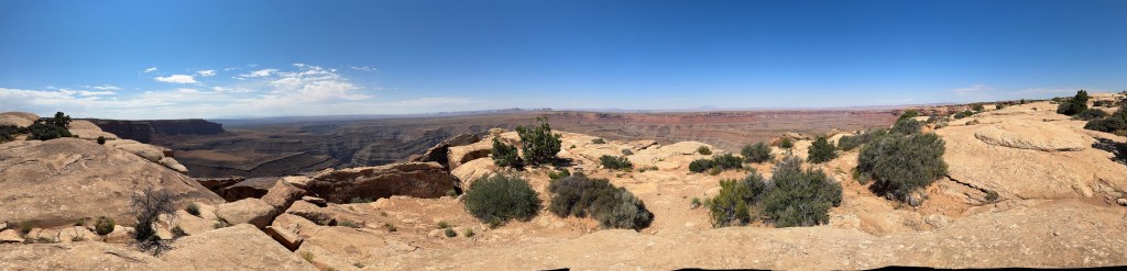
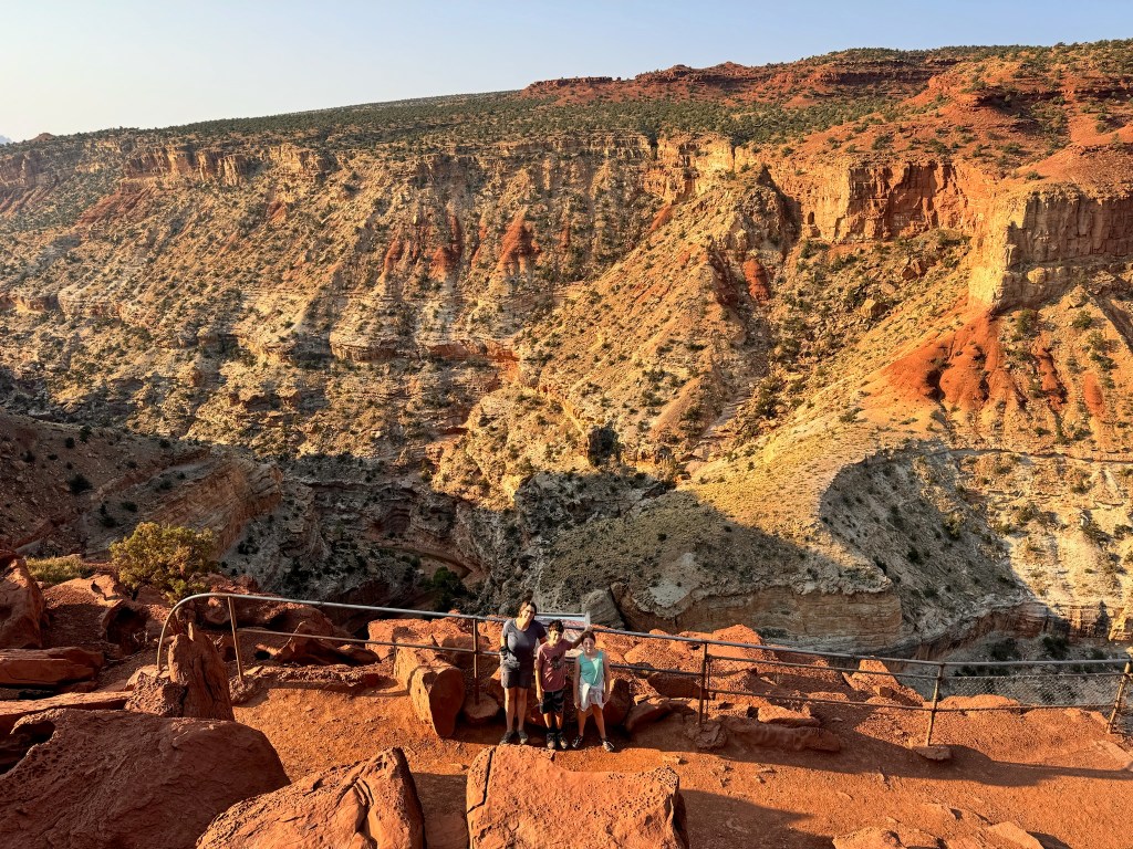
We got an early start, heeding warnings that trailhead parking lots would fill by 9am. We were out by 7:40am, the earliest so far. Our first stop was Gooseneck Point, where we were surprised to learn that Sulpher Creek which ran through the bottom of the canyon was at the same level as the top of the Grand Canyon so if we wait some unknown millions of years we could find another Grand Canyon here.

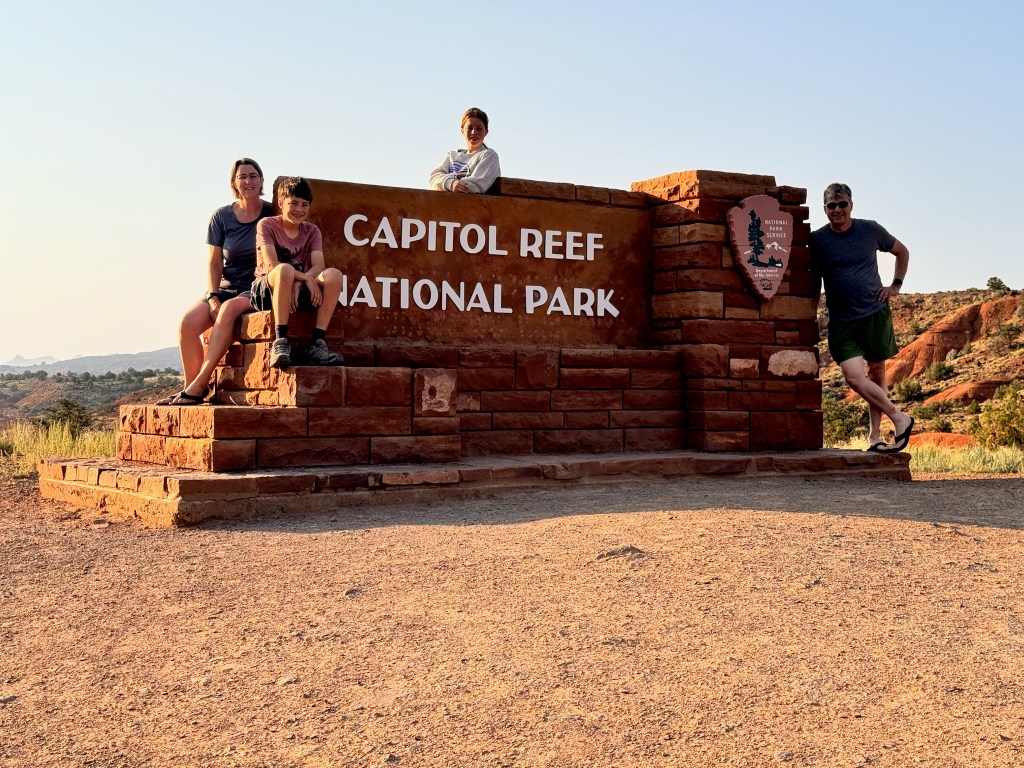
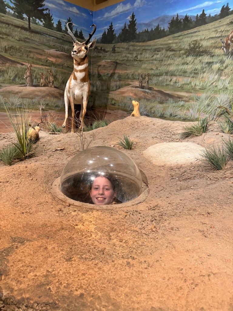
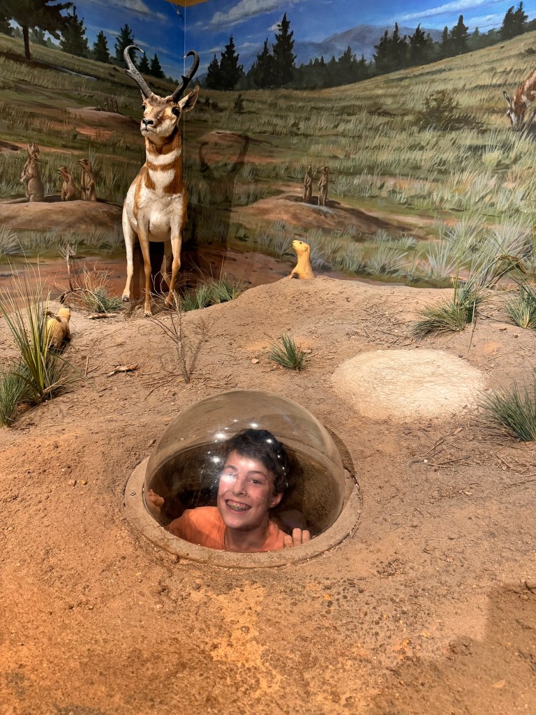
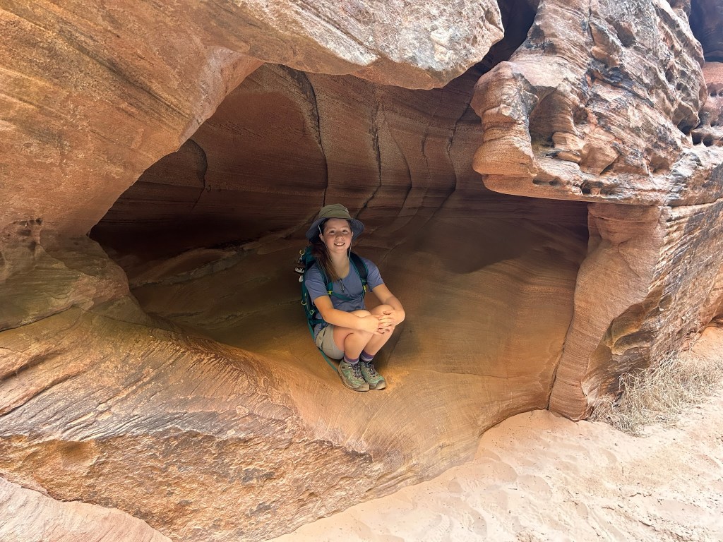
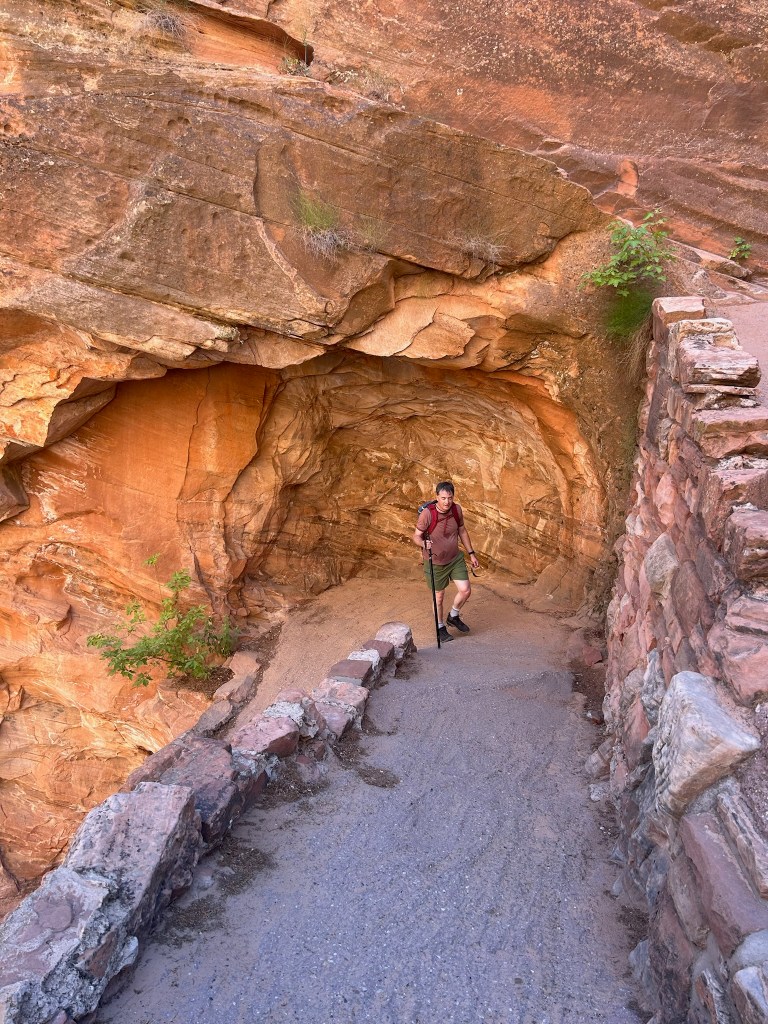
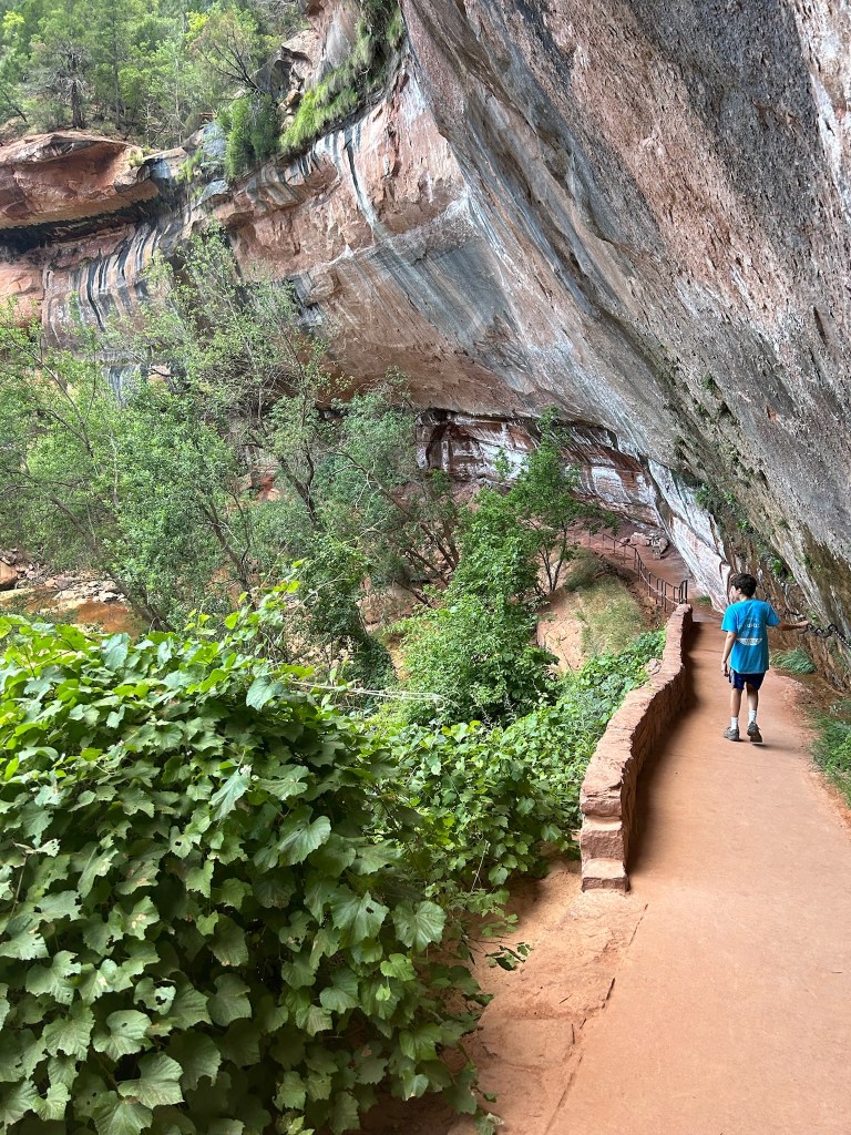
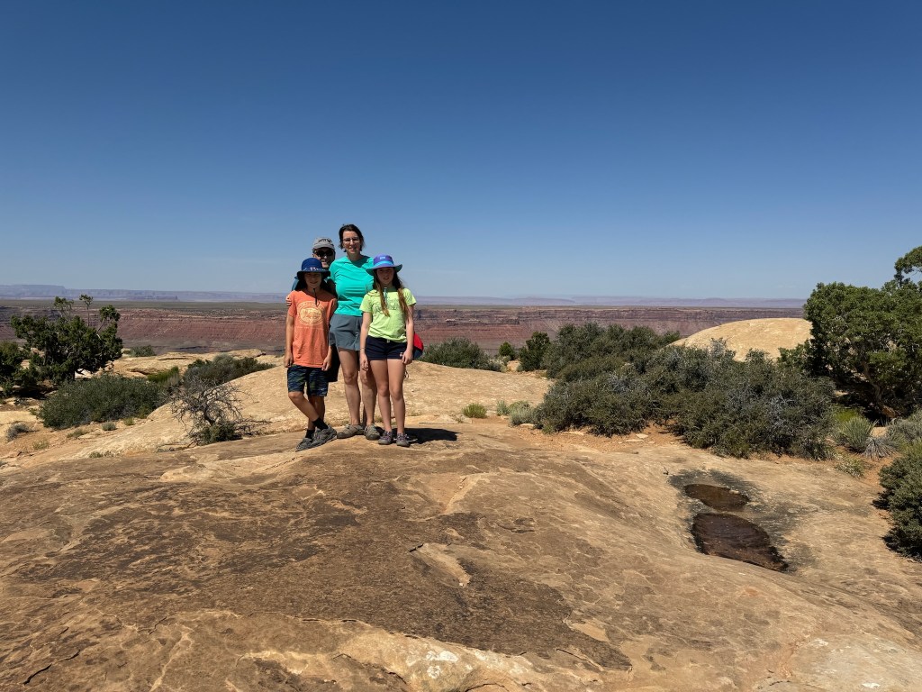
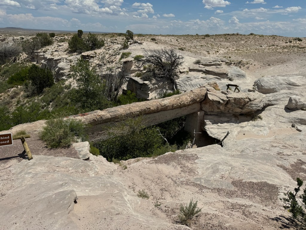
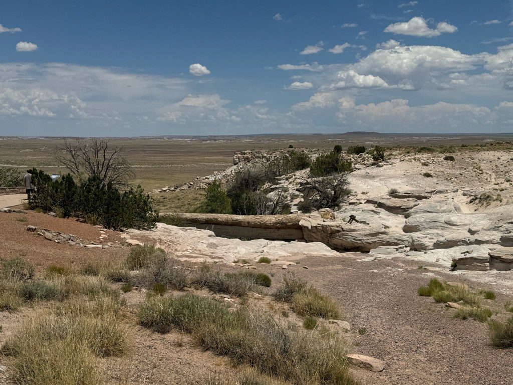
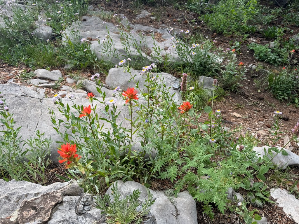
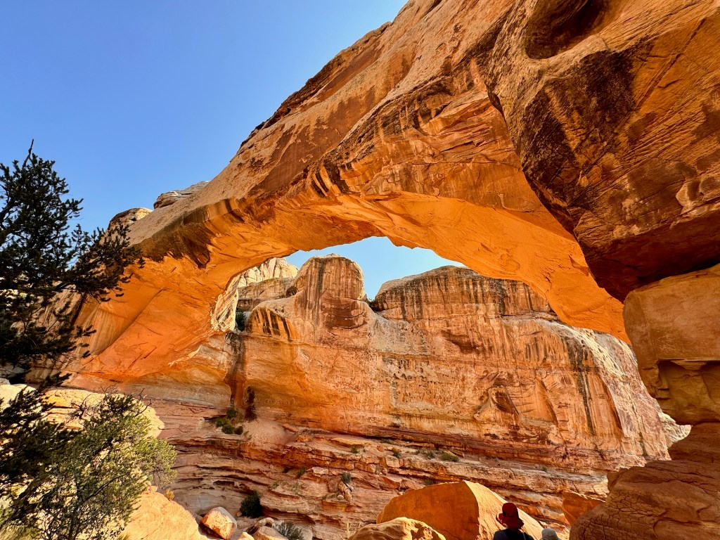
After that quick stop, we headed for the main event, a 2-mile hike to Hickman Bridge, a natural bridge spanning 130 feet long and 125 feet high. From the trail we also saw a smaller bridge, several holes to hide in, and the Capitol Dome, a formation that gets its name from the iconic building top in Washington, D.C.

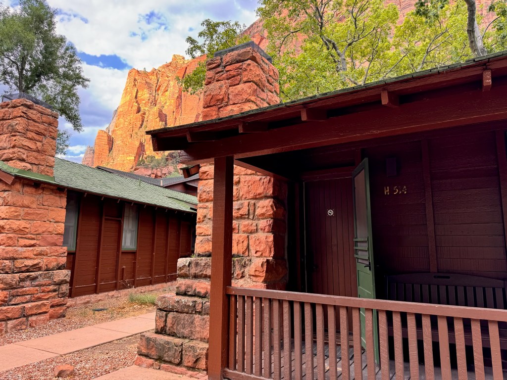
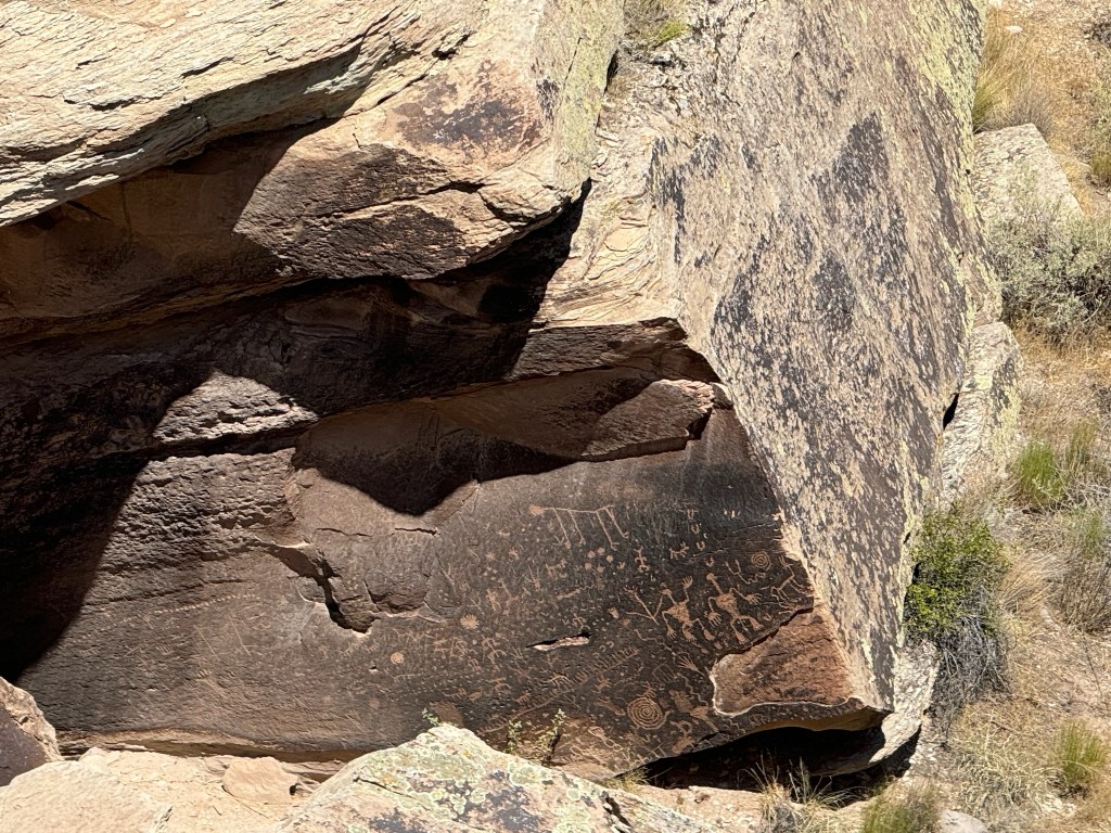
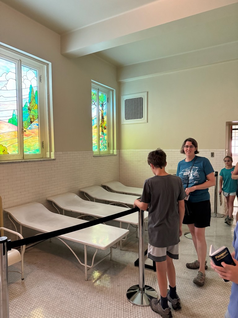
We stopped at Gifford House, an historic building from early Mormon settler time for pie and a cinnamon roll (which were both delicious). On our way out of the park, we made stops at the blacksmith shop, schoolhouse, and petroglyph panel, evidence of the Fremont people.

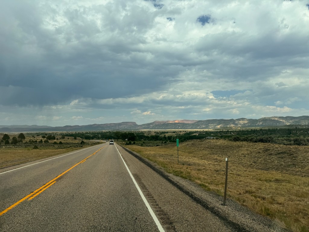
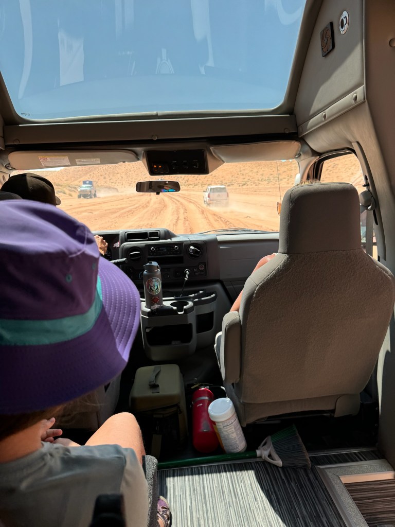
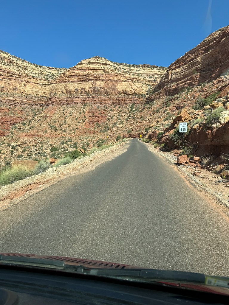
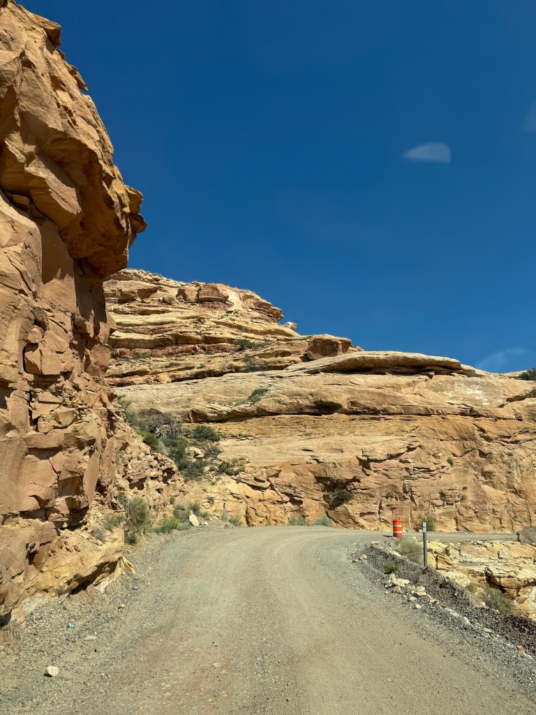
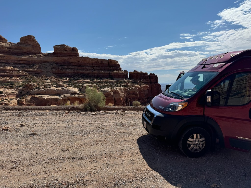
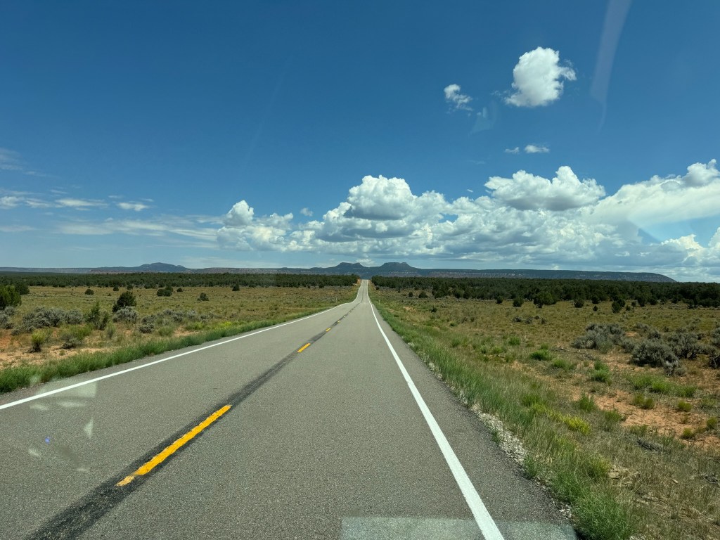
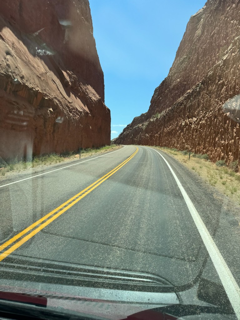
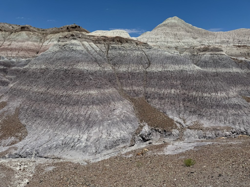
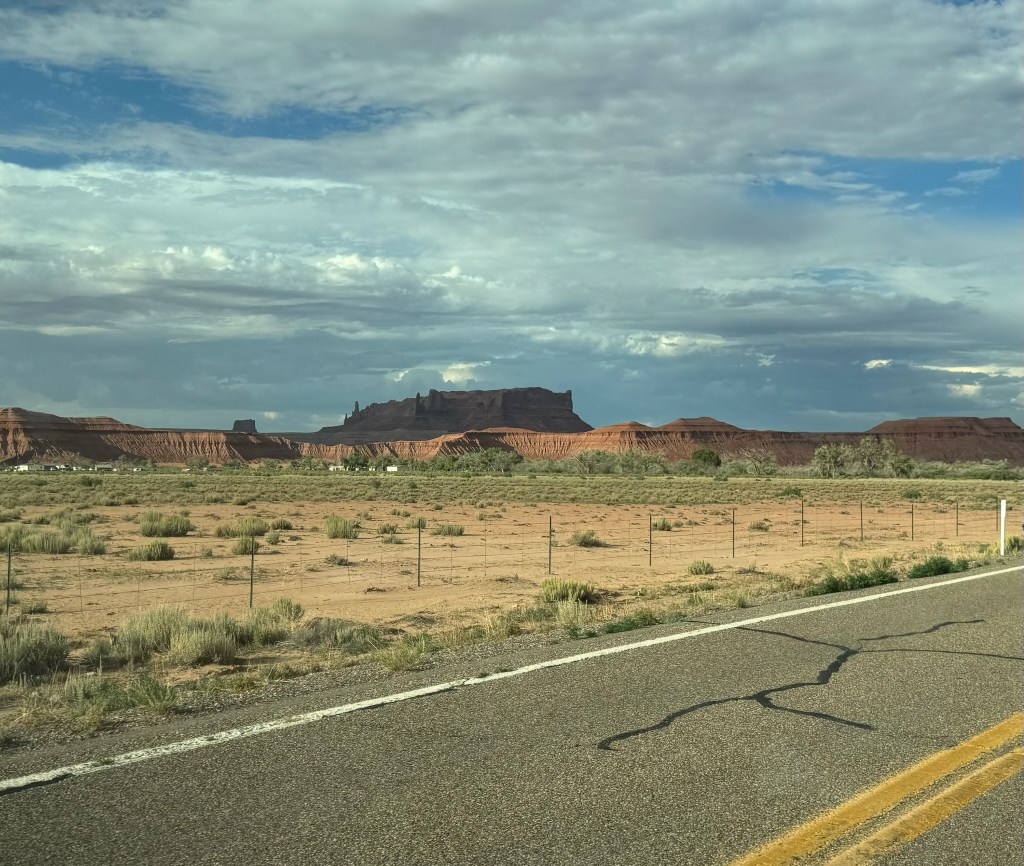
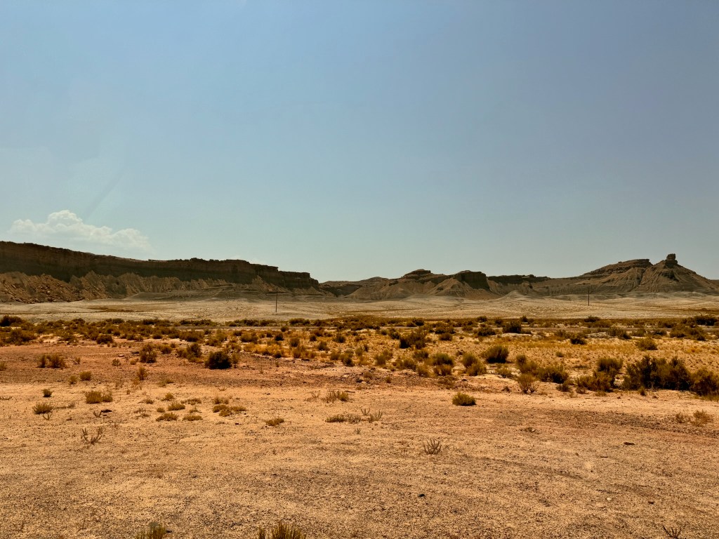
Our road to Arches was about as uninhabited/uninhabitable as it gets. It looked like a Martian landscape. Brady was so proud that we beat Elon Musk to Mars.

After a couple of hours in a literal and cell signal desert, we emerged in Green River, the land of civilization, fast driving, and 5G. We ate lunch at Tamarisk Restaurant overlooking the Green River, itself. We finally got to try traditional Navajo fry bread, which was delicious and similar to fried dough, but more airy and flavorful…bonus, better dipping sauces.

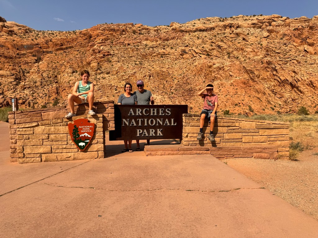
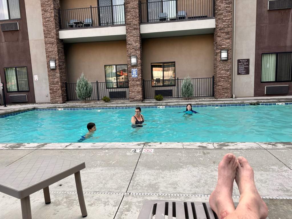
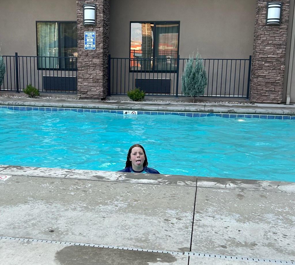
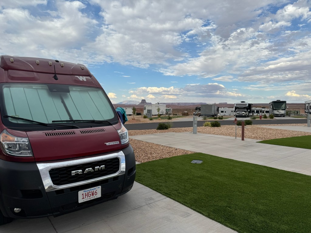
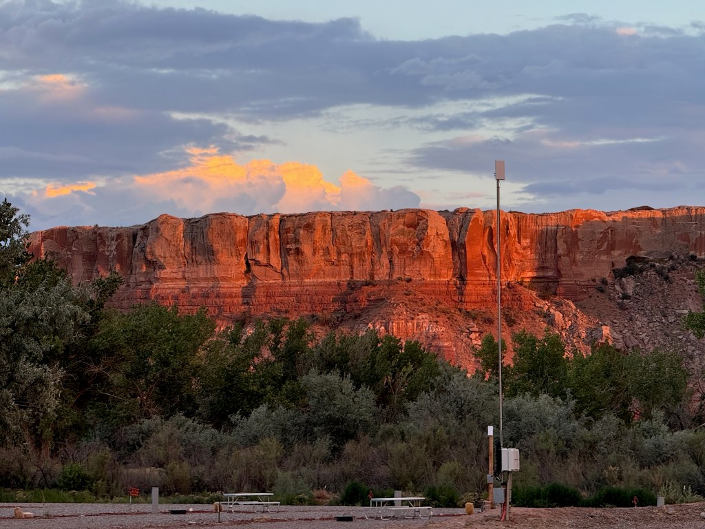
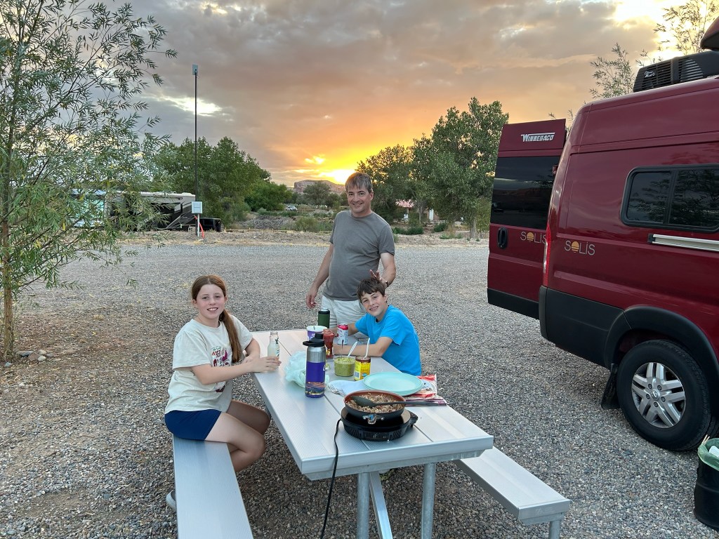
With only an hour left to drive, some green returned to Mars. We arrived at Sun Outdoors, our home for the next four nights…or so we thought. Susan quickly put in all the laundry upon arrival, because it was so hot, we were going to go directly to the pool. By the time Susan returned from the laundry room, the writing was on the wall. The van’s AC could not keep up with the 104-degree heat in the blazing sun. Everyone hid in the van sweating while we booked a room in a nearby hotel and waited for the laundry to finish. Our new home for four days became the Sleep Inn, with its pool and hot tub and free breakfast. On the way, we stopped by the Arches National Park Visitor’s Center for the obligatory passport stamps, and some t-shirts. After a swim in the pool to cool off, we got dinner at Canyon Pizza Co., just a short walk down the street from our hotel. We had the lights out by 9:30pm so we could get an early start on Thursday morning.

Sweatin’ in the Hoodoos

Tuesday, July 23, 2024

Starting mileage: 17137, Distance travelled: 132, Miles hiked: 6.2

Our day started with a shuttle ride into Bryce Canyon NP. Since we’d already stopped at the Visitor’s Center the day before, we took the shuttle directly to Bryce Point, the highest point in the park overlooking the Bryce Amphitheater.

We hiked the Rim Trail 1.5 miles to Inspiration Point and then another .7 miles to Sunset Point. As we made our way across the rim of the canyon, we got several new vantage points from which to view the fins, windows and hoodoos, the formations of sandstone that make up the amazing landscape.

David got some nice portraits in front of the multiple views.

We have literally hundreds of pictures we could share because every view was unique, but we’ll spare you the scrolling. From Sunset Point, we took the Navajo Loop Trail, a deceptively challenging 1.3 mile circuit hike that drops down 500 feet into the base of the canyon and back up. Both the descent and ascent involved crazy switchback and blazing sun. The kids both took a turn at wielding Thor’s Hammer, one of the most recognizable hoodoos in the park. We also nearly missed Two Bridges, which looked closed off until we looked more closely. There was some significant complaining along this trail. I’ll leave it to you to figure out who was responsible based on the photos.

Once we emerged from the deep canyon, we ate sandwiches and walked another half mile or so to the general store to get David something to eat. Did we mention that in the flurry to get out of the van with sunscreen, boots, snacks, and water, David forgot his entire backpack?!? Once fortified, we hopped back on the shuttle to return to our van outside the park. We were off to our next park, Capitol Reef, about 2 hours away. We made it to the Visitor’s Center with minutes to spare before they closed at 4:30. Part of the park is a what remains of a historic Mormon settlement, including orchards. Before we headed to our campground for the night, we stopped to pick apricots, the fruit in season. They were delicious.

After checking into the Wonderland RV Park in Torrey, UT, we got some excellent Mexican food at a little restaurant in town. Susan and the kids played some Quixx as the sun set and we got to bed early so we could get an early start on Wednesday.

Maybe we shoulda brought a boat…

Monday, July 22, 2024

Starting mileage: 17049, Distance travelled: 88, Miles hiked: 6

We moved out of our Zion Lodge cabin and headed out for a day of adventure in the Narrows, a deep, 16-mile canyon continuing to be carved out by the Virgin River. On the way out, we realized the one thing we forgot at home, the dry bag! We had to improvise using nested ziploc bags to protect the one phone and key fob we took along. There was an added complication of the river water being tainted with toxic Cyanobacteria so we had to keep water bottles and snacks dry as well. David became anxious that we weren’t equipped properly, seeing all the rented water boots and wooden walking sticks but our old Keens and hiking poles served us well. Laura volunteered to navigate without a pole since we only had three and we dubbed her, the water goat by the end because she was much faster and more agile than the rest of us. The one-mile Riverside Walk lead to the beginning of the Narrows, which varied from an inch to about 4 feet in depth. While there were occasional stretches of sandy bottom or dryish trails, most of the walk was on pebbles, rocks, and boulders typical of a river bottom. The footing was treacherous and Susan and David definitely needed the poles to stay upright. We were joined in the river by hundreds of other hikers, in various states of dress and preparedness, from full flotation devices (in case of flash flood) to crocs and slides, some of which were lost downriver. We were only mildly concerned about flash flooding, which the Park Service listed as possible (not probable or likely). Only through one early section did the water require you to go in waist high (or chest high for Laura). The canyon walls were spectacular, including hanging gardens, waterfalls and many seeps creating beautiful colored sections. We made it in almost a mile and a half before deciding to turn around, which ended up working out perfectly, for two reasons. First, it was nearly noontime so the sun began to reach the canyon bottom and heat it up. Second, we made it back to the shuttle stop just before a possibly flash flood-inducing thunderstorm rolled in. Susan and David still got wet through the open roof of the shuttle but it felt good in the heat.

We retraced our steps out of the park, including back through the giant tunnel, which we had to wait for an RV to pass through solo. Before we reached our destination at the Bryce Canyon Visitor’s Center, the landscape began to transform.

We stopped by the Visitor’s Center to get information to plan our next day and get the passport stamped. Not only was there a 3D model of the entire Giant Staircase from Bryce to the Grand Canyon but also…a prairie dog habitrail for Laura and Brady!

We drove back out and checked into our campground and quickly scooted over to get dinner because we had skipped lunch and everyone was starving. We went to Ruby’s Inn Cowboy Buffet and Steakhouse, the restaurant attached to our campground. Although the reviews were not promising, the quick buffet access to food saved us from a hangry kid catastrophe. Laura and Susan took a dip in the pool before we all crashed for the night.

Epic Ridgeline Hike…AKA we really ARE crazy!

Sunday, July 21, 2024

Starting mileage: 17049, Miles travelled: 0

Miles hiked: 9 (Brady & Susan), 5.5 (Laura & David)

It was an early start to get everything ready and hit the trailhead to Angel’s Landing by 8:30am. Susan had scored a rare permit to hike the trail back in April through the quarterly lottery system. Our permit allowed us to be on the hairy final half mile after 9am. It took us a little over an hour to climb the first two miles, including some very stacked switchbacks called Walter’s Wiggles. We gained nearly 1000 feet of elevation in those two miles but it was almost entirely in shade. Laura was feeling much better and everyone was in good spirits.

With the day beginning to warm and the shade disappearing, we started up the ascent to Angel’s Landing. The half-mile trail is straight up the knife’s edge with only a thick chain to hold onto and single-file two-directional traffic. Although incredibly intense and strenuous, everyone loved this last segment of the climb. The view was spectacular and the team spirit on the trail was really fun and inspiring. From the top you could see in all directions, including up and down the length of the canyon.

By the time we made it halfway down, we were feeling incredibly grateful (and smart) for starting so early. The temperature was rising and although we got back into the shade at the bottom of Walter’s Wiggles, the last 30-40 minutes was in unrelenting sun. We all agreed that this final stretch was by far the hardest and we were so happy to get back on the air conditioned shuttle at the bottom. We passed many people heading up as we were finishing up around 12:30 in the sunny, 104-degree heat, and couldn’t figure out how that was possible.

We got lunch at the cafe back at the lodge and basically recovered the rest of the afternoon, chilling out in the cabin. Some of us iced sore knees and took showers and rehydrated. We headed back to the lodge for a giant pretzel and a drink in the beer garden before having dinner at the Red Rock Grill. After dinner, Brady and Susan decided to take the shuttle back up to the Grotto stop and hike the Kayenta Trail to Emerald Pools. The air temperature had cooled down and the sun was long gone from the bottom of the canyon. We saw all three: lower, middle, and upper Emerald Pools. In the evening we saw more lizards and tadpoles on the trail than fellow hikers. We also missed the last shuttle and walked the half mile extra back to our cabin, much of it followed by a wild turkey who took an interest in us.

Slot Canyon in the Heat

Saturday, July 20, 2024

Starting mileage: 16900, Miles travelled: 149

We had a slower morning because our canyon tour didn’t start until 11:00am. We took showers and packed up, drove to downtown Page for supplies and WiFi to post yesterday’s blog, and got coffee. As we headed to our Upper Antelope Canyon tour, Laura started to feel nauseous… bad timing. She sipped water and did some deep breathing and managed to make it through the tour, including two VERY bumpy rides across the sandy river wash to reach the mouth of the canyon. The drive to the canyon was like driving in 6 inches of snow at a reasonable clip without regard to whether you slid or not, quite exciting, but bumpy.

The tour itself was breathtakingly beautiful, a high noon tour through the A-shaped slot canyon provided multiple sunbeam views. Jay, our tour guide was a pro. Though the tour was heavily scripted, he shared lots of science and history, taking excellent photos at ideal locations where the light was spectacular, tossing sand to accentuate the sunbeams. We really enjoyed the walk through the canyon even though we could have done it on our own in about 15 minutes instead of an hour and a half (some of us are more impatient than others). The walk back to the van was brutally hot and the danger of Laura vomiting was ever-present but we safely made it back to the tour base with no incidents.

We considered visiting Horseshoe Bend, an extreme oxbow completely surrounding a huge butte, even going as far as paying the $10 entrance fee and eating lunch in the parking lot to hide from the 102-degree heat. Ultimately, Laura was not up for it and leaving the car idling for an hour while two people walked to see it was just not practical. Instead we headed straight for Zion National Park, about two and a half hours away. 

The drive into Zion was absolutely spectacular, rivaling both Yosemite and Glacier. Stunning rock formations, big horn sheep, and idiotic drivers were abundant. We drove the longest tunnel through a mountain we’ve ever seen, followed by stacked switchbacks down into the base of the canyon. 

We arrived at the visitor’s center just around 5:30pm, got our passport stamp and some Zion swag before heading to our night’s accommodations. Since we were staying in a cabin at Zion Lodge, inside the park, we got to drive our camper along the restricted shuttle-only road that runs north-south through the park. We were all excited to be sleeping in the same place for two nights in a row! Our cabin was nestled among some enormous canyon walls as you can see.

Are we crazy?…possibly

Friday, July 19, 2024

Starting mileage: 16616, Distance travelled: 284, Miles walked: 3.5

We found ourselves in Bluff, UT because David’s college friend, Eric (whose family hosted us on last year’s adventure) highly recommended Muley Point Overlook. The recommendation conveniently omitted the death-defying drive up the side of a bluff, followed by a brain-rattling 5-mile dirt road out to end of the giant bluff. Last summer we thought we had steeled our nerves on the most harrowing of cliff-side drives, but clearly we were wrong. Adding to our anxiety on the ascent, we saw evidence of at least one vehicle that didn’t make it to the top.

Driving up moki dugway to Muley Point

We were rewarded by some of the most spectacular 270-degree views…and cute little lizards skittering around everywhere.

We wimped out and decided it was too risky to drive back down the way we came. If we came across ANY other vehicle coming up the road, there would be NOWHERE to go except over the edge. We were once again rewarded by even more amazing views even though it meant driving an extra hour. Possibly that extra hour ended in some kid shenanigans.

We headed south to get around the rough terrain, back into Arizona, and west to get across to Page, AZ, for our next adventure. We arrived at our campsite just before 5pm (4pm? Damn Arizona!) in 102 degree heat. We stayed at the Antelope Point Marina and RV Park, right on the shores of Lake Powell at the intersection of the Glen Canyon National Recreation Area and the Navajo Nation. Upon arrival, Brady opened the van door to a strong, hot desert wind and exclaimed,”it’s like being in a blow drier!” We were just a short walk (1.25 miles) to a place you could swim so we put on our suits and headed down for a dip before dinner. Although the water was close to 80 degrees, it was very refreshing and the terrain and red sand were very cool.

After walking back, much refreshed, we changed and headed down to the marina for dinner. We went to the world’s largest floating restaurant, Jadi’Tooh (The Point), right out on the docks.

After dinner, we came out to see amazing sunset views on both sides. The temperature had cooled off enough for us to sit outside on our tiny piece of turf and enjoy the nearly full moon playing in the clouds.

Wooded Badlands and Hours of “Cow or Shrub”

Thursday, July 18, 2024

Starting mileage: 16239, Distance travelled: 377

Our day started waking at our no-frills, highway-side RV park which got us a little closer to the day’s destination, Petrified Forest National Park. The highway was dotted with asphalt-colored volcanic rock detritus that confused us for miles, thinking it might be torn up old road. We crossed into Arizona and made it to the visitors center by what we thought was 10:30 but have since been confused by Arizona’s stubborn refusal to follow Daylight Savings Time.

After a couple of scenic overlook pauses, our first stop was the Painted Desert Inn, a national historic landmark that had been turned into a mini-museum and gift shop.

Our next stop was Puerco Pueblo, an ancient Native American settlement that shows signs of early technologies, including using a crack in a boulder to track the solstice.

A short distance further was Newspaper Rock, the largest concentration of petroglyphs in the park, arranged across two giant boulders. There was also a dramatic rock fall there.

Blue Mesa was our next stop and longest hike in the blazing sun. We walked a total of one mile through blue and purple hills scattered with petrified wood logs. Erosion evidence was on full display and pebbles were literally littering the tops of sandstone slopes. A mile might not sound like much but between the elevation gain and the brutal 95-heat with zero shade, it was rough.

We stopped briefly at Jasper Forest (largest collection of petrified trees in the park), Agate Bridge (longest petrified wood spanning a gully), and the 1932 Studebaker marking the location of former Rt.66 (as the only National Park it passed through).

We finally made it to the south end of the park, where we ate lunch at a picnic area threatened by a murder of giant crows. We visited the Rainbow Forest Museum, home to fossils from the park, including dinosaurs and non-dinosaur ancestors of the modern crocodile. Enormous polished cross-sections of petrified wood were also on display, showcasing the incredible array of colors it can possess. A walk through Giant Logs behind the museum showed off the biggest tree in the park, “Old Faithful,” boasting a 10-foot circumference at its largest section.

Our final stop in the park was Crystal Forest, on our way back north. We were mildly disappointed with the lack of “crystals” as advertised, but also nearly had a repeat of yesterday’s thunderstorm adventure, but this time in a flat desert with no shelter. We repeatedly exhorted Dad to cease with the obsessive photographic documentation and just get back to the safety of the van.

Shortly after leaving the park, Brady discovered that ant colony had decided his iPad was the safest nesting area. At some point during the day, they had moved two mounds of eggs the size of a stack of quarters to the screen of his iPad. Once discovered, they began relocating again to an unknown location in the van, while the family panicked until we could find a place to stop. Once we were able to clean the eggs, we realized that they had also been relocated under the iPad and inside the case.

The drive north to Utah was beautiful, passing through very flat scrubby desert with huge, glorious rock formations surrounding us in all directions. On this stretch we passed through our first sections of open range land where cattle roam free. To keep ourselves entertained and avoid sibling squabbling, we started playing “Cow or Shrub,” a rousing game of quick identification along the way. It had the added benefit of avoiding plowing into a cow (or a shrub) at 70 MPH.

We crossed the Utah border and immediately landed at our home for the night, Cadillac Ranch RV Park in Bluff, UT. Despite a distinct ranch aroma on the breeze, it had amazing views at sunset and the best facilities, including the fastest internet we’ve had in a campground.

Stuck in the Sky

Wednesday, July 17, 2024

Starting mileage: 15866, Distance travelled: 373

We awoke late in Amarillo, TX, glad to find our camper van intact after parking overnight in a sketchy deserted end of the parking lot with warning signs about leaving valuables. The time change worked in our favor and bought us an extra hour. Welcome to mountain time! Our drive time was relatively short compared to the prior four days. We only drove four hours west to Albuquerque, NM. With only a short time to explore, we opted for an aerial tram ride to the top of the Sandia Mountains in the Cibola National Forest on the northeastern edge of the city. The tram has the longest single length between towers. The ride up provided views of the Albuquerque region and the Sandia range. The craggy rocks and deep canyons were striking.

At the top, the views were no less spectacular and we could see the other side of the Sandia Crest, north over a ski area in the process of rebuilding after the pandemic. There’s a very high-end restaurant at the top that serves formal dinners but in the afternoon is more casual. We got drinks and enjoyed them along with the stunning vistas.

We decided to take a relatively short hike up to the highest point, where the Kiwanis Ski Cabin was perched, blending into the landscape. The first two versions of the cabin, made of wood, burned and blew off the mountainside. The currently standing stone and masonry structure was built in 1936 by the Civilian Conservation Corps. We quickly realized that the 10,000 ft altitude made a fast pace impossible, and made some of us lightheaded.

The fauna was incredibly varied along the trail and Laura captured several of the flowers.

Just as we were beginning to head back, Susan and Laura saw a giant bolt of lightning in the middle of the canyon, only a few hundred yards away. We quickened our pace on the decent and at one point heard a crack of thunder so loud and close we all jumped. Although no rain was falling, we were right I the center of the electrical storm. When we reached the tram station we were not surprised to see a crowd huddled inside waiting for the suspended tram service to resume. All things considered, it didn’t take that long and we were down on the third tram in about an hour.

We asked a local woman on the tram for a dinner recommendation and had a fabulous New Mexican meal at El Pinto.

Relaxing Spa Getaway or Secret Torture Chamber?

Tuesday, July 16, 2024

Starting Mileage: 15298, Distance travelled: 568

After a delicious breakfast at our hotel, including coffee delivered to our room upon awakening, we walked the Grand Promenade behind Bathhouse Row and made our way to the Visitor’s Center to get our passport stamped. Boy were we surprised by what else we found. Not only were there exhibits about the hot springs and the history of the National Park, but the entire bathhouse that housed the Visitor’s Center was a preserved bathhouse, complete with hydrotherapy chambers that look like torture devices, ladies lounges, and a full gymnasium.

We hit the road again for a long day of driving, passing through Cherokee, Muscogee (Creek), and Seminole Nations, Oklahoma City, and finally Amarillo, TX, where we landed at 9pm. We got a quick bite to eat at a Jimmy John’s sandwich shop after being turned away at Red Robin which supposedly closed at 10pm, but sadly, was locked. David thinks we drove 1 million miles but you can see above that it was far less than that. We did, however, make a conscious decision to put lots of road behind us today, so we could spend some time in Albuquerque tomorrow.

Historic motels, Midwestern pyramids, and Waffles!

Monday, July 15, 2024

Starting mileage: 14,930, Distance travelled: 315

The day started with a quick snack to get us from bed to the nearest Waffle House, the next chain restaurant on our bucket list. As far as diner food goes, we were pretty pleased, but the service is what put Waffle House on our thumbs up list, well, and the pecan waffles, which were pretty delicious. Dad’s dissenting opinion was not recorded. Our next stop was Memphis. We passed over Graceland and the Pyramid Bass Pro Shop to visit the National Civil Rights Museum, located in the Lorraine Motel, in the very spot where Dr. Martin Luther King, Jr. was assassinated. The museum was incredibly well designed and integrated into the motel building.

It was surprisingly easy to get in and out of downtown Memphis, even in our big van. David thought it was super cool to learn they were restoring their trolly car networks we saw a workin trolley while we were downtown. We caught a glimpse of the Pyramid Bass Pro Shops as we got on the bridge to cross the mighty Mississippi into Arkansas.

We arrived in Hot Springs National Park just at dinner time and arrived at our second historic hotel of the day, Hotel Hale, the only functioning hotel on Bathhouse Row. After a bit of a struggle with the valet parking on a very tight street with no pullout, we got checked in and had a delicious dinner at the Superior Bathhouse Brewery next door, which uses the mineral spring water to brew yummy beer and root beer. We walked through the downtown after dinner and got ice cream in the historic Arlington Hotel and Spa.

Look who we found I downtown Hot Springs? This time I got the kids to pose with him.

If only we had found this parking when we arrived…or maybe not. Look closely

Once we made it back to the hotel, everyone took a turn soaking in the mineral spring water that was piped right into our room. Very relaxing! We captured some shots of our unique hotel room that incorporates original brick and wood from the bathhouse era.