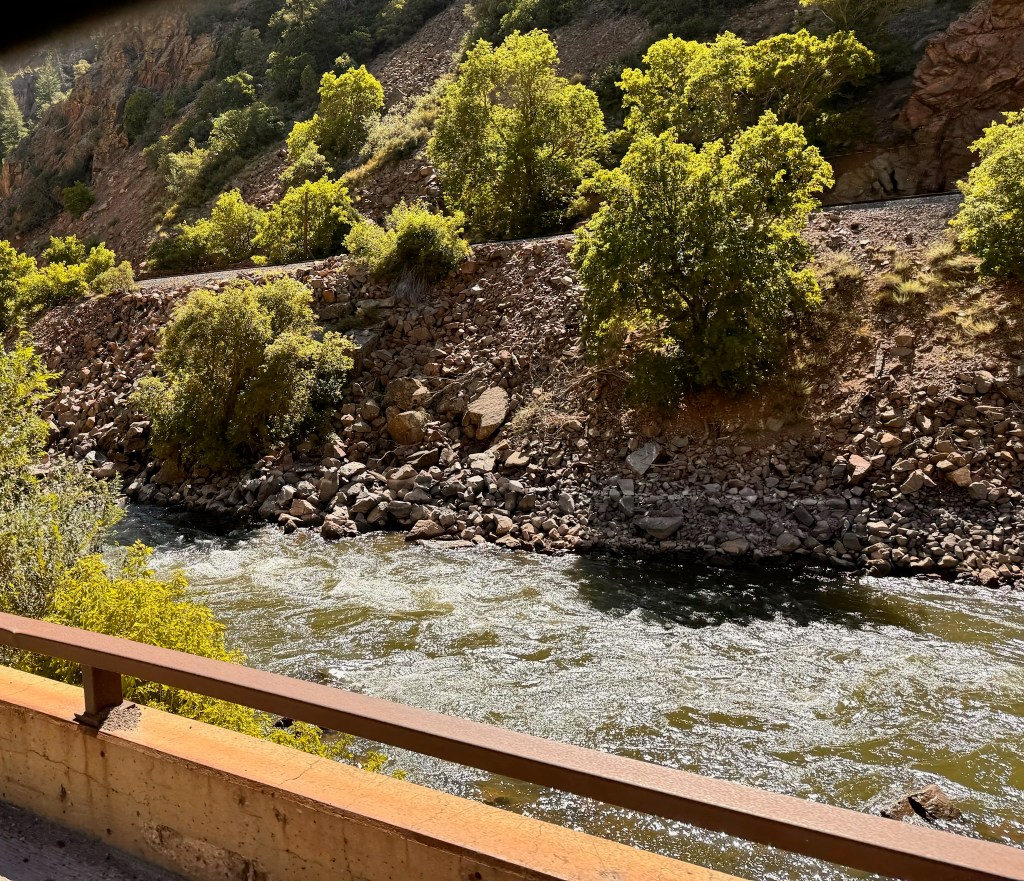
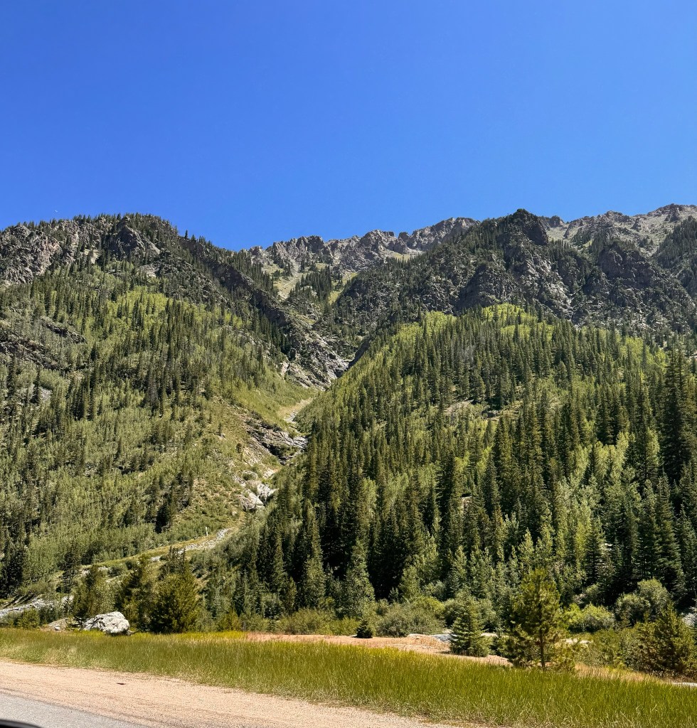
We woke up in Carbondale and got ourselves on the road by 10am. We weren’t in a big hurry because we didn’t have to be in Fort Collins until the afternoon and only had a 3.5 hour drive ahead of us. The drive was spectacular, first going along the Colorado River with many white water rafters, then through Vail, where we saw off-season ski resorts, and finally directly through the Rockies, including more than one long tunnel. We got as high as 11,000 feet and David remembered traveling through the mountain when he was in college and getting passed in his VW Bug on a downhill stretch by a cyclist.
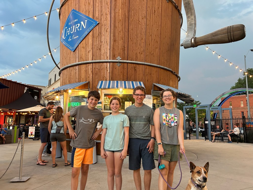
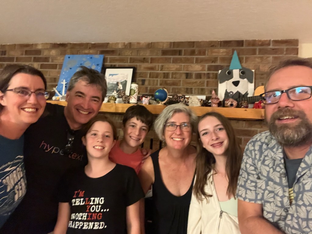
We checked off another fast food chain by eating at Which Wich, a sandwich shop in Lakewood, CO. We arrived at Susan’s friends’ Jeff and Rachel’s house in Fort Collins just about 3pm. It was wonderful to catch up with them and for the family to meet their 15-year-old kids, Lev and Naomi. They were amazing hosts and prepared a delicious dinner for us. Their house is lovely and well situated on a beautiful street within walking distance of the vibrant downtown. We walked for ice cream at the Old Town Churn, which was actually shaped like an ice cream churn. The ice cream was delicious too.
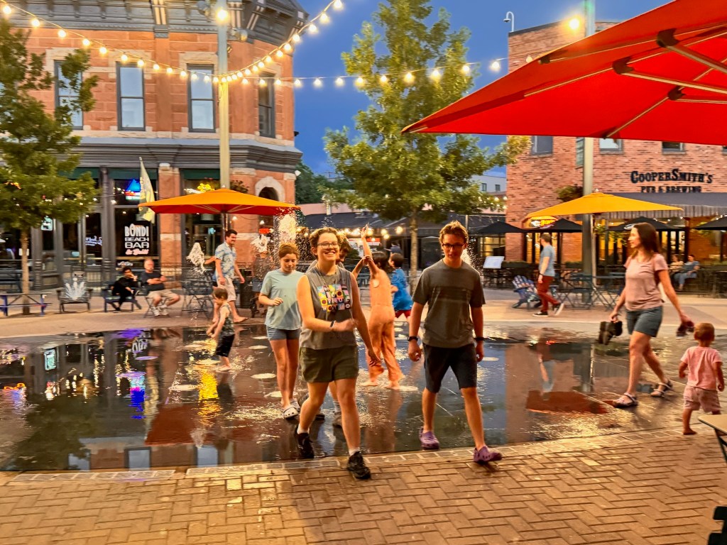
On the walk back kids were playing in a water feature in one of the pedestrian walkways, and our kids joined right in to play chicken with the spurting water.
Starting mileage: 17842, Distance travelled: 148, Miles hiked: 5
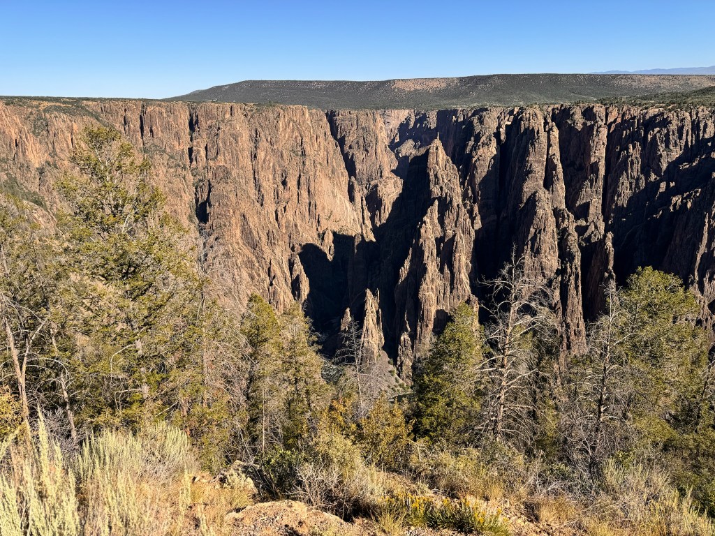
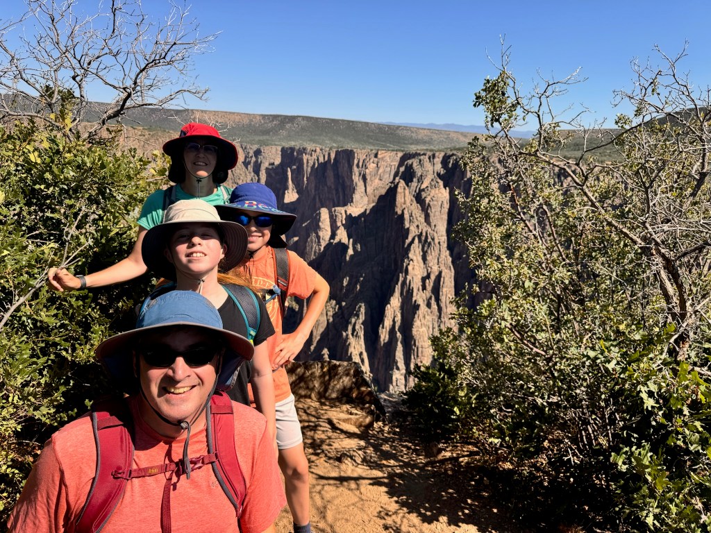
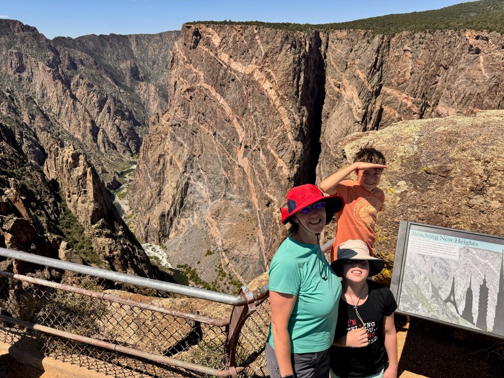
Although we didn’t get to hike all the way to the Gunnison River, we did hike down into the canyon a bit on today’s adventure. We parked at Tomichi Point and jumped on the Rim Rock Trail to the Visitor’s Center to see the amazing views from there, including Gunnison Point. We continued along the Oak Flat Trail which dipped down into the canyon by about 500 feet. The Oak Flat Trail connected us to the Uplands Trail through a flat, brushy meadow, which connected back to Rim Rock Trail back along the canyon to our van at Tomichi Point, for a total distance of about 3.8 miles.
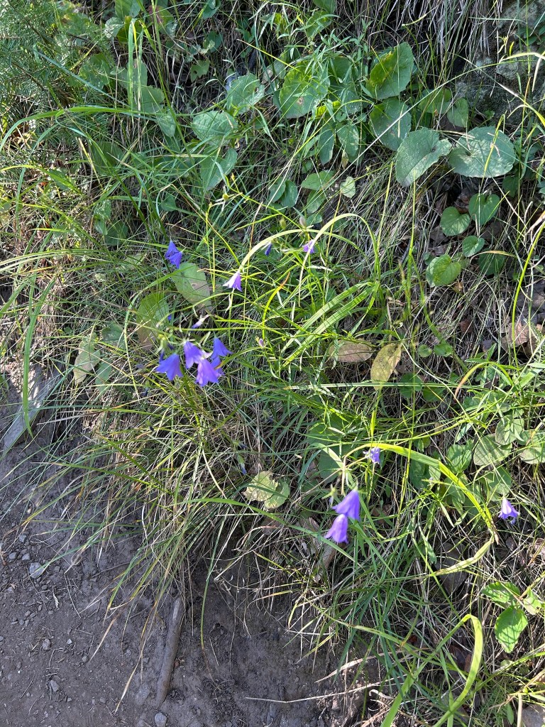
There was more flora than fauna along the trail but we did see several birds and David caught a photo of a baby bunny.
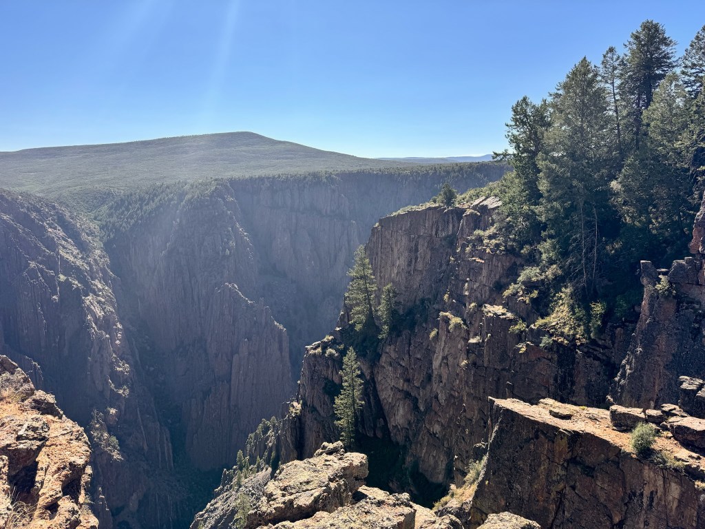
After completing our hike, we drove the remainder of the scenic South Rim Road, stopping at various overlook trails. The most impressive was the Painted Wall, a 2,250-foot sheer drop on the north rim. It is one of the largest vertical cliffs in the country, almost twice as tall as the Empire State Building.
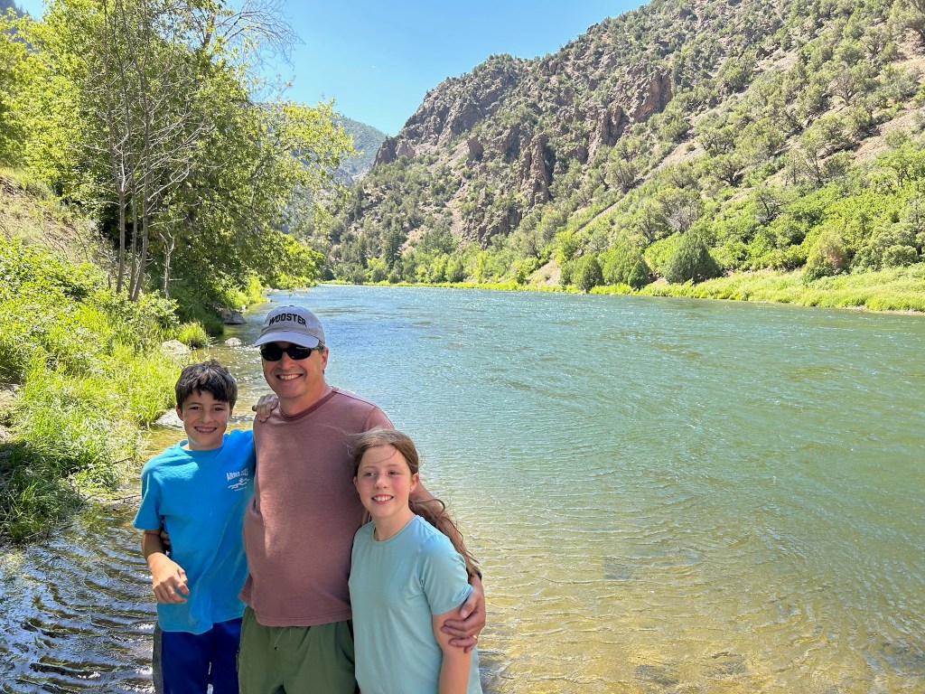
We left the Black Canyon to head for Carbondale, CO to have dinner with David’s college friend, Lisa and her family. That also shaved off a couple of hours from our drive to Fort Collins. David surprised her by contacting her after nearly 20 years when he realized how close we were to where she lived. We enjoyed a lovely evening meeting everyone, including Lisa’s husband, Jeff and their 13-year old daughter Madeleine. David and Lisa had fun reminiscing about their college days and he was pleased to find her doing well. We found Carbondale to be a lovely little small town and we enjoyed Thai takeout and a drink from the local distillery.
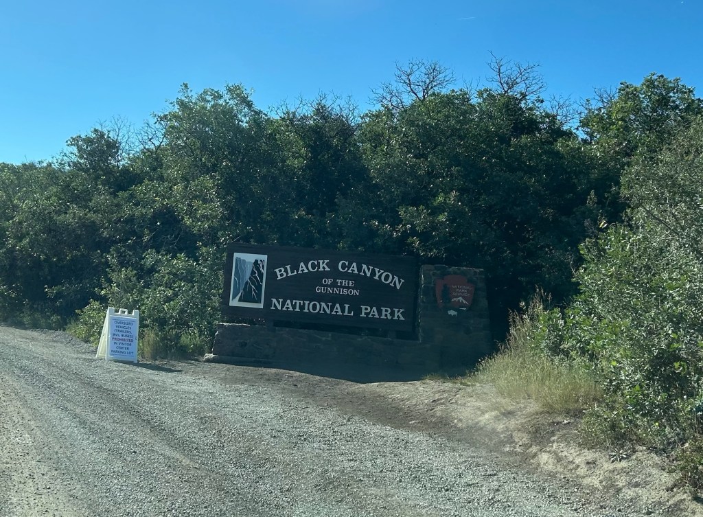
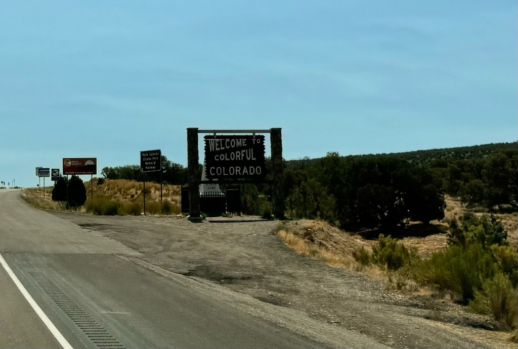
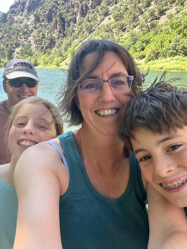
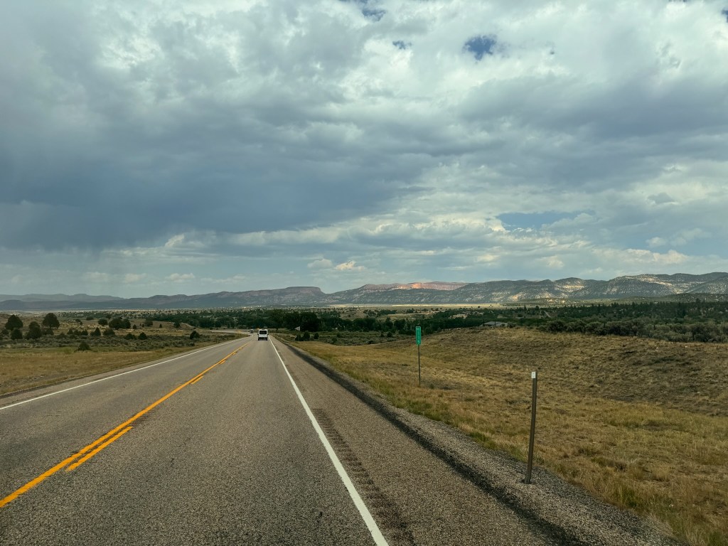
We had another lazy start to the day after staying up to watch the Olympics and more National Parks documentary…only one episode left! For the first time in 4 mornings, we ate breakfast together as a family, not running up and down stairs with coffees and breakfasts back to the room to trade off shower and bathroom time. We checked out of our hotel and were on the road by 10am. We were hoping to stop in Grand Junction, CO for BOTH a board game/coffee store AND a used video game store, but apparently the entire state of Colorado shuts down on Sunday…and we thought Utah was religious! We ended up going straight through to Montrose, CO, the gateway town to Black Canyon of the Gunnison National Park (longest NP name ever!) On the way, we ended up returning to Mars before entering Colorado. It turns out Elon Musk had already beat us, erecting a city of silver silos for a mysterious purpose.
We ate lunch at Starvin’ Arvins, a breakfast/brunch place with yummy food and enormous portions! Susan’s bread options with her spinach omelet, which was slathered in hollandaise, was a cinnamon roll. Seems innocent enough…but no! It was the size of her head and everyone had to pitch in. But then Laura and Brady’s meals arrived, three stuffed crepes, swimming in berries with sauce, plus two eggs and a mound of home fries. David got a very sensible salad, but the rest of us couldn’t finish our meals…breakfast leftovers for tomorrow. Even David’s salad came with a half cup of salad dressing…at least it was on the side. From lunch we headed straight to the Visitor’s Center, because major construction is starting tomorrow and the VC will be closed, along with most of its parking.
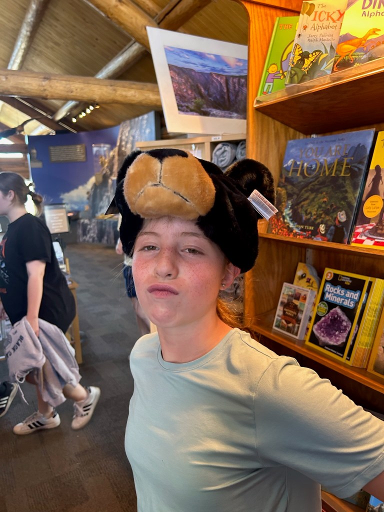
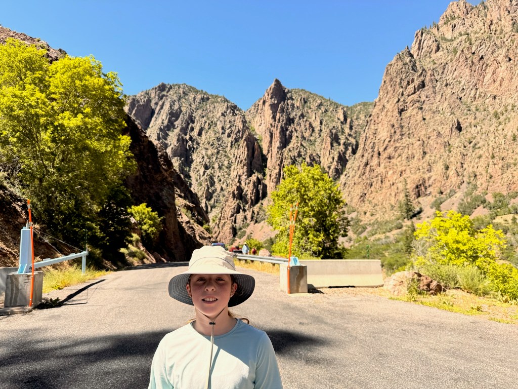
Brady really wanted to try getting one of a limited number of Wilderness permits that would allow us to hike down into the 1800-foot canyon to the Gunnison River below. They actually HAD permits left for Monday, but we decided it was a bit too much for us at the end of 7 days of pretty intense physical demands. It involved a 1.5-mile pretty much vertical rock slide without marked trails in both directions. With Laura still not at 100%, Susan with a bad knee and hip, and David’s worrying about his 57-year-old self making it back in a reasonable amount of time, we decided against it. After getting our passport stamps (and trying on silly bear hats), it was only 3pm, so we decided to get to the bottom of the canyon the only way we could, by driving down the East Portal Road, a 15% decline through switchbacks galore, that ended up burning our brakes!
Driving down the East Portal Road to the Gunnison River.
The views were spectacular and we were able to put our toes in the Gunnison River at the bottom. Sadly, we didn’t catch Brady’s initial reaction on camera…needless to say, it was chilly.
We headed back into town and landed at an excellent KOA, with one minor exception, that wasn’t really their fault. After getting sunscreened and into our suits, some kind folks in the hot tub tipped us off to a poop in the pool, obviously made by a child with irresponsible parents. David suggested that it might just be a Baby Ruth but we weren’t risking it. Instead we wrote yesterday’s post, ate leftovers for dinner, and played some more Quixx. We had planned to take a walk into Montrose to check out the main drag and get dinner, we had an attack of the lazies and didn’t make it. Although we saw an amazing sunset from the campground, there wasn’t a great opportunity for night sky watching when Laura and Susan attempted it. Sadly, our greatest regret of the trip after visiting 6 night sky parks, we didn’t once see the night sky.
Starting mileage: 17523, Distance travelled: 102, Miles walked: 4.8-5.4
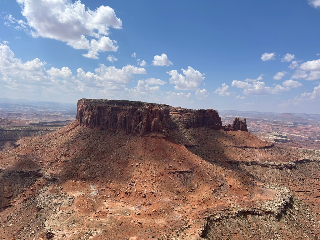
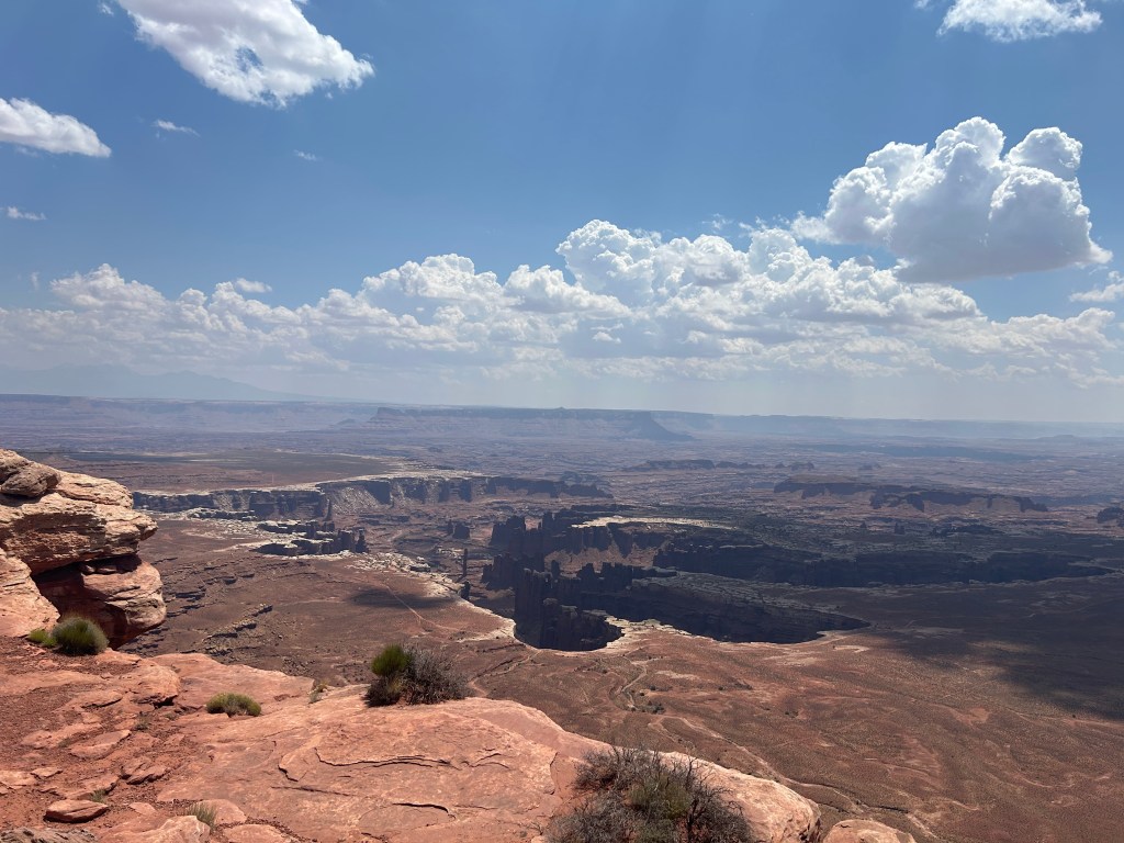
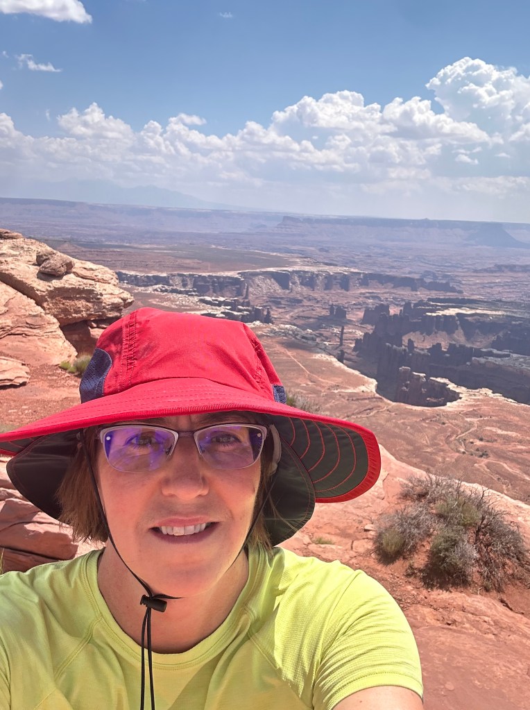
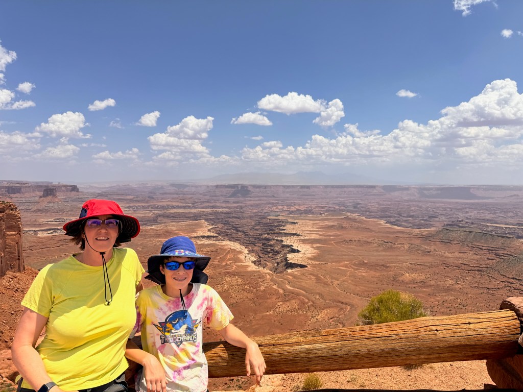
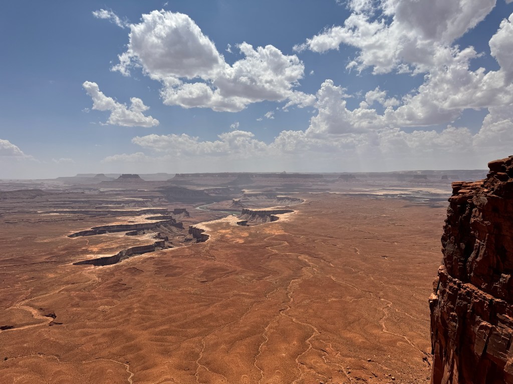
The day started out slowly with everyone sleeping in. Susan was up at 7am but let everyone sleep in and they didn’t wake up until after 8:15. Canyonlands National Park was 45 minutes away so we didn’t hit our first trailhead until 11am. Laura was feeling under the weather with a sore throat and fatigue despite the good night’s rest. The temperature was slightly cooler due to the elevation. We were on top of a giant, flat Mesa (redundant?) called Island in the Sky. It overlooks enormous, elaborate canyons formed by the Colorado and Green Rivers. We started at the far end of the scenic road with a hike to Grand View Point and it lived up to its name.
By the end of the 2-mile hike, Laura was definitely flagging so she and Susan hung back on the next vista. Brady and David hiked a short 0.6-mile trail to Upheaval Dome, a 2-mile wide crater with an uplift in the center. Scientists debate the origin to be either a salt dome or meteor strike, with the latter gaining more support recently.
We made quick stops at Buck Canyon, Candlestick Tower, and Green River Overlooks.
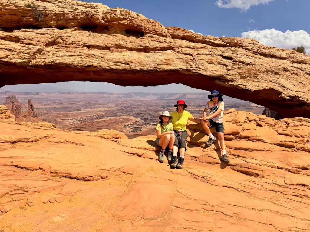
After some lunch and a rest, Laura was a good sport, and after some bribery agreed to one short 0.6-mile hike to view Mesa Arch and the view was worth it, but Laura begs to differ. When you look through the light sandstone arch, it frames red mesas in the background.
We got back to the hotel around 4pm and rested up a bit. David got sunburned for the first time, probably due to our later start time. We were out in the 10am-3pm range rather than 7am-1pm range when the sunlight isn’t as direct. We walked into downtown Moab again for dinner at Dewey’s Restaurant, named after a historic bridge that spans the Green River.
Starting mileage: 17483, Miles travelled: 40, Miles hiked: 4.5
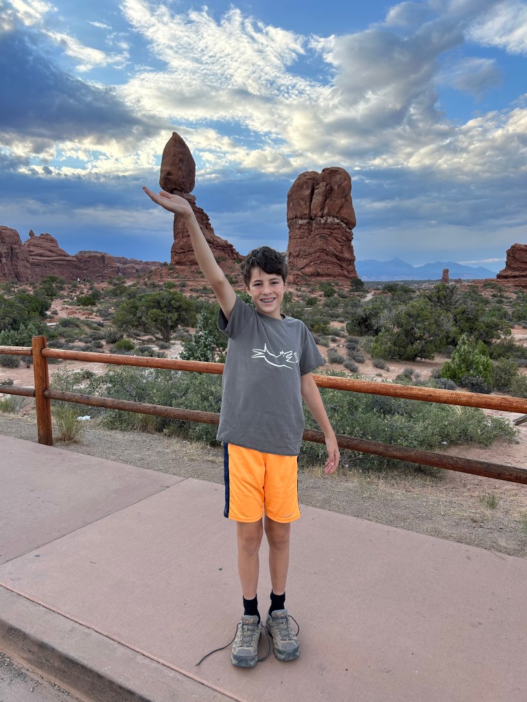
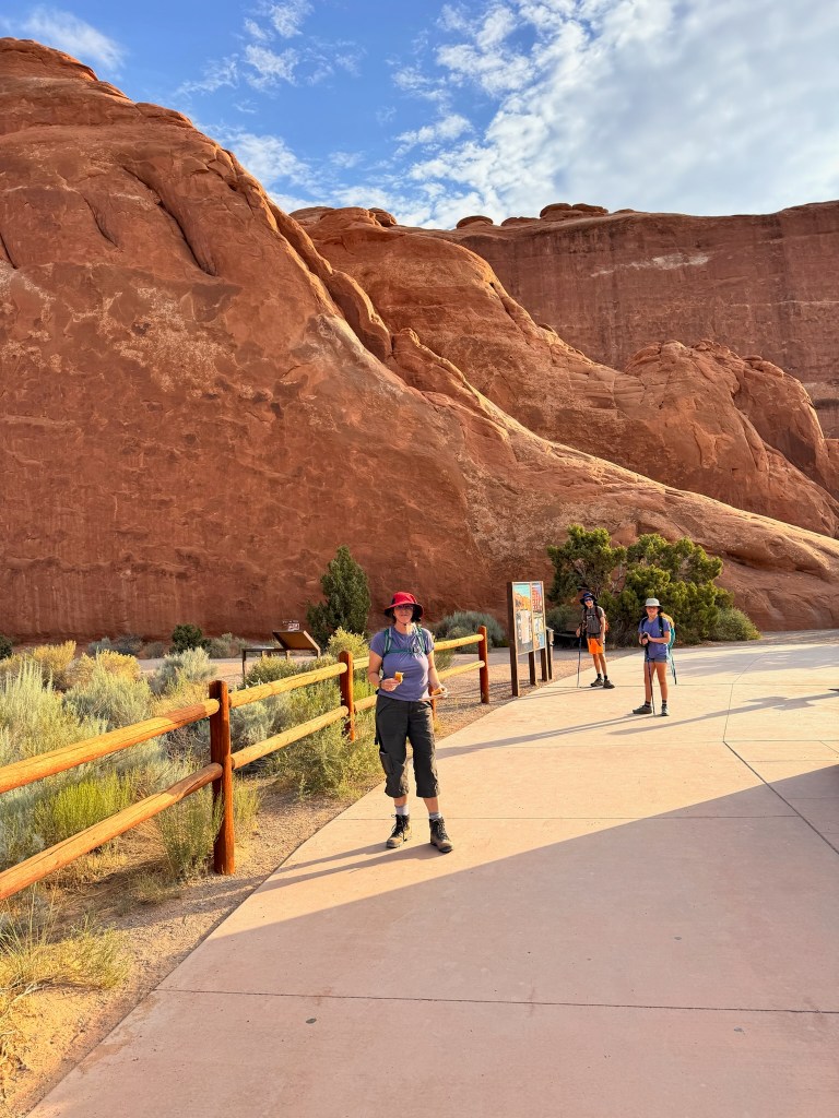
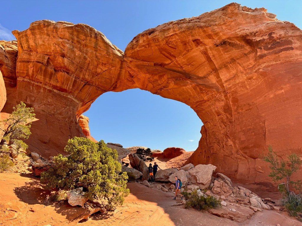
This morning we were more prepared for a pre-7am arrival and we saw the sunrise and made it with 10 minutes to spare. We headed straight to the last stop on the scenic road, the Devil’s Garden trailhead. We made one pitstop at Balanced Rock, which Laura and Brady tried to balance on their hands.
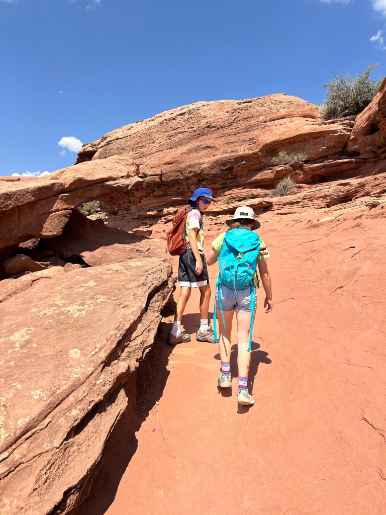
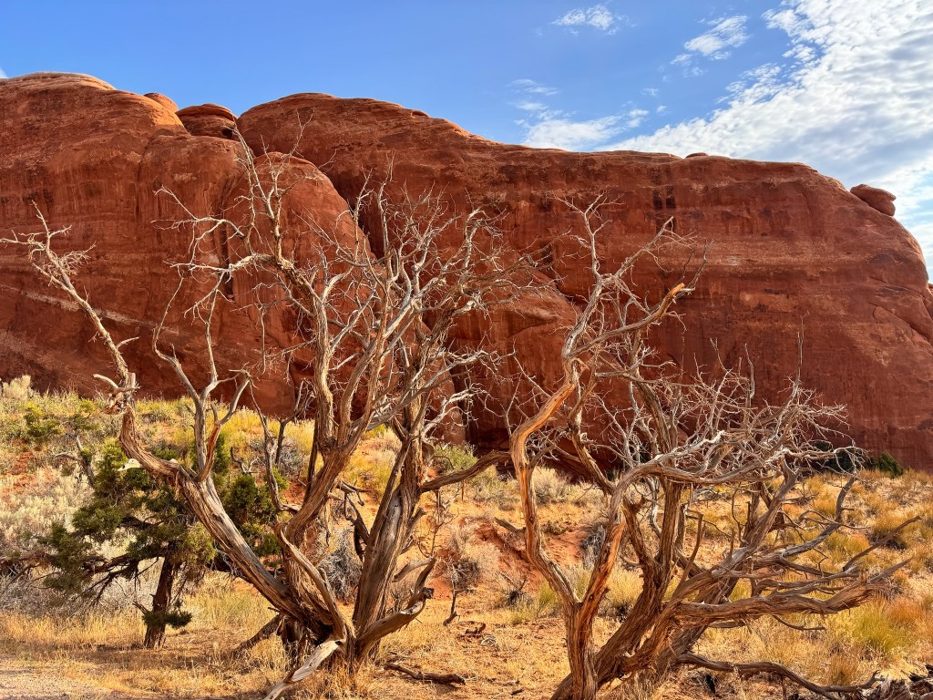
Our first hike was to Landscape Arch, the longest span in the park. The hike was through a set of large fins, which created narrow canyons and lots of sand hiking.
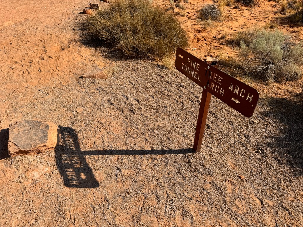
Upon completing the hike, we slowly made our way back down the scenic drive, stopping at several views/hikes along the way. First, we stopped for a 1.6 mile hike to see Pine Tree Arch and Tunnel Arch.
Next we pulled off for a short walk to see Skyline Arch.
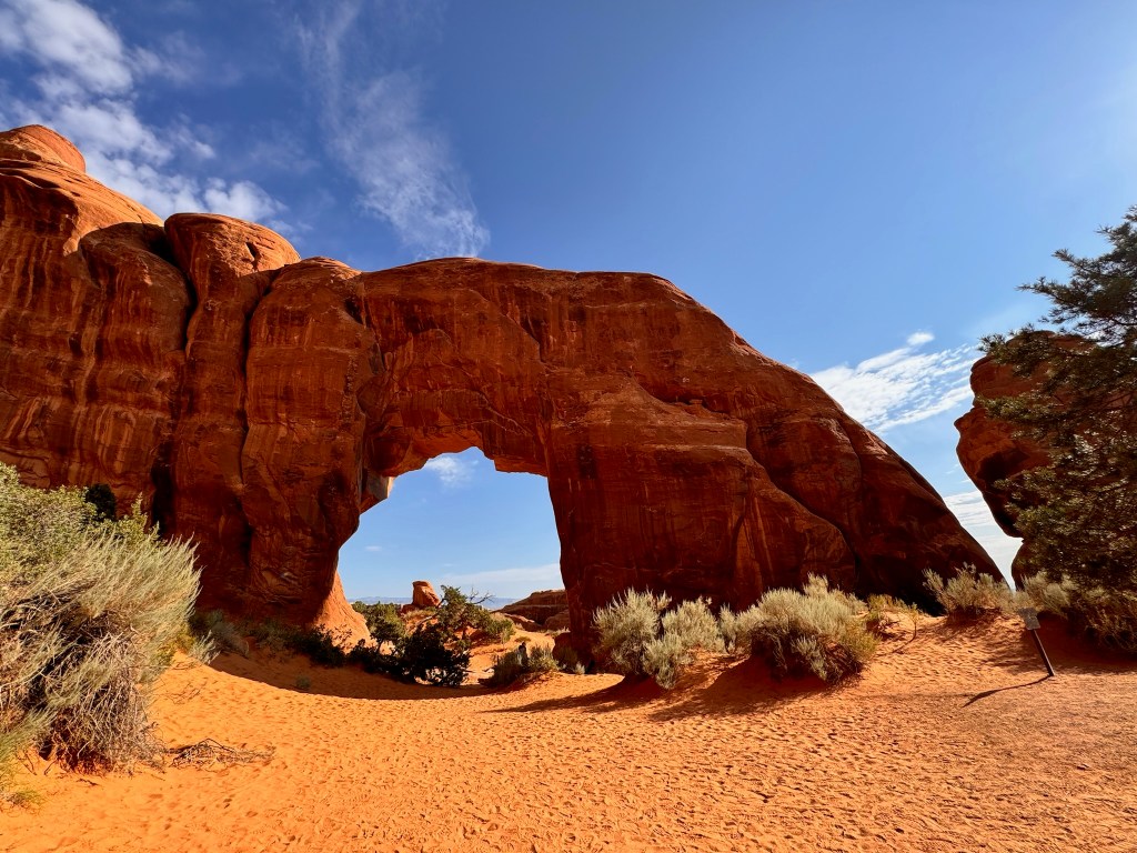
The next hike was 2.3 miles to Broken Arch, which we pretty much had to ourselves for a change. Despite the name, it looked more stable than Landscape Arch. There was a short side hike to Sand Dune Arch.
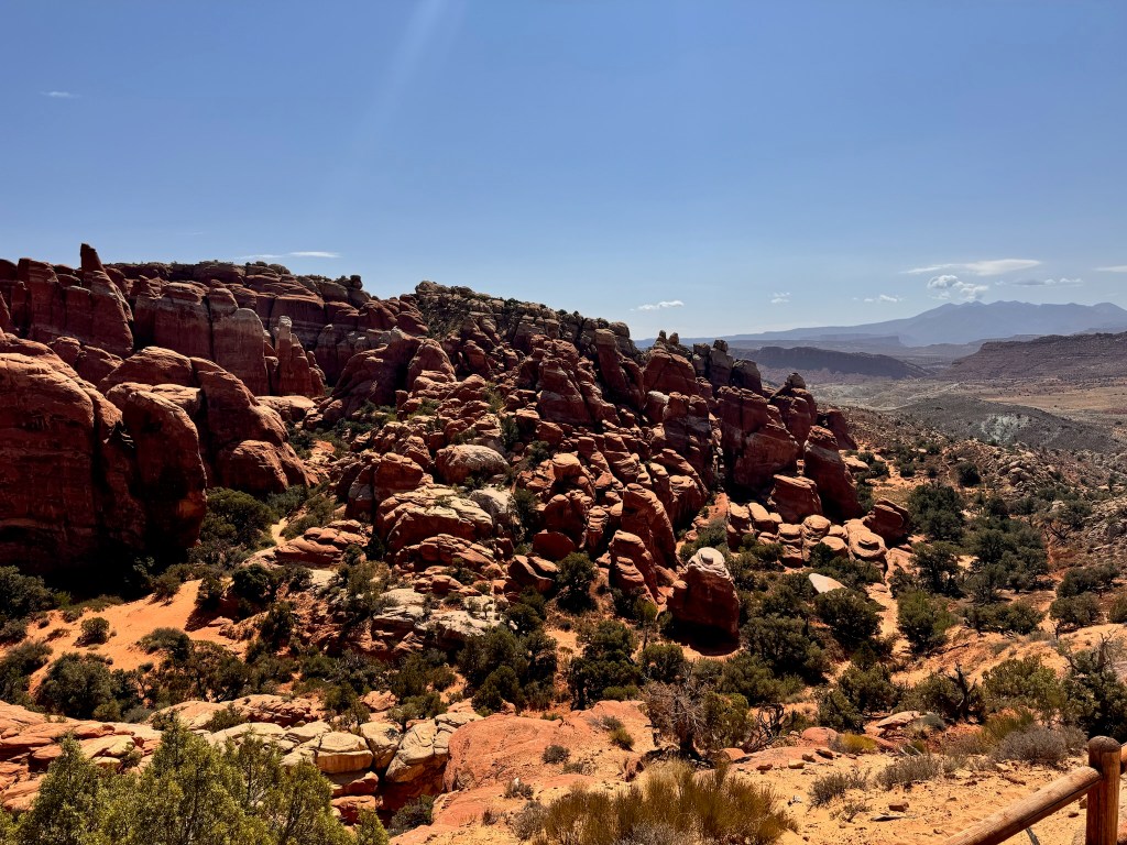
Our next stop was an overlook of Fiery Furnace, a maze-like array of pinnacles that apparently lights up in the sunset like a burning furnace.
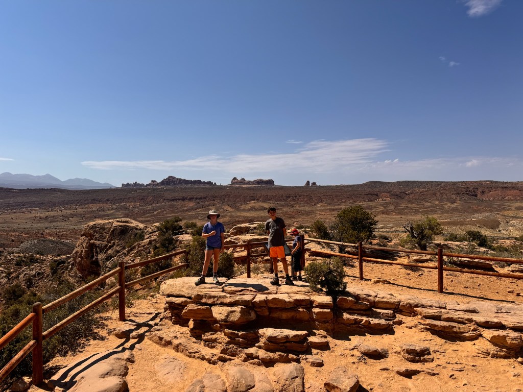
Our last stop was a rather underwhelming Panoramic Point viewpoint. It lived up to its name but the details of all the formations was lost in the distance. We may return here for stargazing tomorrow when the weather is supposed to be clear.
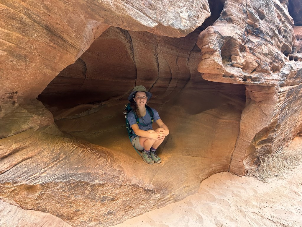
After our final stop, we were feeling a little arched out so we returned to the Visitor’s Center to view the exhibit and film and escape the afternoon heat and sun. See if you can pick out which photo of Brady and Laura above is the fake, actually taken in the exhibition. We returned to the hotel for lunch, a nap, and a swim. We went out to dinner at the Trailhead Public House where we sat outside and Laura braved the tomato jalapeño bisque and even liked it. The food was delicious and interesting, including Brady’s pork green chili poutine and the Wagyu burgers. We had yummy cinnamon bread pudding and churros a la mode for dessert.
We once again crashed early after playing some Quixx and watching more of the 6-part Ken Burns National Parks documentary that we’ve been working on since last summer’s adventure.
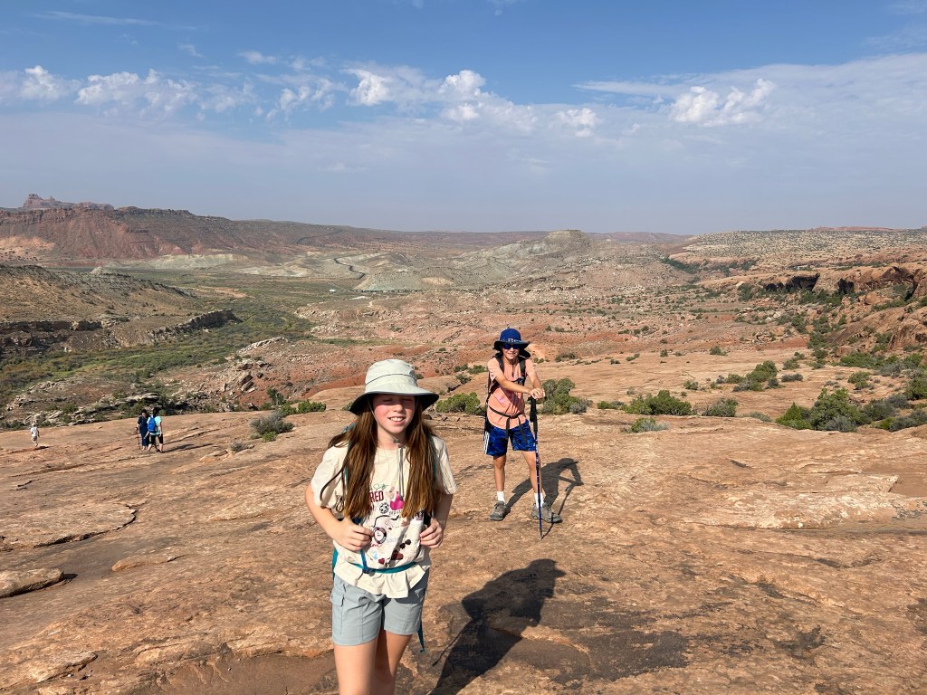
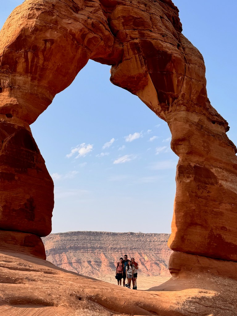
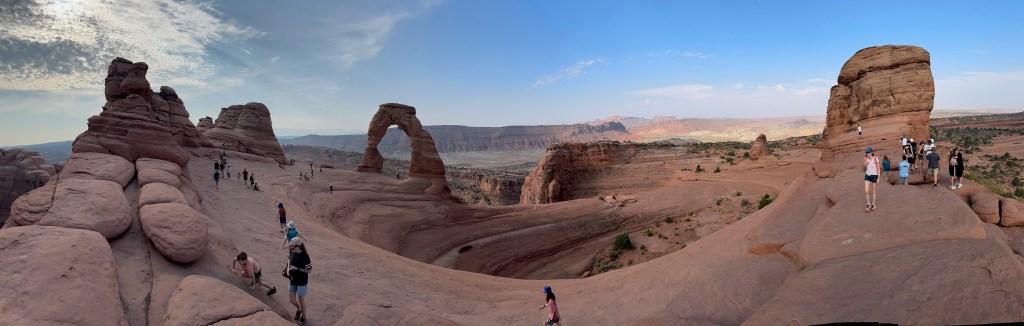
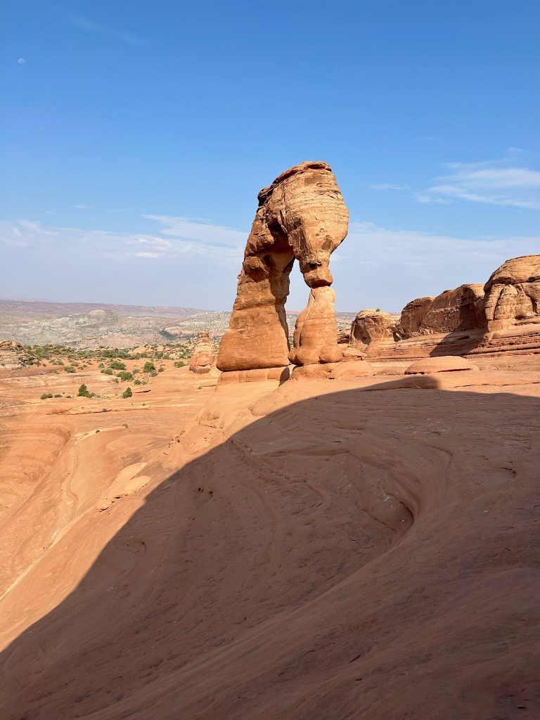
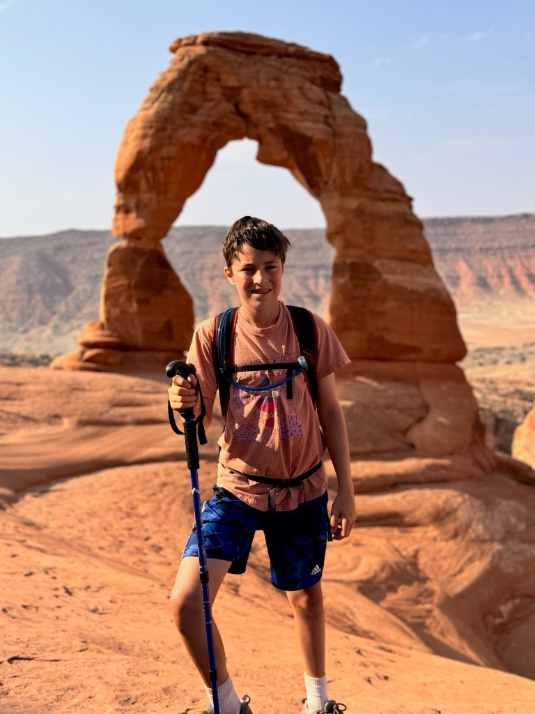
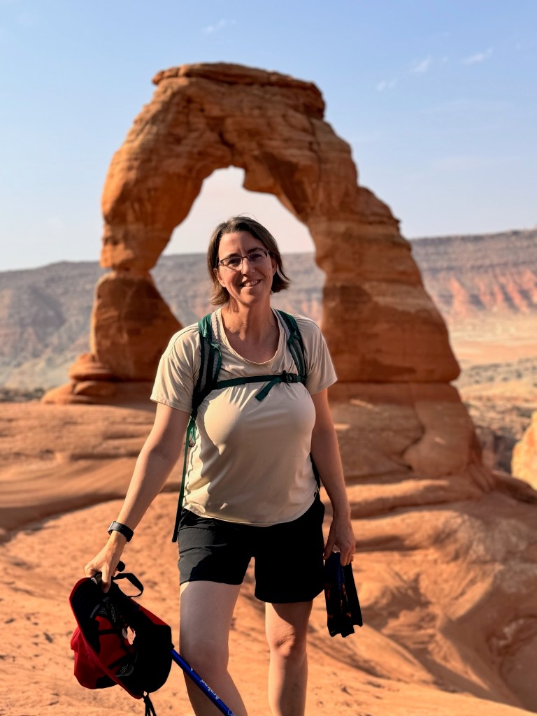
We got an early start, trying to get our most strenuous hiking done before the temperatures soared and crowds got crazy. We had a timed-entry ticket for 8am but attempted to get to the park before 7am when they the timed-entry ticket is required. Only David understood that this was an unrealistic goal and calmly tried to explain that while everyone else frantically tried to get out the door. We didn’t quite make it but arrived at 7:30am and they let us in anyway. We selected the most popular hike to start so we could ensure that we got parking. We hiked 3.5 miles to see the Delicate Arch and it didn’t disappoint. Coming around the corner when it came into view was breathtaking.
David got some nice portraits here too.
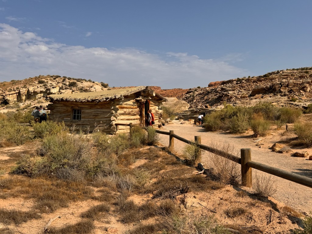
At the trailhead, there were also petroglyphs and Wolfe Ranch, a one-room cabin dating back to the early 1900s.
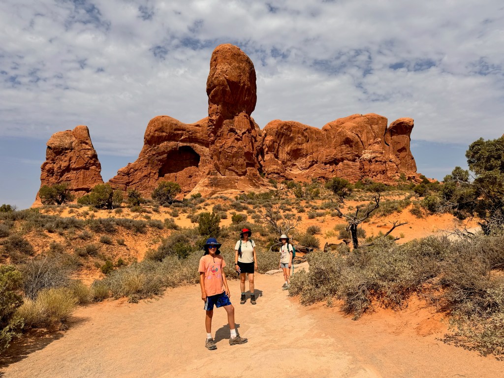
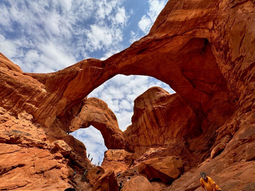
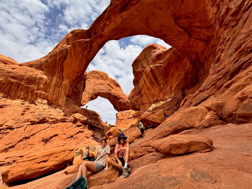
Our next stop was Double Arch Trail. We went by the Elephant Arch and Parade of Elephants before arriving at the double arch. Susan climbed up into the second of the arches, not an easy feat, but worth the photo op.
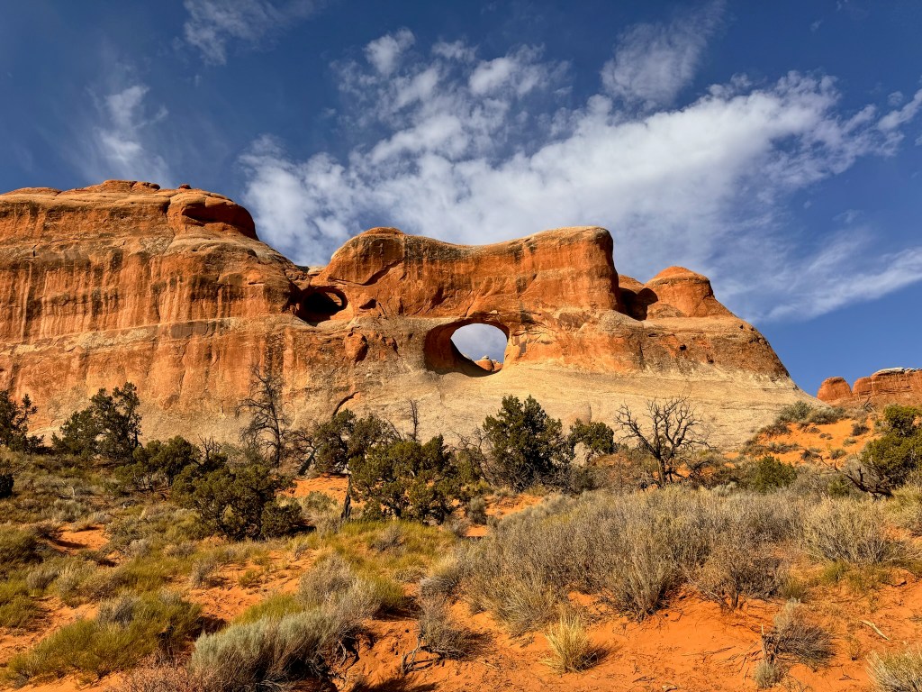
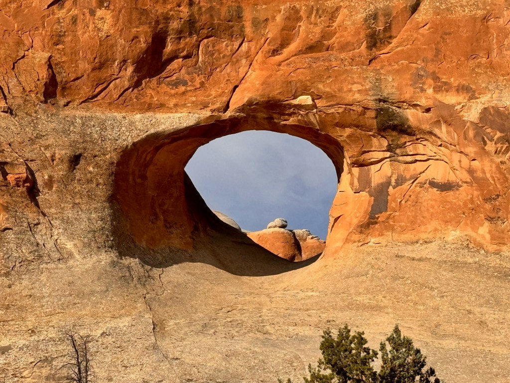
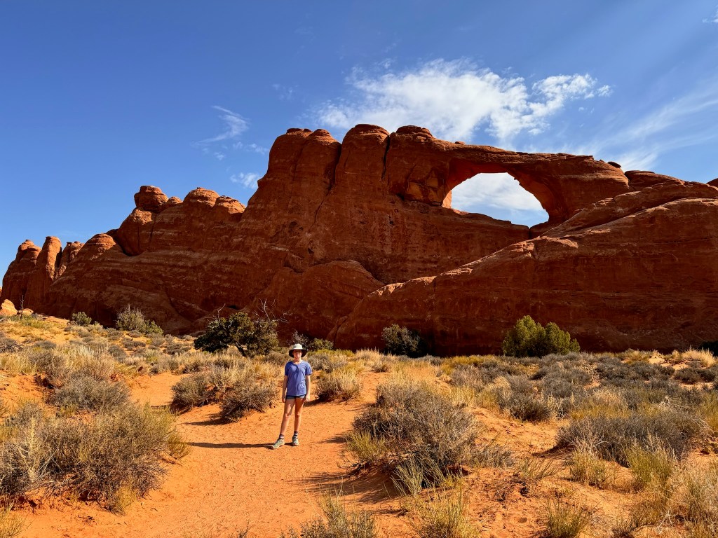
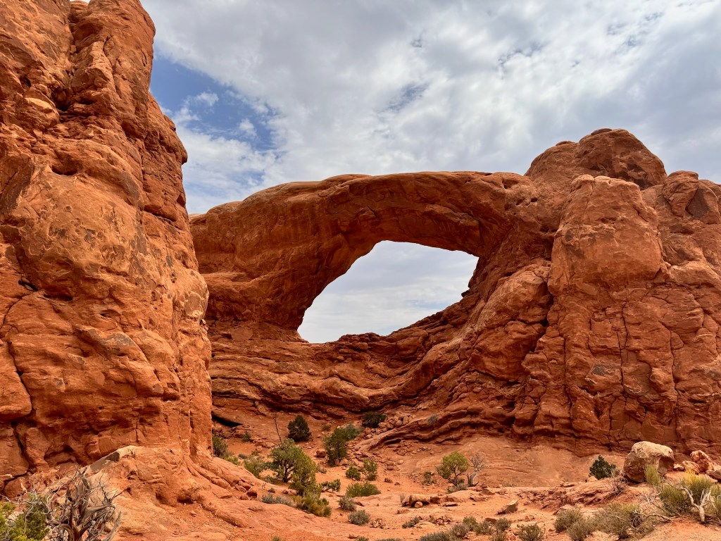
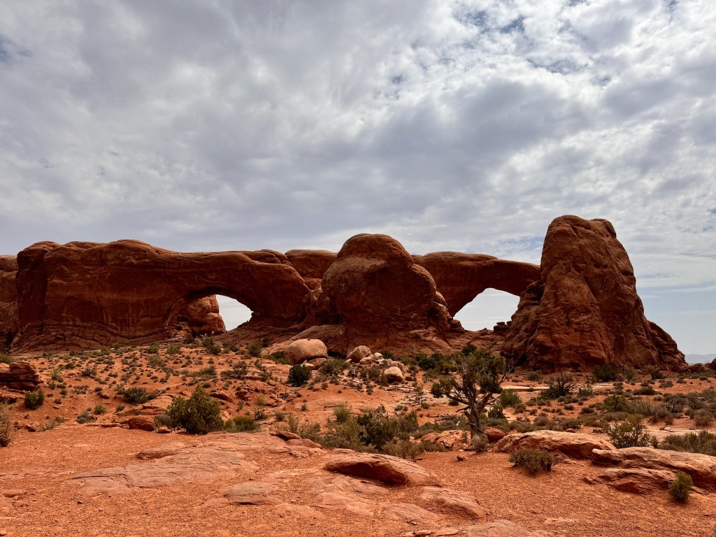
A short distance across the parking lot was the Windows trailhead, which lead to the North and South Windows and Turret Arch.
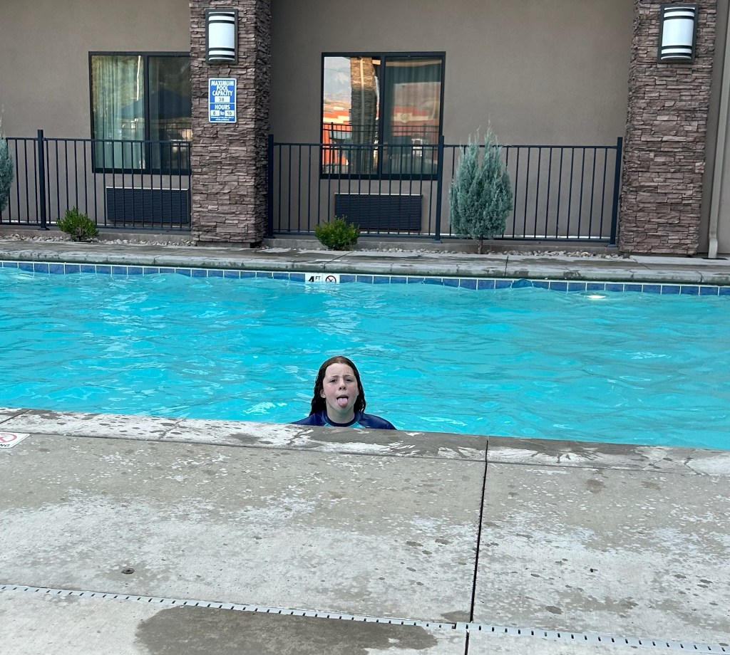
Unfortunately on our way back down the trail to the parking lot, Laura slipped off the edge of the walkway, gouging her knee with gravel on the way down. She was fine but her left knee sustained a significant wound that we needed to get cleaned out and bandaged. Susan did some quick and dirty first aid on the spot but we needed a pharmacy for more supplies. We were pretty much done hiking since it was after noontime and everyone was hungry. We returned to the hotel, ate lunch and took care of Laura’s injury, getting out all the gravel and disinfecting it. We chilled out in the hotel room most of the remainder of the afternoon, went for a swim in the pool before dinner, then went out for gelato. As soon as we stepped out to walk to the gelato place (located in the Moab Food Truck Park), we feared the worst. The darkest cloud was forming over the canyon wall behind us and it followed us all the way to the gelato place and home, without ever raining more than a few drops…but we did get a gorgeous double rainbow out of it.
We went to bed early so we could get up even earlier on Friday to get into the park before 7am. Our reserved ticket was for 9-10am which was way too late to avoid crowds and heat so we planned better the second day.
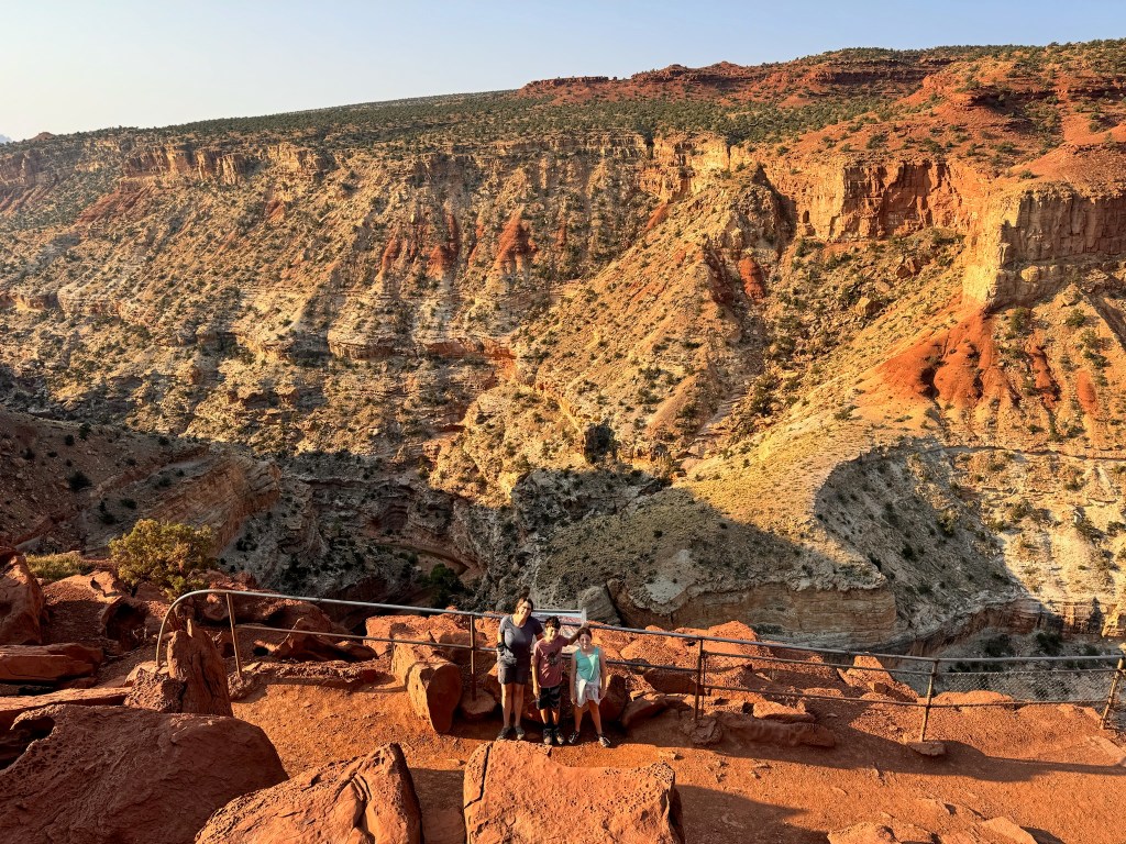
We got an early start, heeding warnings that trailhead parking lots would fill by 9am. We were out by 7:40am, the earliest so far. Our first stop was Gooseneck Point, where we were surprised to learn that Sulpher Creek which ran through the bottom of the canyon was at the same level as the top of the Grand Canyon so if we wait some unknown millions of years we could find another Grand Canyon here.
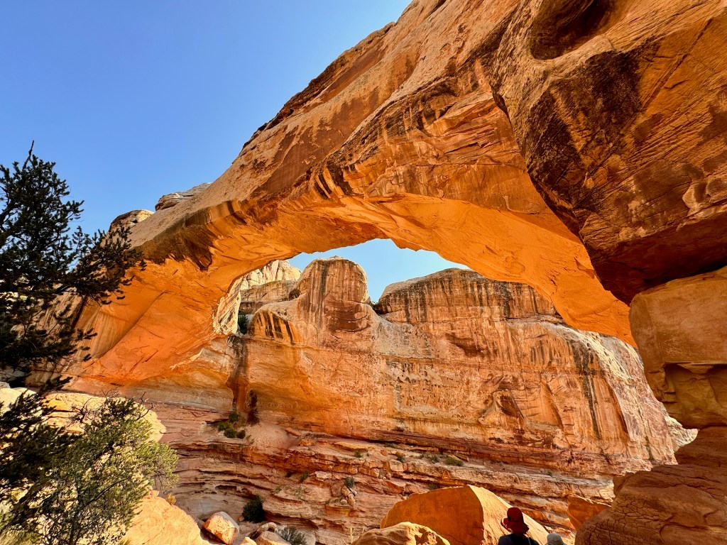
After that quick stop, we headed for the main event, a 2-mile hike to Hickman Bridge, a natural bridge spanning 130 feet long and 125 feet high. From the trail we also saw a smaller bridge, several holes to hide in, and the Capitol Dome, a formation that gets its name from the iconic building top in Washington, D.C.
We stopped at Gifford House, an historic building from early Mormon settler time for pie and a cinnamon roll (which were both delicious). On our way out of the park, we made stops at the blacksmith shop, schoolhouse, and petroglyph panel, evidence of the Fremont people.
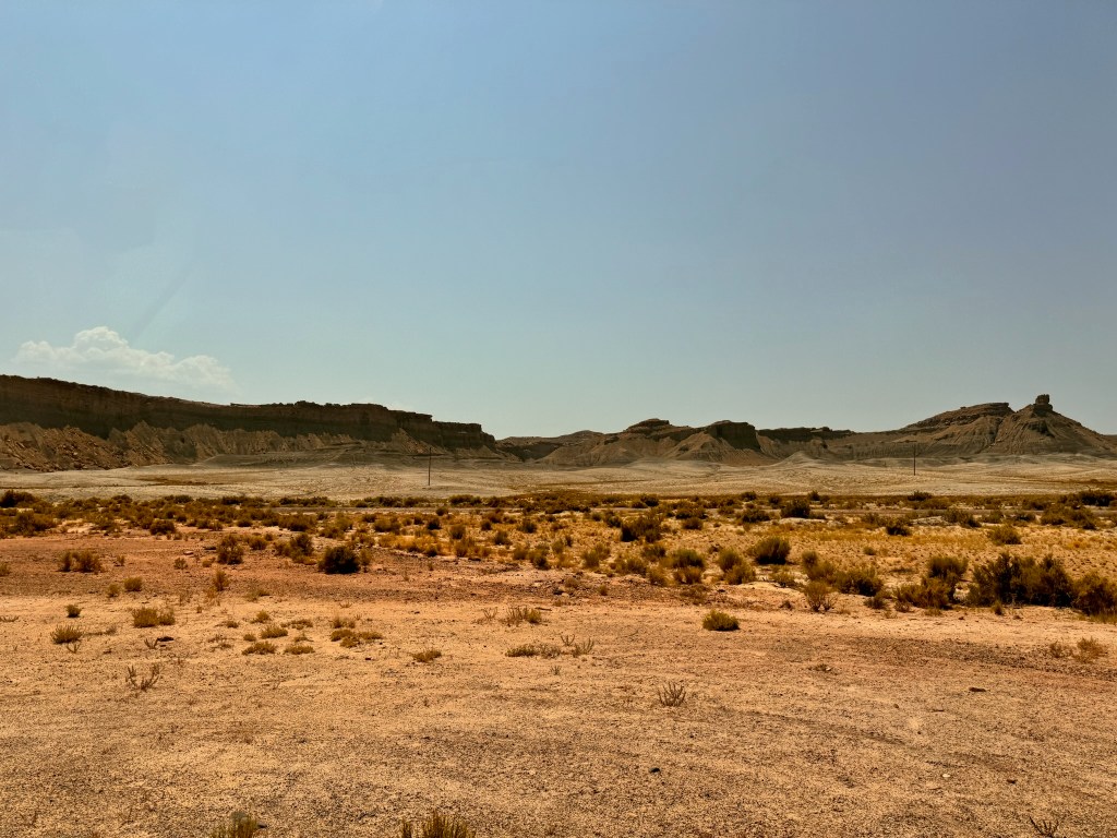
Our road to Arches was about as uninhabited/uninhabitable as it gets. It looked like a Martian landscape. Brady was so proud that we beat Elon Musk to Mars.
After a couple of hours in a literal and cell signal desert, we emerged in Green River, the land of civilization, fast driving, and 5G. We ate lunch at Tamarisk Restaurant overlooking the Green River, itself. We finally got to try traditional Navajo fry bread, which was delicious and similar to fried dough, but more airy and flavorful…bonus, better dipping sauces.
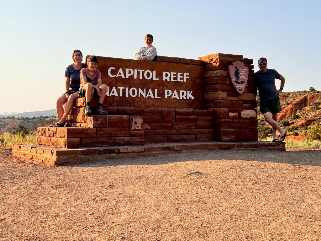
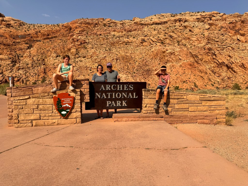
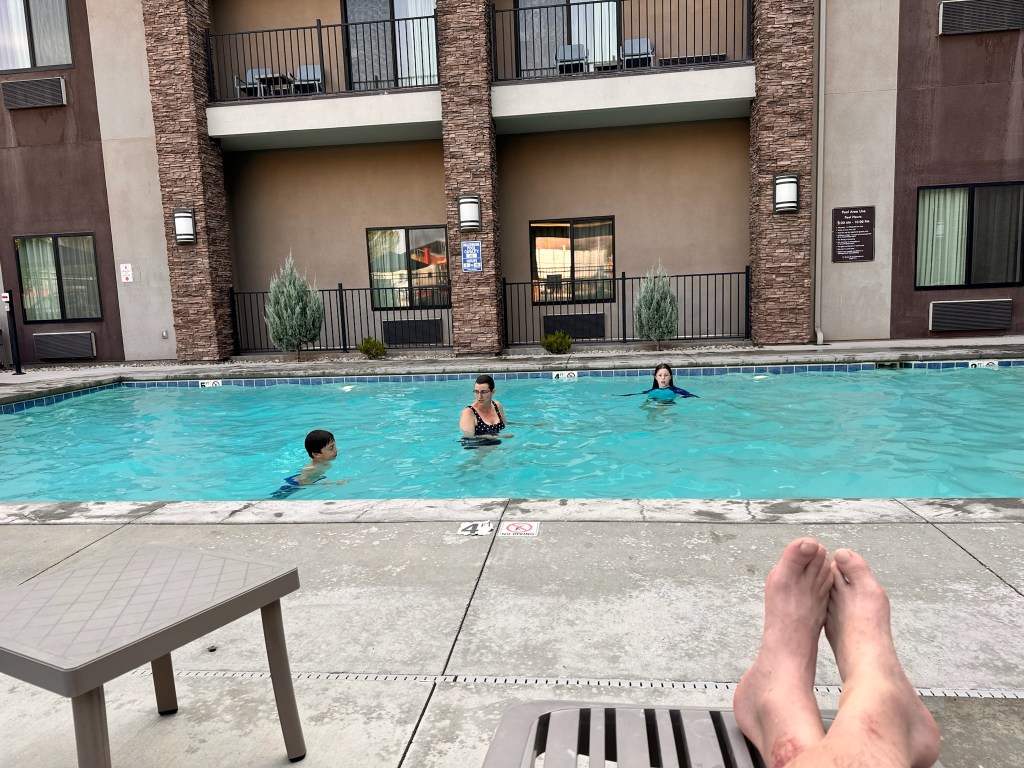
With only an hour left to drive, some green returned to Mars. We arrived at Sun Outdoors, our home for the next four nights…or so we thought. Susan quickly put in all the laundry upon arrival, because it was so hot, we were going to go directly to the pool. By the time Susan returned from the laundry room, the writing was on the wall. The van’s AC could not keep up with the 104-degree heat in the blazing sun. Everyone hid in the van sweating while we booked a room in a nearby hotel and waited for the laundry to finish. Our new home for four days became the Sleep Inn, with its pool and hot tub and free breakfast. On the way, we stopped by the Arches National Park Visitor’s Center for the obligatory passport stamps, and some t-shirts. After a swim in the pool to cool off, we got dinner at Canyon Pizza Co., just a short walk down the street from our hotel. We had the lights out by 9:30pm so we could get an early start on Thursday morning.
Starting mileage: 17137, Distance travelled: 132, Miles hiked: 6.2
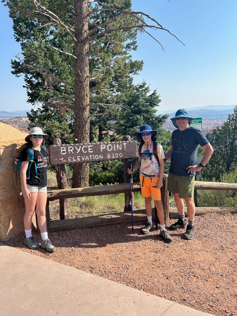
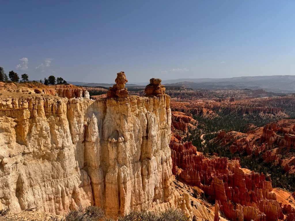
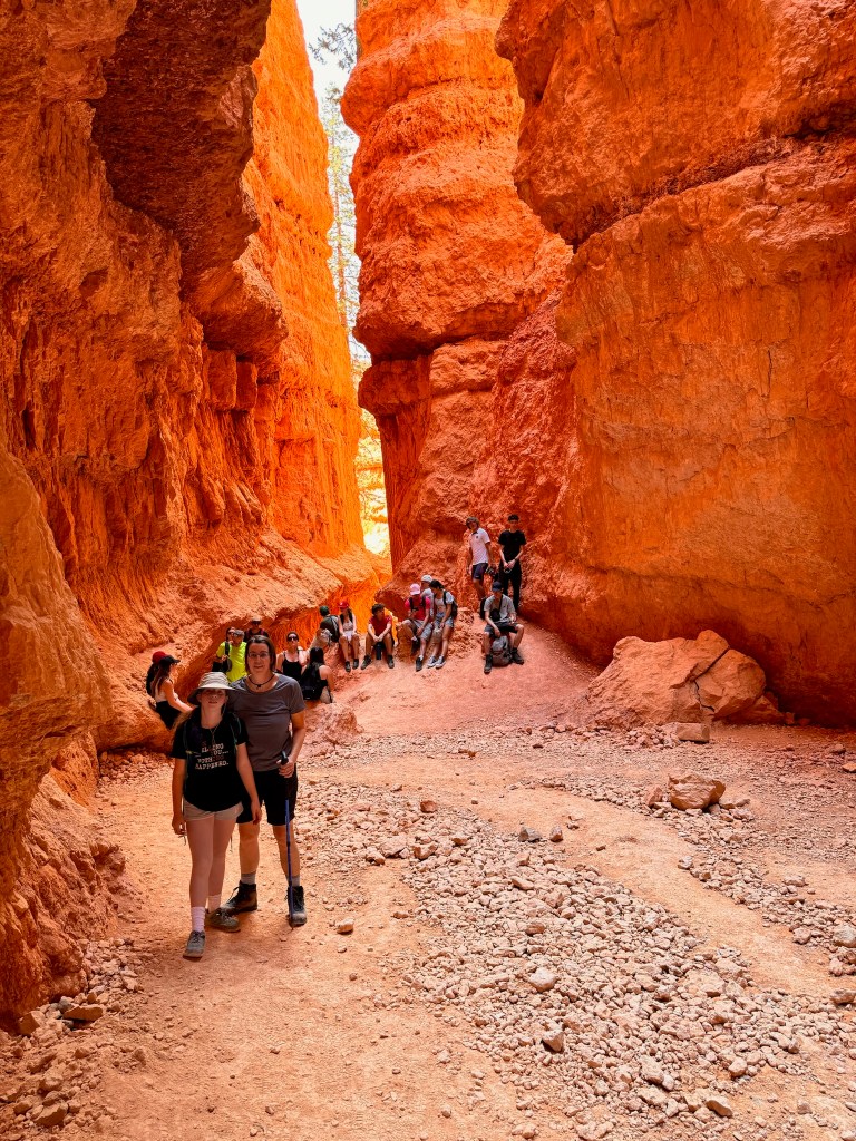
Our day started with a shuttle ride into Bryce Canyon NP. Since we’d already stopped at the Visitor’s Center the day before, we took the shuttle directly to Bryce Point, the highest point in the park overlooking the Bryce Amphitheater.
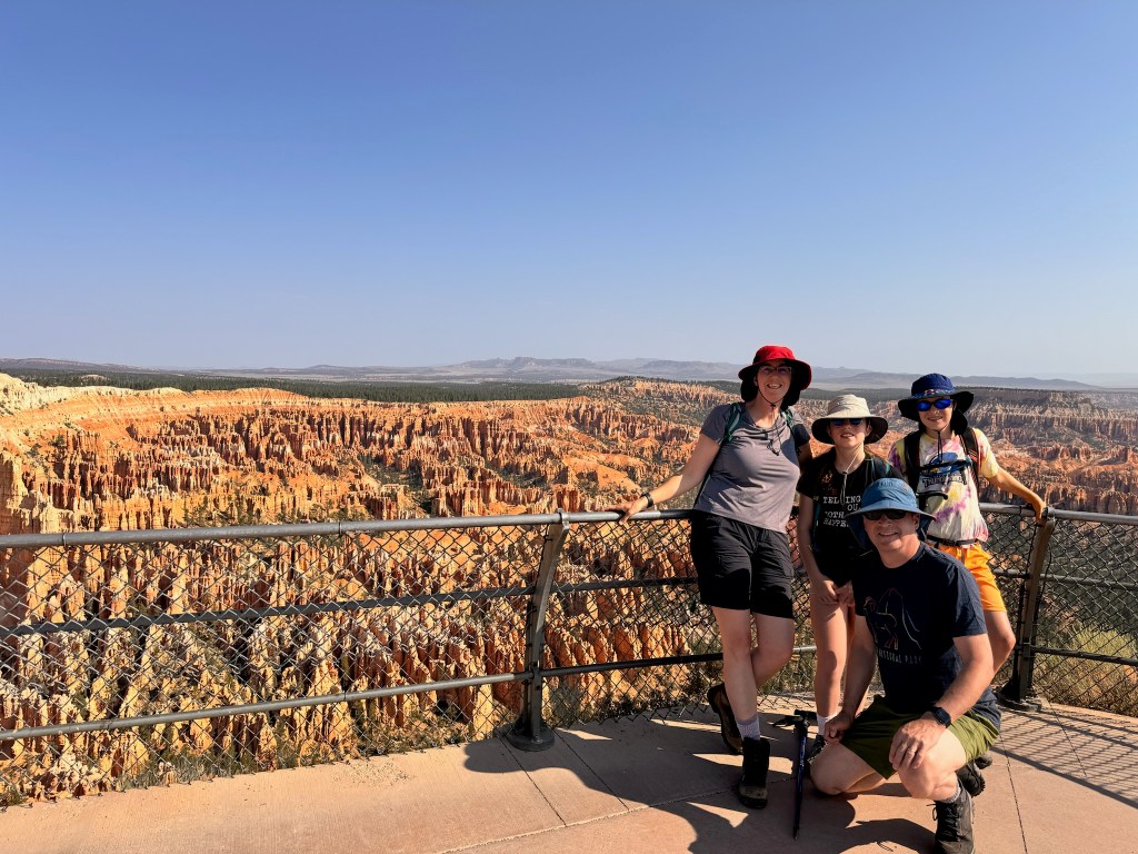
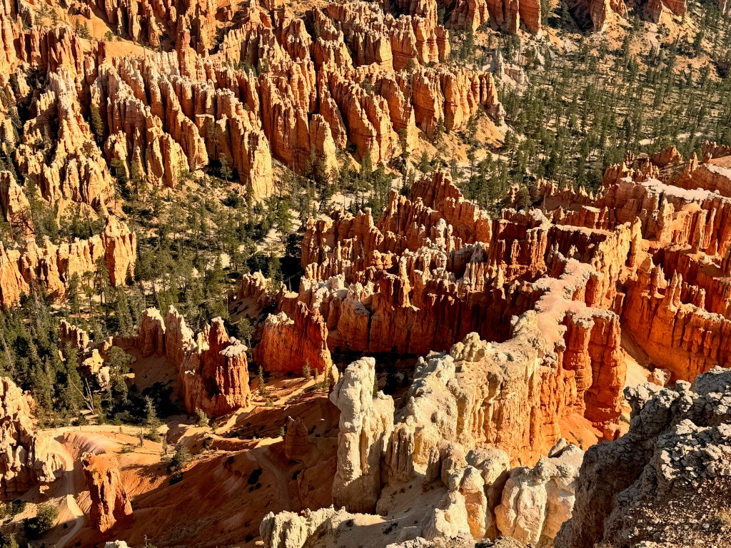
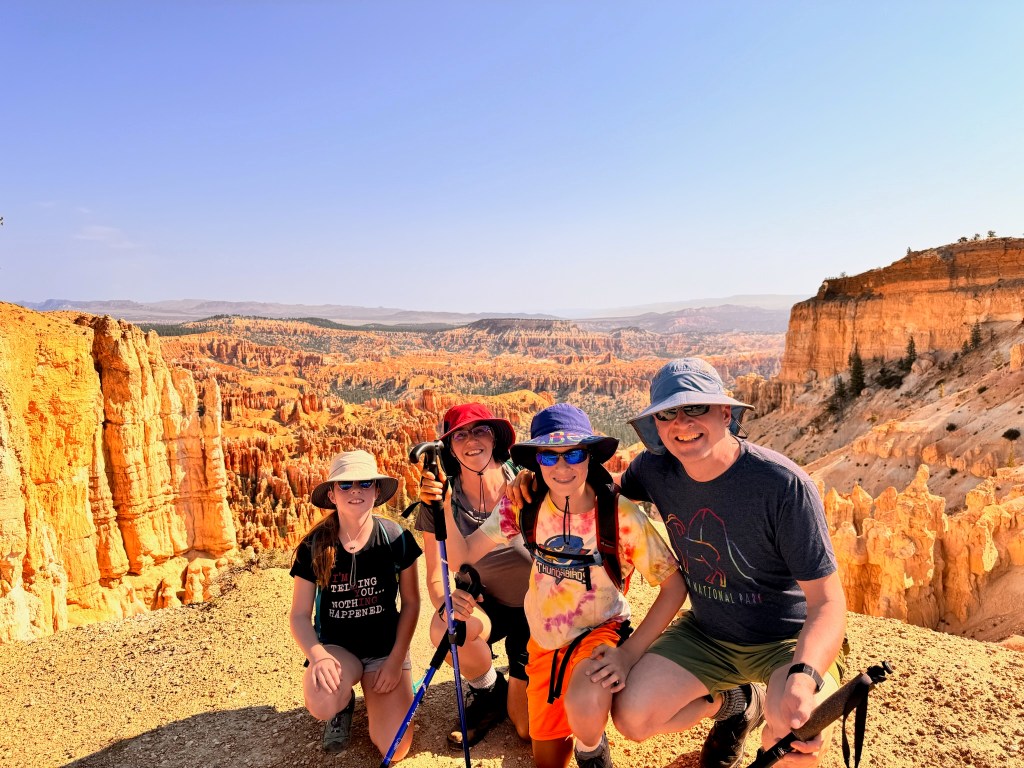
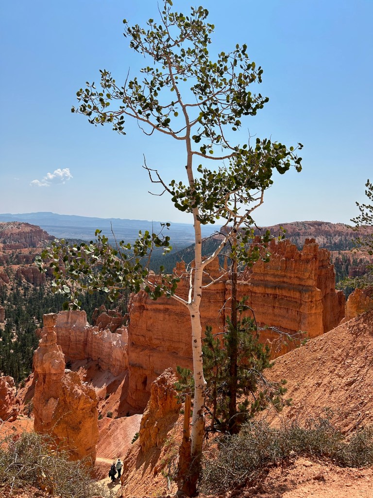
We hiked the Rim Trail 1.5 miles to Inspiration Point and then another .7 miles to Sunset Point. As we made our way across the rim of the canyon, we got several new vantage points from which to view the fins, windows and hoodoos, the formations of sandstone that make up the amazing landscape.
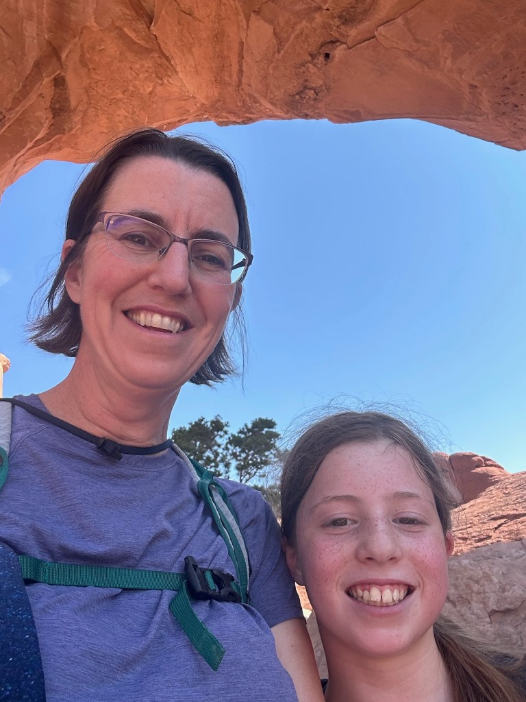
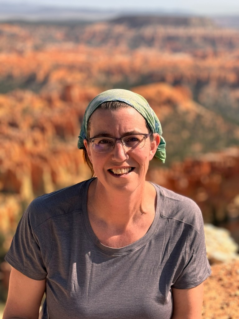
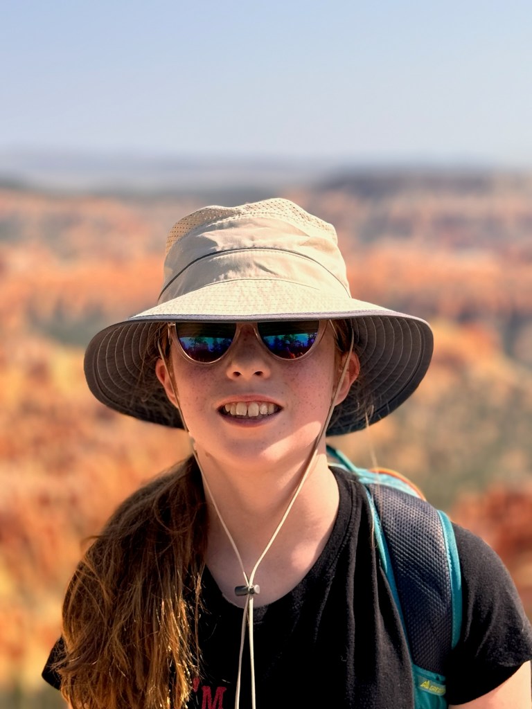
David got some nice portraits in front of the multiple views.
We have literally hundreds of pictures we could share because every view was unique, but we’ll spare you the scrolling. From Sunset Point, we took the Navajo Loop Trail, a deceptively challenging 1.3 mile circuit hike that drops down 500 feet into the base of the canyon and back up. Both the descent and ascent involved crazy switchback and blazing sun. The kids both took a turn at wielding Thor’s Hammer, one of the most recognizable hoodoos in the park. We also nearly missed Two Bridges, which looked closed off until we looked more closely. There was some significant complaining along this trail. I’ll leave it to you to figure out who was responsible based on the photos.
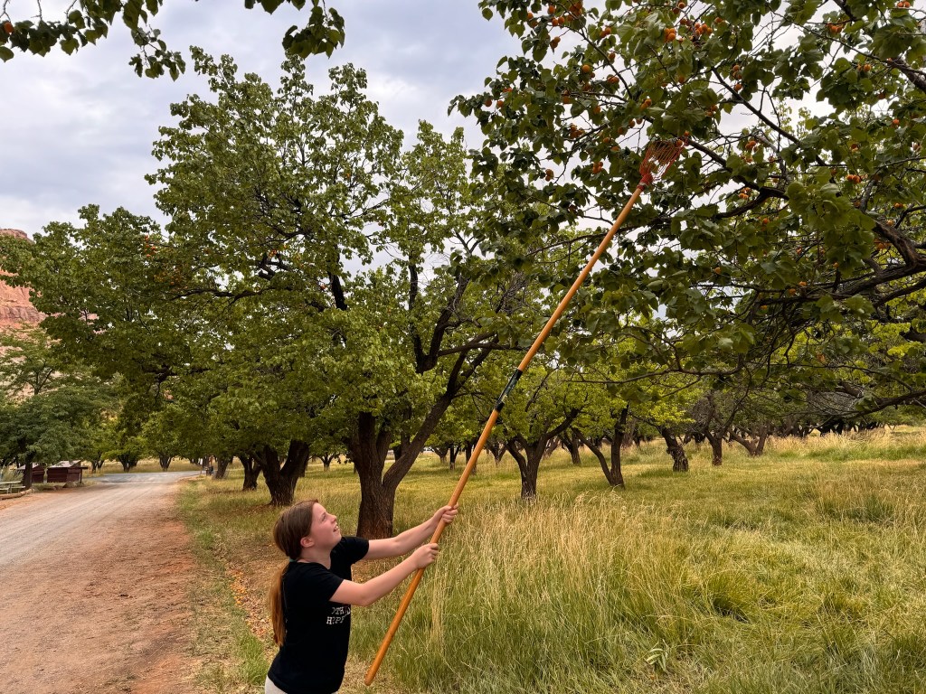
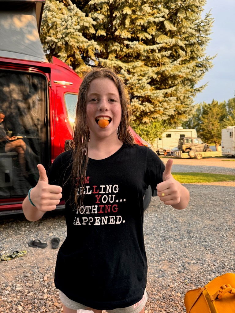
Once we emerged from the deep canyon, we ate sandwiches and walked another half mile or so to the general store to get David something to eat. Did we mention that in the flurry to get out of the van with sunscreen, boots, snacks, and water, David forgot his entire backpack?!? Once fortified, we hopped back on the shuttle to return to our van outside the park. We were off to our next park, Capitol Reef, about 2 hours away. We made it to the Visitor’s Center with minutes to spare before they closed at 4:30. Part of the park is a what remains of a historic Mormon settlement, including orchards. Before we headed to our campground for the night, we stopped to pick apricots, the fruit in season. They were delicious.
After checking into the Wonderland RV Park in Torrey, UT, we got some excellent Mexican food at a little restaurant in town. Susan and the kids played some Quixx as the sun set and we got to bed early so we could get an early start on Wednesday.
Starting mileage: 17049, Distance travelled: 88, Miles hiked: 6
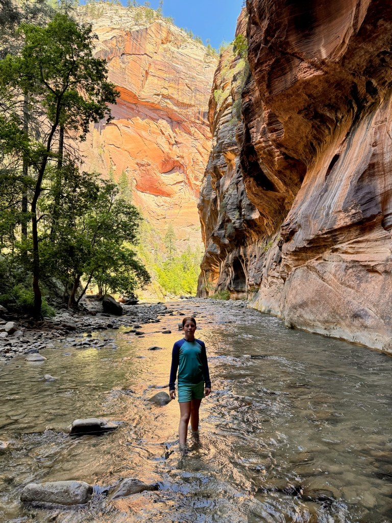
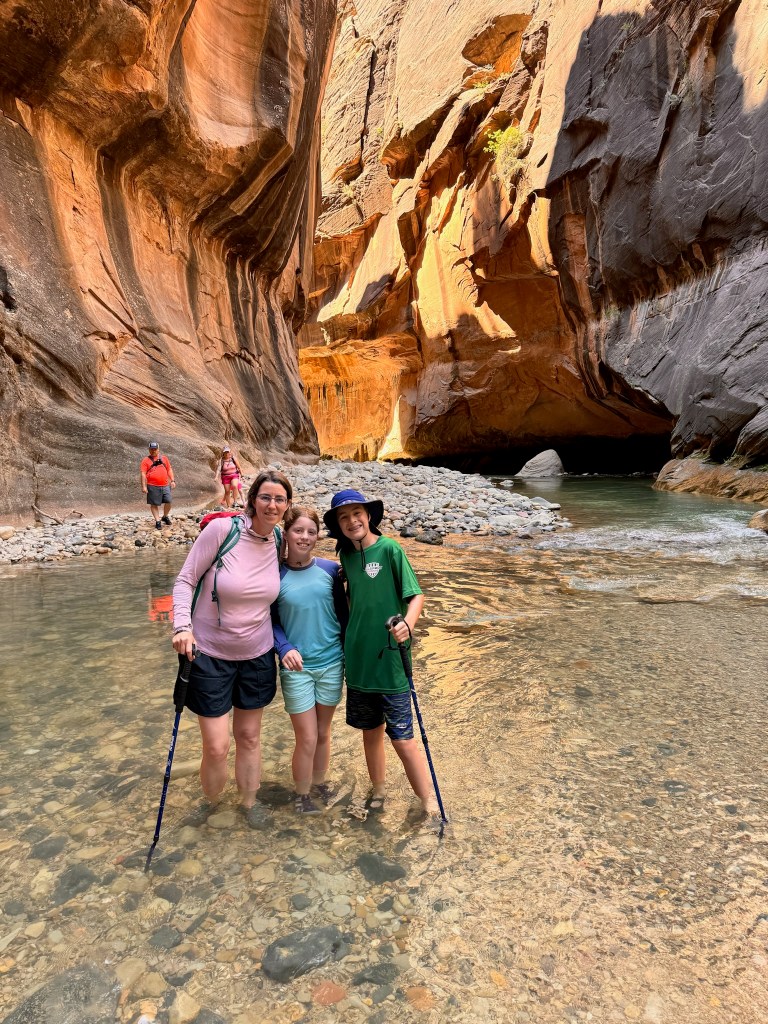
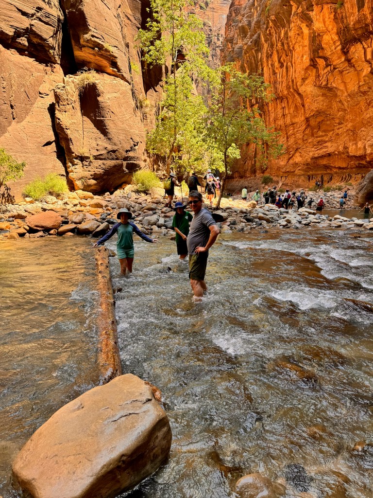
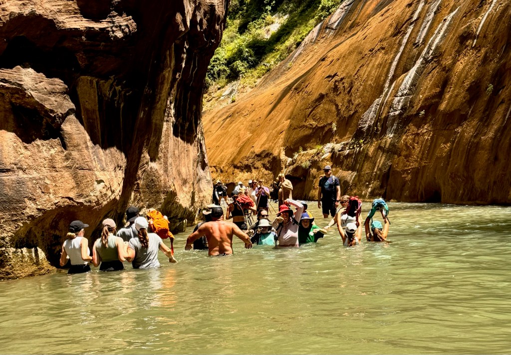
We moved out of our Zion Lodge cabin and headed out for a day of adventure in the Narrows, a deep, 16-mile canyon continuing to be carved out by the Virgin River. On the way out, we realized the one thing we forgot at home, the dry bag! We had to improvise using nested ziploc bags to protect the one phone and key fob we took along. There was an added complication of the river water being tainted with toxic Cyanobacteria so we had to keep water bottles and snacks dry as well. David became anxious that we weren’t equipped properly, seeing all the rented water boots and wooden walking sticks but our old Keens and hiking poles served us well. Laura volunteered to navigate without a pole since we only had three and we dubbed her, the water goat by the end because she was much faster and more agile than the rest of us. The one-mile Riverside Walk lead to the beginning of the Narrows, which varied from an inch to about 4 feet in depth. While there were occasional stretches of sandy bottom or dryish trails, most of the walk was on pebbles, rocks, and boulders typical of a river bottom. The footing was treacherous and Susan and David definitely needed the poles to stay upright. We were joined in the river by hundreds of other hikers, in various states of dress and preparedness, from full flotation devices (in case of flash flood) to crocs and slides, some of which were lost downriver. We were only mildly concerned about flash flooding, which the Park Service listed as possible (not probable or likely). Only through one early section did the water require you to go in waist high (or chest high for Laura). The canyon walls were spectacular, including hanging gardens, waterfalls and many seeps creating beautiful colored sections. We made it in almost a mile and a half before deciding to turn around, which ended up working out perfectly, for two reasons. First, it was nearly noontime so the sun began to reach the canyon bottom and heat it up. Second, we made it back to the shuttle stop just before a possibly flash flood-inducing thunderstorm rolled in. Susan and David still got wet through the open roof of the shuttle but it felt good in the heat.
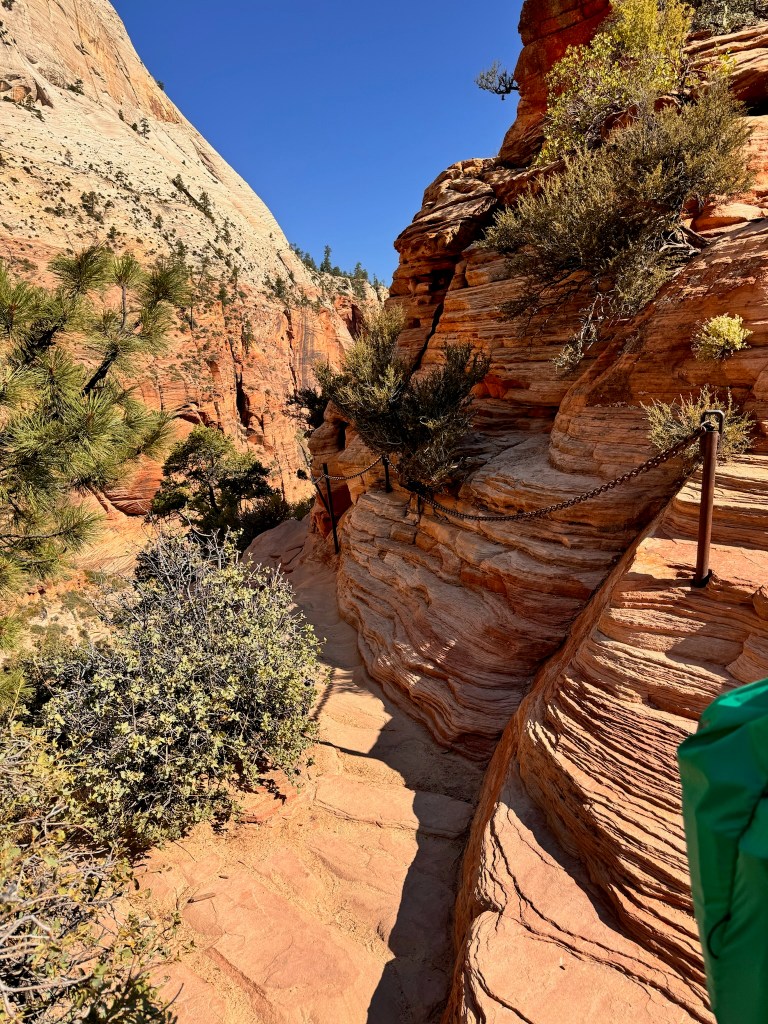
We retraced our steps out of the park, including back through the giant tunnel, which we had to wait for an RV to pass through solo. Before we reached our destination at the Bryce Canyon Visitor’s Center, the landscape began to transform.
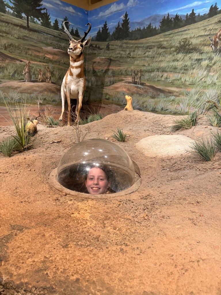
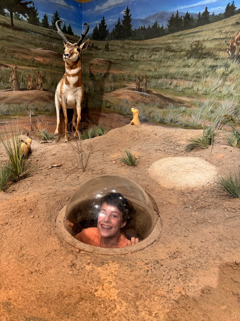
We stopped by the Visitor’s Center to get information to plan our next day and get the passport stamped. Not only was there a 3D model of the entire Giant Staircase from Bryce to the Grand Canyon but also…a prairie dog habitrail for Laura and Brady!
We drove back out and checked into our campground and quickly scooted over to get dinner because we had skipped lunch and everyone was starving. We went to Ruby’s Inn Cowboy Buffet and Steakhouse, the restaurant attached to our campground. Although the reviews were not promising, the quick buffet access to food saved us from a hangry kid catastrophe. Laura and Susan took a dip in the pool before we all crashed for the night.
Miles hiked: 9 (Brady & Susan), 5.5 (Laura & David)
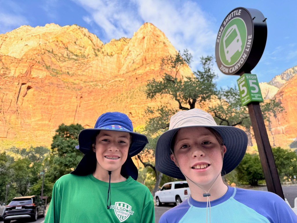
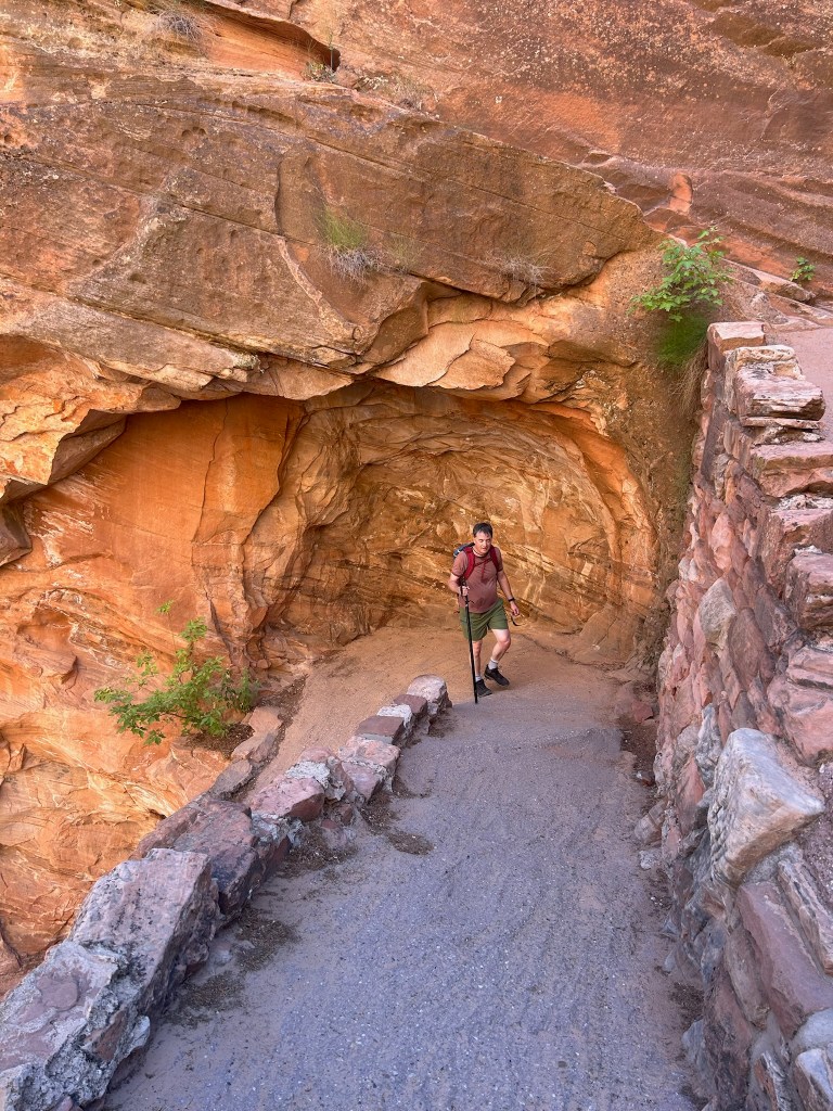
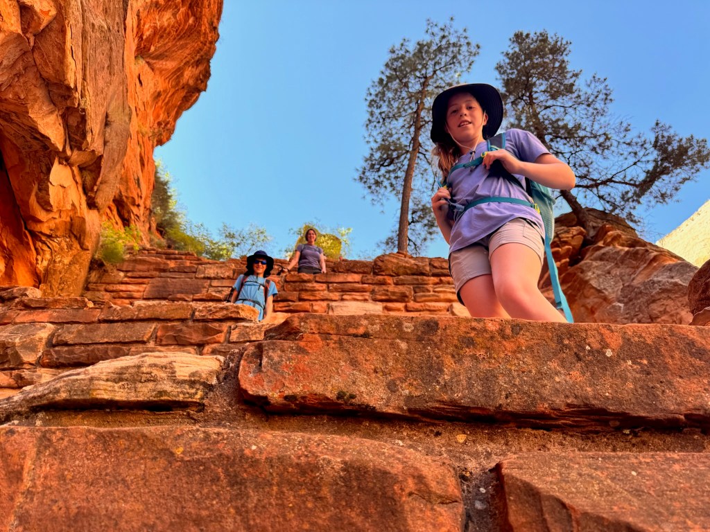
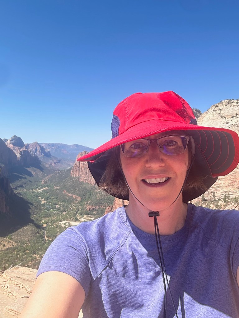
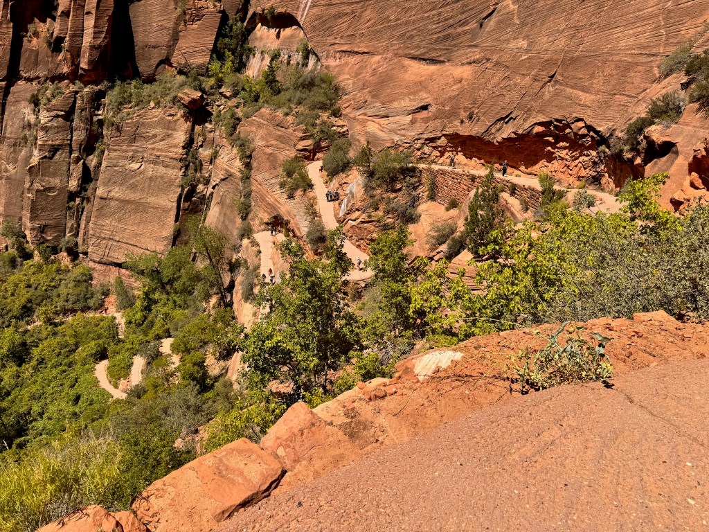
It was an early start to get everything ready and hit the trailhead to Angel’s Landing by 8:30am. Susan had scored a rare permit to hike the trail back in April through the quarterly lottery system. Our permit allowed us to be on the hairy final half mile after 9am. It took us a little over an hour to climb the first two miles, including some very stacked switchbacks called Walter’s Wiggles. We gained nearly 1000 feet of elevation in those two miles but it was almost entirely in shade. Laura was feeling much better and everyone was in good spirits.
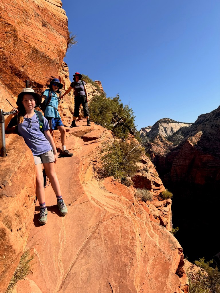
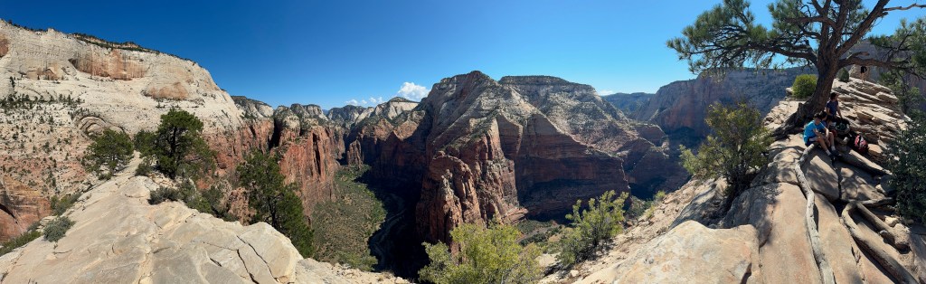
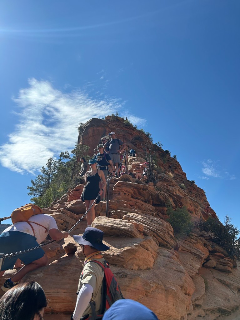
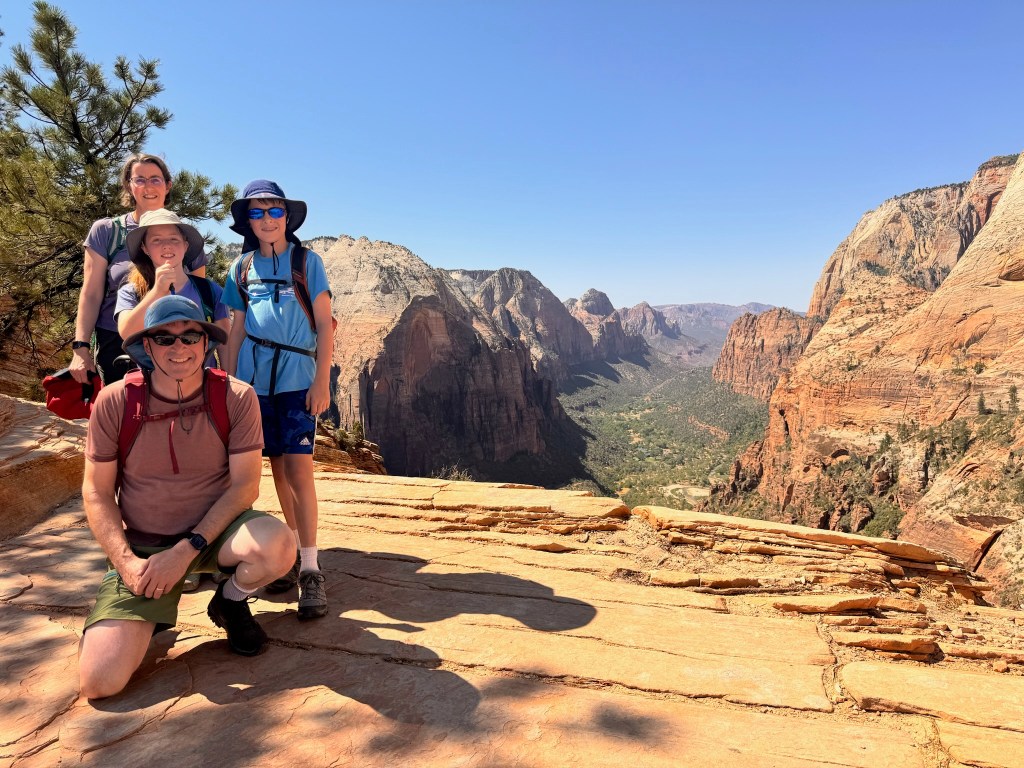
With the day beginning to warm and the shade disappearing, we started up the ascent to Angel’s Landing. The half-mile trail is straight up the knife’s edge with only a thick chain to hold onto and single-file two-directional traffic. Although incredibly intense and strenuous, everyone loved this last segment of the climb. The view was spectacular and the team spirit on the trail was really fun and inspiring. From the top you could see in all directions, including up and down the length of the canyon.
By the time we made it halfway down, we were feeling incredibly grateful (and smart) for starting so early. The temperature was rising and although we got back into the shade at the bottom of Walter’s Wiggles, the last 30-40 minutes was in unrelenting sun. We all agreed that this final stretch was by far the hardest and we were so happy to get back on the air conditioned shuttle at the bottom. We passed many people heading up as we were finishing up around 12:30 in the sunny, 104-degree heat, and couldn’t figure out how that was possible.
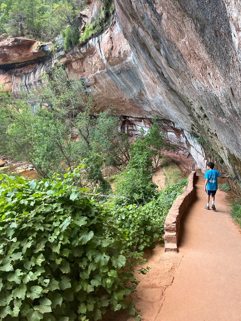
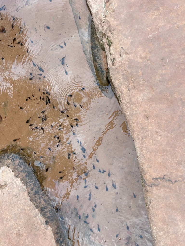
We got lunch at the cafe back at the lodge and basically recovered the rest of the afternoon, chilling out in the cabin. Some of us iced sore knees and took showers and rehydrated. We headed back to the lodge for a giant pretzel and a drink in the beer garden before having dinner at the Red Rock Grill. After dinner, Brady and Susan decided to take the shuttle back up to the Grotto stop and hike the Kayenta Trail to Emerald Pools. The air temperature had cooled down and the sun was long gone from the bottom of the canyon. We saw all three: lower, middle, and upper Emerald Pools. In the evening we saw more lizards and tadpoles on the trail than fellow hikers. We also missed the last shuttle and walked the half mile extra back to our cabin, much of it followed by a wild turkey who took an interest in us.